What a great chase day yesterday! Initially was worried about the morning stuff ruining moisture return to northern Kansas, but that ended up not being the case as mid to upper 60s made it there in plenty of time. My chase partner stopped briefly in Blue Rapids, KS for lunch before heading southwest as the first cells formed near HWY 81/HW 24 intersection. Had a bit of an issue with the road network(more dirt roads than gravel roads) but came up on the severe warned cell near Aurora, KS.
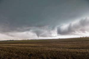
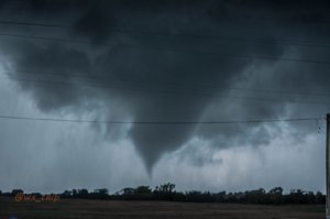
Storm made a good attempt at a large rotating wall cloud before that fell apart. As we headed north on a gravel road, a shear funnel formed just in front of us that lasted for about a minute. The storm had crazy amounts of rotation on it all over on the base and we were watching for spin ups constantly. Soon another small white funnel formed and persisted for about a minute but never got close to the ground. At Aurora we went east as we were now behind the storm.
Heading east, the storm made it's best attempt at a tornado as a beautiful large white rotating wall cloud came almost to the ground but nothing spun up underneath it. Shortly thereafter, we ran into a dirt road going east or paved road going north/south. We made the decision to bail on the storm since we were already behind it and it was beginning to line out it appeared. There was a cell to the south that was at the end of the broken line at the time that we felt had the best chance now. Of course no sooner do we leave our first storm, than 10 minutes later it forms a strong couplet and gets tornado warned, I believe near the town of Morganville or a bit north of there near Clifton. In fact the NWS had a radar confirmed large and dangerous tornado warning with it too.
Kicking ourselves as we watched the storm on radar, we headed south and then east on Hwy 24 towards Clay Center. The road to the west of town though was under construction and down to one lane it said with a pilot car. As we approached the zone there was a poor guy having to stand out in the POURING rain and wind and lightning holding the stop/slow sign. He had his back to us and turned around as we approached but didn't really do anything so we slowly drove by him heading east. The road had cones on the middle line and we were presumably in the one lane road section but didn't know which side we were supposed to drive on. We continued east driving on our own lane which had new asphalt while the westbound lane was milled. We figured we were supposed to be on the milled lane but didn't want to drive on the wrong lane in a blinding rainstorm! Eventually we did run into a pilot car and a line of cars coming west on their lane so I think we were driving on the wrong side but the first guy never stopped us anyway. This decision of moving forward and not having to wait for the pilot car that was actually coming was crucial to what happened next.
On this road we had been skirting the northern edge of the cell we wanted to get out in front of. In Clay Center the rain let up but the hail started to fall. Was mainly quarter sized but there were some larger stones. In Clay Center, we dropped south on Hwy 15. We made it just out of town and got a view of a rather large but broad wall cloud to our southwest.
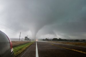
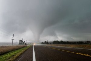
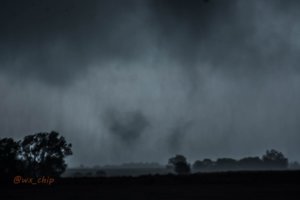
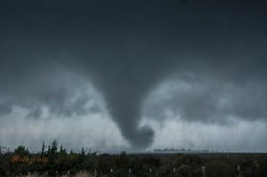
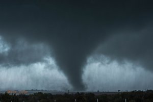
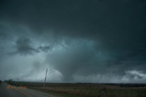
We stopped briefly off of a road to the west of the highway, and within a couple of minutes a tornado formed. It initially wasn't fully condensed, but had multiple vortices spinning up underneath it. We jumped back on the highway and stopped one more time to take some quick pics as the tornado continued to try and fully condense. The tornado was heading mainly east and it would take it south of us across the highway. I wanted to get on the south side of the storm though to avoid any possible left turns by the tornado to the northeast. We blasted south as the rotating rain curtains and occasional vortices spun up to the right of us by less than a quarter mile. Finally when we knew were far enough south, we stopped the car as we were getting hit by rain and the RFD. Got out of the car and took some pics as the tornado was now fully condensed and growing in size as it crossed Hwy 15. Unfortunately almost immediately thereafter, the tornado became completely rain wrapped. We attempted to get back out ahead of it enough to see it but again ran into a dirt road so our chase stopped there. We had one last view of the tornado through the rotating rain curtains as it looked like it had morphed into a large wedge.
Unfortunately for myself, I have no real great video of the intercept as in our brief stops and then blasting south, I never had a chance to get the car turned back around to the north to take video with my dashcam until it became rain wrapped, so I only ended up with still pics of the tornado. If this is the last chase of the season until next spring, this will help make the next 5 months or so a little more bearable!
