chrisbray
EF4
Not sure if anyone was out in Iowa but I will include it anyway.
So, I made an impromptu decision on Sunday night. Well, not entirely. I had been eyeing Sunday in the days leading up to it, as NAM/GFS had some impressive parameters for July showing across Illinois. However, on the day of, a huge MCS came through in the morning, and all the models seemed to back off in terms of convective parameters, and even firing storms across much of the area. I decided to just go about my day as normal, and keep an eye on things. If the clouds cleared out and good surface heating occurred, there may still be storms later.
Clouds seemed to clear out for most of the day, and it seemed like good surface heating may just happen. Storms waited to fire until around 7:45 pm. It wasn't until I was putting my kids in bed around 8:30 that I noticed they were issuing severe warnings, and I could see on radar that some of the nearby storms were starting to rotate. I made a last minute decision to chase at about 8:40 pm, knowing it would be a shot at tornadoes, but they would be in the dark. However, the storms approaching from the west were less than half an hour away, so I figured if I hurried out the door I could be intercepting them right as they would be producing.
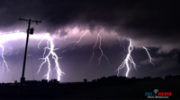
I drove west on 17 and then took Illinois 115 south towards Cabery. Unfortunately, there were signs indicating the road would be closed to due bridge repairs. I started to get really worried as now I had to take the grid to get to my intercept point, and the storm was getting uncomfortably close. After working my way around the grid, I got to just North of Cabery to take a look. I could see the storm structure, but was not able to tell if there was a tornado approaching. The lightning barrage ahead of the storm was super intense and scared me to the point of bailing on my location and re-positioning to the southeast.
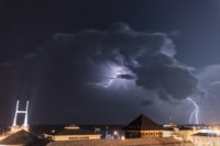
Once I was east of Cabery, I found a nice road intersection where I could view the approaching storm to the Northwest. The lightning kept up, so I used a Gorilla tripod to try and take some still pictures from my car with the window down. Fortunately, the storm became less HP than I had anticipated, so the tornado was not rain wrapped at all as it approached. Eventually it passed a few miles north of me and I could see a funnel/tornado straight ahead of me down the road, whenever lightning would allow a glimpse. Not wanting to lose ground, I decided to continue east, paralleling the storm as it now moved almost due east. As I was doing this, a long, thin rope tornado became visible, arcing down from the cloud. (Brandon Copic got really good video of this here:
)
I did manage to stop at one point and try to take some photos, hoping one would expose the tornado since my crappy Iphone video was not really capturing it in the darkness.
After this, I realized the new area of rotation was forming just barely to my south, and I would need to dive south and east to get out from underneath the storm, in case it produced again. I did manage to get out of there in good time, then re positioned East, just West of the FFD, and just south of where the base of the updraft was. After the storm moved through Clifton, I observed it produce a long protrusion that certinaly had the look and shape of a Funnel. I reported it as such, then watched as it dissipated. Shortly after, it seemed like the storm was pretty much done in terms of tornadoes and funnels. It seemed to develop a featureless, flat base, and I decided to call it a Chase and begin the short trek home around 10:50pm.
View media item 1177View media item 1174View media item 1178View media item 1175View media item 1179View media item 1176View media item 1180
So, I made an impromptu decision on Sunday night. Well, not entirely. I had been eyeing Sunday in the days leading up to it, as NAM/GFS had some impressive parameters for July showing across Illinois. However, on the day of, a huge MCS came through in the morning, and all the models seemed to back off in terms of convective parameters, and even firing storms across much of the area. I decided to just go about my day as normal, and keep an eye on things. If the clouds cleared out and good surface heating occurred, there may still be storms later.
Clouds seemed to clear out for most of the day, and it seemed like good surface heating may just happen. Storms waited to fire until around 7:45 pm. It wasn't until I was putting my kids in bed around 8:30 that I noticed they were issuing severe warnings, and I could see on radar that some of the nearby storms were starting to rotate. I made a last minute decision to chase at about 8:40 pm, knowing it would be a shot at tornadoes, but they would be in the dark. However, the storms approaching from the west were less than half an hour away, so I figured if I hurried out the door I could be intercepting them right as they would be producing.
I drove west on 17 and then took Illinois 115 south towards Cabery. Unfortunately, there were signs indicating the road would be closed to due bridge repairs. I started to get really worried as now I had to take the grid to get to my intercept point, and the storm was getting uncomfortably close. After working my way around the grid, I got to just North of Cabery to take a look. I could see the storm structure, but was not able to tell if there was a tornado approaching. The lightning barrage ahead of the storm was super intense and scared me to the point of bailing on my location and re-positioning to the southeast.
Once I was east of Cabery, I found a nice road intersection where I could view the approaching storm to the Northwest. The lightning kept up, so I used a Gorilla tripod to try and take some still pictures from my car with the window down. Fortunately, the storm became less HP than I had anticipated, so the tornado was not rain wrapped at all as it approached. Eventually it passed a few miles north of me and I could see a funnel/tornado straight ahead of me down the road, whenever lightning would allow a glimpse. Not wanting to lose ground, I decided to continue east, paralleling the storm as it now moved almost due east. As I was doing this, a long, thin rope tornado became visible, arcing down from the cloud. (Brandon Copic got really good video of this here:
I did manage to stop at one point and try to take some photos, hoping one would expose the tornado since my crappy Iphone video was not really capturing it in the darkness.
After this, I realized the new area of rotation was forming just barely to my south, and I would need to dive south and east to get out from underneath the storm, in case it produced again. I did manage to get out of there in good time, then re positioned East, just West of the FFD, and just south of where the base of the updraft was. After the storm moved through Clifton, I observed it produce a long protrusion that certinaly had the look and shape of a Funnel. I reported it as such, then watched as it dissipated. Shortly after, it seemed like the storm was pretty much done in terms of tornadoes and funnels. It seemed to develop a featureless, flat base, and I decided to call it a Chase and begin the short trek home around 10:50pm.
View media item 1177View media item 1174View media item 1178View media item 1175View media item 1179View media item 1176View media item 1180

