Brett Nickeson
EF2
Wednesday the 29th was quite the surprise day. I went to work without any intention on chasing and never really looked at the forecast that closely until Mike H. posted a HRRR reflectivity forecast on facebook. So I poked around a few models and to my surprise it didn't look all that bad for western Iowa, with decent instability and veering with height, but there were very weak low level winds. So I decided I'd just wait around and possibly run out the door if anything good popped up on radar since it was fairly close to Omaha. A storm popped up in western Iowa sometime around 4:30 or so. By the time I got home around 5:15 it had developed into a decent supercell with a hook forming and deviant right motion to the south. I grabbed my camera gear and headed out the door just with my cell phone and left all the laptop gear at home.
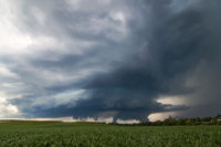
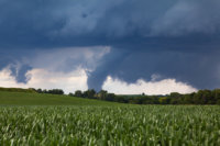
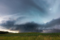
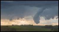
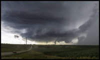
By the time I neared it north of Neola, IA about 40 minutes later it had some fairly impressive structure and a well defined base. As I was exiting the interstate I could make out the shape of a decent cone tornado which was a huge surprise, given the weak low level winds and less than 2% chance per SPC outlooks. I drove through town and took the first west road I could, which fortunately had a spot about a half mile or so out of town where I could see the tornado as it was beginning its ropeout process. Now, for anyone who has chased in western Iowa in late June or July, you know just how bad the hills are and how valuable a marginal view is. Add in the five foot tall corn and I was happy I could see anything. So I stuck with my view from about 6 miles away until the tornado was gone. I followed it SSW as it produced at least two more tornadoes back within the rain, the first of which came with some gorgeous structure that I stopped and timelapsed as can be seen in the video below.
Not bad for leaving at 5:15 and getting home at 7:15 on a less than marginal day that very few other people saw! Now I know how you Oklahoma folks see so damn many of them each year...
View attachment baaff8dbd4a7ec60e710b479302cf882.jpg
View attachment 0330fd0de2fba9b00798faf5b4e77013.jpg

