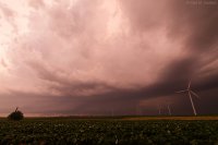
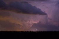
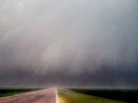
2016-06-22 REPORTS: IL/IN/MN

Joined
Jun 16, 2015
Messages
476
Location
Oklahoma City, OK
Most of the visible tornado reports came out of Illinois with this event, but the states outlined in the title appeared to see the most significant severe, overall.

I started the day in eastern Iowa and was pretty certain that storms would not mature until Illinois, so I headed east. The first dominant supercell popped up right near the IA/IL state line and I stayed with it for a while, but aside from displaying a quasi-wall cloud at times, it never produced. I eventually saw a new cell pop up to the south and I blasted in that direction.

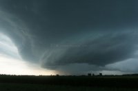
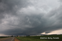
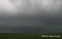
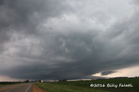
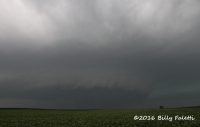
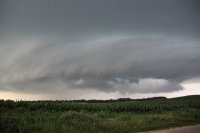
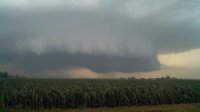
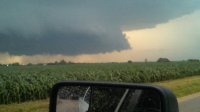
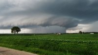
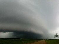
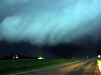
The storm had a hook-like appendage on radar, but didn't look all that impressive from my vantage point. I stuck with the storm and when it became tornado-warned, I was initially surprised, since it looked junky, at least visually. Some time later, the storm quickly organized and showed considerable low-level rotation. The picture from below was taken three miles west of New Bedford, as the cloud base was lowering and the storm looked like it might be trying to produce.
shelf.jpg

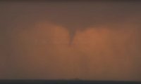
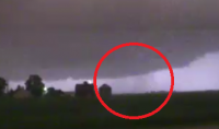
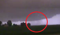
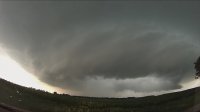
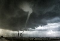
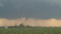
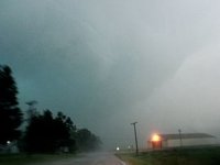
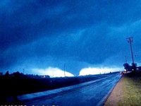
I witnessed a funnel cloud with the storm for a couple of minutes, one mile south of Manlius, IL. From other reports, it is possible that this was a tornado, but that was not clear from where I was watching it.
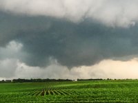
manlius_funnel.jpg

I followed the storm southeast, but suddenly my chase day was cut short when a huge deer appeared on the road and my front end was smashed. This was all while it was windy and rainy, but luckily I was going only about 45-50 mph and glanced it, so I was not injured and my car is still somewhat driveable.

Not a bad chase for me, considering up until almost 8:00 everything was fairly messy looking on both radar and in person. Even if it wasn't for the deer, it's unlikely that I would have seen anything impressive in the lingering time before darkness crept in.
 
I am back into my post-spring chase season full-on work mode, taking care of essentially 2 full-time jobs. However, I was able to break away and leave at 11AM to make this day's event. I didn't have a specific target set in stone, just northern Illinois wherever the warm front ended up when storms developed. I began my storm intercept mode near the town of Polo, IL as convection began to ramp up in intensity along the Mississippi River. I was on the first storm that emerged from this at Dixon, IL. CG lightning was going nuts, a theme I'd see all afternoon. When I got visual of the base south of Dixon, the storm had dramatic structure, but appeared elevated and at risk of growing upscale rapidly. So, I left this storm and jumped on the second one that developed just to the west, reaching it at Deer Grove. This one had better structure, and more importantly had surface inflow channeling into a persistent wall cloud:

june22a.jpg
I followed this southeast for a while, but it appeared the storm wasn't really getting its surface inflow established and again, looked as if it might grow upscale. Outflow was really pushing hard south and east of the meso and threatening to blow out the low level circulation. I wanted to be in Chicago for lightning if upscale growth happened, so I headed down to I-80 and moved ahead of the storm to keep that option in play. It was at this time that the storm's inflow started countering the outflow. Structure and radar velocity improved, so I went back north to re-intercept at Troy Grove. The storm was really going nuts at this point on all accounts - screaming inflow, CG barrage. I was in the vicinity of the reported tornadoes here, but did not see them with my eyes as I could only make short stops to stay ahead. I saw a few power flashes in the RFD., and there was a pretty tight anticyclonic circulation here that may have produced a ground circulation near I-39. The storm was heavily HP, but inflow was intense. The inflow tail was pulling scud tags right up off of the ground east of I-39. Eventually, I got a glimpse of a funnel/possible tornado way back in the notch at Waltham:

june22d.jpg

Darkness fell at this point, and I was beginning to think my day was a bust for for-sure tornadoes. I began heading south for home at Ottawa, hoping to stay ahead of the MCS. This was in question due to a lot of debris in the road and downed power lines. I only felt comfortable going 35mph tops. Finally, I made it out of the wind damage swath and could resume normal speeds. At Pontiac, I noticed the southwest flank of the MCS was beginning to organize, so I headed west a few miles to investigate. The storm cycled a couple times, then really ramped up as it approached me 5 miles northwest of Pontiac. I shot relatively constant handheld still images here at 1600 ISO at the full-wide end of the 10-22mm lens, the frequent lightning providing enough illumination to clearly see what was happening and to capture imagery.

june22c.jpg

The tornado was close enough to hear, and the noise rapidly increased as a farmstead was impacted about 3/4 mile to my southwest. I drove over to check on the residents as the tornado continued into Pontiac. I was the first one to arrive at two farmsteads that were hit. Thankfully, everyone was OK at both locations. The houses had heavy damage, and some outbuildings, barns and grain bins had been destroyed.

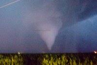
This was the best image I captured of the tornado, the light courtesy of a lightning flash:

june22e.jpg

The first farmstead was being impacted at the time of this image:

june22f.jpg
 
A couple thoughts I can add to this thread...
1. I have video of the same storm Quincy posted about near New Bedford and included pics which are similar to the video I captured. I started at Dixon and moved to Sterling then as initiation happened around 2300 (FYI I was by the river there and the actual highlight of the evening besides the weather was seeing pelicans circling above the river, which I've never seen). Because I wanted to stay out of low visibility, I decided to move south on IL 40 and skirted just south of the apparent WF boundary the storms were training on, eventually ending south of there around CR 2000 North and about 3 miles south of that on CR 1745, while several storms formed and became TOR warned to my WNW and moved along the WF boundary to the ESE. I was able to watch the wall cloud Quincy talked about as it passed to the NW/N/NE of me.
2. While chasing, I waited at a corner trying to relocate away from the mesocyclone (I was heading W turning S) as a train of under-30-year-olds in old beat-up cars chasing it as a group turned from S on 40 to E by where I was (on CR 2000) and trying to follow it (it was RIGHT THERE). Were they "legit" storm chasers? Or "local yocals"? I have no idea...they didn't have any 'gear' as I could tell. Just a bunch of people following the 'leader'. I'm thankful there wasn't any actual tornado at that point...they could have been hurt.
3. The most important: When I chase I PRAY that any tornadoes don't hurt people badly. My prayers were answered yesterday, as apparently it was all property damage and just some minor injuries. I am thankful for that, and also seeing what I did see...it was a fun chase overall and worth the effort.
 
Last edited:
First chase in Illinois and we got more than we bargained for. My most intense and eventful chase ever. A broken door from RFD and hundreds of near-miss CGs later, we were able to get 4 tornadoes, but man did it take a lot of hard work. No noteworthy stills but was able to get some video. First multivortex tornado was near Ambro, Il, the rest were near Troy Gove, Il. Ultimately turned around on the storm that produced the Pontiac EF-2, otherwise would've had 5 tornadoes on 3 supercells.


Chased yesterday with @Matt Magiera among several others, most from COD and NIU. We all met up in DeKalb and then headed to Rochelle where Victor Gensini and the College of DuPage meteorology crew were doing a special balloon launch. After 90 minutes and a lot of attention from onlookers, the launch proceeded...with not-so-great results...


After the launch was over, we decided Dixon was the right spot to await initiation. We waited there for an hour or so as storms began to initiate and slowly strengthen over eastern Iowa and northwest Illinois. The first cell we got onto was near Dixon. It had a massive base and began to draw inflow as an inflow band formed and grew in size. We thought at the time that with the motion happening, it would surely put down a tornado. I think it was probably still in the transition from being an elevated storm to surface based, though, and NWS Chicago didn't tornado warn it at that point in time.
upload_2016-6-23_23-21-44.png

We raced southeast to keep up with it as it became an HP mess. At a certain point we decided to bail for the southern supercells, even though the northern one was putting down rain-wrapped tornadoes.

We got onto out second storm near Cherry. Had some great structure as it really wrapped up in front of us. Stupidly, my ISO was on auto, so it was taking pics at ISO 3200, and all of my pics at this point were really noisy.
upload_2016-6-23_23-21-3.png

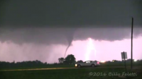
We raced to catch up with it once again, and ended up between Cherry and Troy Grove, where we watched one funnel come down and fail to touch down. A minute later, a second one descended, producing a skinny tornado for maybe a minute.
Video grab:
upload_2016-6-23_23-27-2.png

We continued the chase from there as this storm went HP as well. We saw a second tornado way in the distance to our northeast through lightning flashes. This was the one that was confirmed north of Ottawa. It was a maybenado to us until we found you could see the same sort of shape in the distance in the same area during multiple flashes of lightning, and until the NWS confirmed it in that area.
upload_2016-6-23_23-35-22.png

Overall an awesome chase! Probably my favorite one. Got to chase with people with the same passion for the first time and saw two tornadoes! Also, my 2016 is now no longer tornado-less! Feels good.
 

Attachments

  • upload_2016-6-23_23-15-30.png
    upload_2016-6-23_23-15-30.png
    837.7 KB · Views: 241
  • upload_2016-6-23_23-20-37.png
    upload_2016-6-23_23-20-37.png
    1.2 MB · Views: 210
  • upload_2016-6-23_23-32-33.png
    upload_2016-6-23_23-32-33.png
    66.3 KB · Views: 204
Jeff, our Pelicans here at Sterling/Dixon are around until September/October before they migrate south, earliest you can watch them is late March depending on the weather. Pretty amazing to watch them circle both towns. I live between the two towns on the river and enjoy them every day when they go back and forth.

Anyways, started my day out west of Polo near Milledgeville. Wanted to avoid as much 'chaser' traffic as possible since this was a fairly big event for northern IL. Watched a cell come together and started to move towards Dixon. Pushing through town, I moved south on Rt26 and hit 30 towards Amboy where I would get off on some backroads. Took a few of my last stills of the day as CG lightning was really intensifying. Couldn't get out of the car safely with all the lightning, had to hand hold everyone unfortunately, ending up with slight blurs. Structure sitting near Amboy was pretty decent.
4 (1 of 1).jpg 5 (1 of 1).jpg

Moved SE out of Amboy towards Mendota, eventually heading back north towards Compton to grab a few pictures in the car.
6 (1 of 1).jpg 7 (1 of 1).jpg

Continued a little more east with this storm, parked somewhere and just watched it. Decided to head south at this point and move to Troy Grove. I was getting tired of the rain in this northern cell. Upon moving into and through Troy Grove, the lightning was extremely intense, something I've not witnessed here in a long time. Sat near the Route 251 area before heading back into Troy Grove. Couldn't see to much due to the rain and my position. Managed to get through Troy Grove 2-3 minutes before the tornado hit. Also had some ground circulation west of the town before entering it.

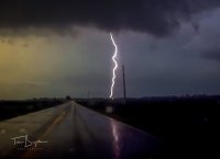
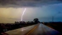
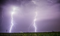
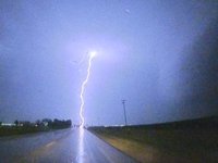
Continued on this storm for awhile, didn't see any tornadoes but really enjoyed the lightning. Saw plenty of power flashes though. Here are a few lightning captures off my dash cam.
9 (1 of 1).jpg 10 (1 of 1).jpg 11 (1 of 1).jpg

Troy Grove's structure was far better than that of the West Brooklyn/Compton one, mainly due to the lack of rain from the south. Here's a time lapse though of both cells. About all I have to contribute, though I mainly go for storm structure.. I'm a structure nut when no hail is present.

Didn't witness to much unsafe activity of chasers/spotters. Only comment I'd say is to the three vehicles on Route 52 who passed 5 cars was probably the most dangerous thing I've seen that night in terms of driving techniques. Not sure what the hurry really was here where passing 5 cars who were already driving 60-65 was necessary. Otherwise, props to those standing outside of their vehicles in all that lightning near Troy Grove, I couldn't do it, to many close calls in the past lol.

 
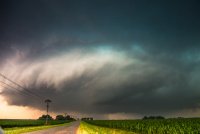
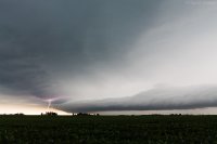
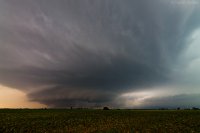
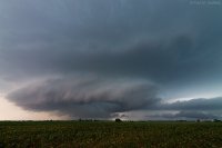
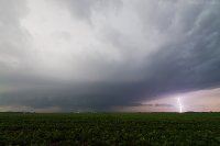
My team first headed to Stockton, IL to hedge our bets in case it looked like initiation would happen further north around Dubuque or even in SW WI. However we soon repositioned south to Mt. Carroll and then Morrison, where we were sitting when initiation finally got underway. A supercell began to mature just to our south near Prophetstown, and we blasted east on US 30 and I-80 to SR 40 south to get a view of the updraft base. A severe thunderstorm warning went out for it while we were en route, and another cell to the east also began to show signs of a couplet on velocity. Unfortunately for us the latter would become the more prolific tornado-producer (Amboy/Earlville). We approached our storm on Hahnaman Road about 10 minutes to 7 PM, being treated to a view of a dramatic updraft base with wall cloud, and pulled off at Luther Road just east of Tampico. Looks like this was taken about the same time as Dan's first picture above:

29396eb22724df87d709f43dac0cb989.jpgRotating wall cloud near Tampico, IL 6/22/2016 by Andy, on Flickr

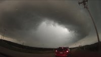
We observed the storm from this position for a few minutes, with noticeable rotation in the base. We stayed until it began to encroach overhead. Grab from my GoPro out the windshield as we departed:

0b7ef01db11fd2d949712d3016bcb163.jpgGoPro view of rotating wall cloud and updraft base 6/22/2016 by Andy, on Flickr

This view is from just to the south at Jersey Road, with a dramatic RFD donut hole in the base, which is already beginning to fill with precip underneath in the distance:

fc5f4c4e6ad9dcc4bc7218c43c3b6565.jpgSupercell updraft base S. of Tampico, IL 6/22/2016 by Andy, on Flickr

From here we zig-zagged along back roads, pacing the storm to the east-southeast. I lost track of which roads we took although I know we were on SR 92 and County Road 2400 North at times. We were too far away to see the funnels/brief tornadoes near La Moille and Troy Grove with this storm. We got on I-80 from SR 251 at Peru, and pulled into a truck stop on E. 8th Road at North Utica to observe a roiling storm base just to our northeast. This was shortly after 8:30, or about midway between the Troy Grove and Marseilles tornadoes. We called the chase here due to impending darkness and my having to be at work by 3AM Thursday.

Video is in the works, I'm hoping a timelapse from my GoPro can do justice to the lightning show from this supercell.
 
Sorry for the late report...but I observed 5 tornadoes on 2 separate supercell storms in North Central Illinois on Wednesday (6/22). First storm I chased was the most HP storm I think I've ever chased and it produced the Compton/West Brooklyn, IL tornadoes. At one point we observed 2 separate tornadoes on the ground at the same time. We dropped south to another supercell which was the most prolific of the night (in my observation). Upon reaching that particular cell we observed excellent storm structure before observing a multiple vortex tornado outside of the town of Troy Grove. A rope tornado developed right in front of our vehicle and danced in the field before dissipating, I deduced this to be a satellite of a larger tornado. We ended the night observing our final tornado outside of Mersailles, IL off of I-80 where it hit a seed plant right next to us and moved into the field. We called the chase after this to check on damage, make sure no one was hurt, and get dinner in Ottawa, IL. Tough day for photography, but I did manage a few shots that I'm quite proud of given the conditions. Check a few out below. Sorry for the short report, been busy the past couple days after chasing, so not much time on my hands. Haven't had time to edit all my photos, just a few. So here they are....

cc0a349301c84ce36d34b6e055d43c3e.jpg
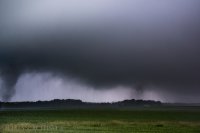
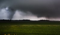
Stovepipe tornado (left) with intermittent multiple-vortex tornado to the north (right). Outside of Compton, IL (supercell #1).

9f8efa634f687f2798be68fae5b76864.jpg
See description above. Closer shot. Tornado on right was real intermittent. Both dissipated/became rainwrapped a few minutes after this

c1424da22b23b4ecdbfa77094d4b6db1.jpg
Supercell #2 with some beefy structure for Illinois.

ce17456af1eafaf04bb031fe04553dbf.jpg
Nice drill-bit tornado outside Troy Grove, IL. This was Tornado #4. There was a broad multiple vortex that was ongoing to the left of this, I believe this to be a satellite tornado. Was real dark, so its kinda grainy, but I'm still happy with it!

e3a91298aba754fed032212d805402d4.jpg
This image is crap, I will admit. But its the last tornado of the day (#5) and the only proof I have for it other than a damaged seed plant and barn outside of Mersailles, IL. You can kinda see it there in the left with the debris flying through the air. My ISO was almost at 4000 and it was still pretty dark. My chase partner's video didn't turn out the great either. So take my word for that one ;)

ad9cc060518290689609419305b1e50e.jpg

Here is some lightning I got before the chase on the 22nd, during the early morning MCS. Handheld shot here.


Started in Rochelle and once it was pretty clear the first few cells were popping strong, headed to Dixon. Watched that cell for awhile but got a little behind it as it was producing near Ambloy. I joined the procession of people on 251 heading South around Sublette and at one point pulled over and watched it while it was off to the NE but I had some RFD rain between me and circulation and never saw much. I continued south through Mendota with the original plan to pull ahead of it on Route 52 but as I got near Troy Grove the 2nd cell to its West was warned and was in clean air. Being by myself and with the 2nd cell precip getting in the way of the first one, i chose to head to the 2nd cell.

I setup in the country NE of Cherry with the rotation headed straight at me. At first, there didn't appear to be a lot of structure but as it got closer it started to show some better signs. Not unlike what another posted, the CGL was intense and at some point I decided I was better in the truck. Eventually as it got pretty close, I positioned further South and watched the cell all the way across and caught the funnels/potential tornado that others have here (Faletti, for example). As it was directly North it really got organized, inflow to the storm picked up a lot and rotation got very noticeable in the wall cloud. Further to the NE is when you could see stronger more localized rotation in the wall cloud which is when it funneled up and down a few times. That's about the only photos I captured at that point. The rest was I spent more time driving to try to stay caught up than having a chance to snap photos.


After that, I tried to catch up with it but it stayed North of 80 longer than I planned and I got too far south to see anything. At that point, it got so HP that it was near impossible to chase much. About the time you'd pull through the RFD into the clear air, it would be caught back up in no time if you stopped. After fighting that a bit, I got tired and broke off near Mazon back north to 80. When I broke off, the Pontiac cell didn't look good at all so I headed home. Certainly kicked myself when it cycled through and started showing the best organization of any cell all night but at that point I was too far gone to catch up to it without going right through the middle of it.
 

Attachments

  • IMG_20160622_200656_050.jpg
    IMG_20160622_200656_050.jpg
    65.6 KB · Views: 206
  • IMG_20160622_201017_652.jpg
    IMG_20160622_201017_652.jpg
    70.3 KB · Views: 193
  • IMG_20160622_201127_249.jpg
    IMG_20160622_201127_249.jpg
    39 KB · Views: 191
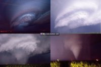
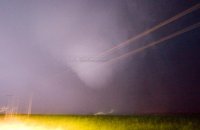
What a chase day for me. Started off targeting Rochelle but after seeing the HRRR begin initiation in Eastern Iowa i moved westward to Dixon and stayed put until the storms got mature. I dropped south to the middle of 3 supercells near the Walnut/Ohio area and got some of the best structure I have ever seen. After photographing the structure I stayed east with that supercell and it had become tornado warned. Areas of rotation were steadily rain wrapped and I was getting a tad frustrated. When I reached Ottawa I drove north on IL-23 and moved into a position for an intercept. An area of broad rotation re developed so I stayed put in my spot at CASE until the rotation got closer. It was dark at this point and very difficult to see. It became tornado warned once again and a tornado was approaching my location. I almost waited too long to escape and could have possibly have been caught up in the tornado. Driving south on 23 towards I 80 I observed some strong winds likely from the RFD. After getting east on I80 I encountered more strong winds and felt like a tornado was developing over my location. Sure enough this was the Marselles-Seneca tornado that was indeed in the process of developing. I saw the tornado visible in the lightning from my location on I 80. Thankful for my teammates on zello who helped get me out of danger a couple of times. I will never again let a tornado get that close. Overall a fun chase with 3 observed tornadoes. Photos are of insane structure near Walnut and the Ottawa and Marselles area tornadoes.
IMG_1312.JPG OTTAWATOR1_JPG.jpg SENECATOR2.png SENECEJPEG.jpg
 
Had to work all day, but since the setup was so close to home I was able to chase afterwards with little impedance. In fact, I was even able to have dinner at home before heading out. Can't beat that.

Time lapsed a developing sup southeast of Prophetstown IL for 20 minutes. Watched it go from a rain shower to a powerful supercell with a mature wall cloud and rapidly rotating rain curtains before I even had to reposition. Followed it for a little while, but ended up leaving it before it went on to produce tornadoes near La Moille and Troy Grove. I left it for a new sup to the west, which was very close to home. As I drove up on the new sup from the east it didn't look too impressive compared to the cell I had just left. I instantly regretted the decision, but due to storm speeds of 50mph+ I had to live with it. Luckily for me the new western sup slowly became more organized, and before long was tornado warned. Followed it east-southeast for awhile, and watched it drop a nice funnel near Manlius IL. Apparently it touched down at some point around Manlius, but I was never able to confirm ground rotation from any of my vantage points along the way. After the Manlius funnel lifted the new storm coming in from the west made things pretty messy, and I called it as sunset upon us. This new storm would eventually go on to produce the tor that impacted Pontiac.

All in all it was a semi-successful chase considering storm mode and speed, and the fact that it was a work day. Given the extreme parameters in place I'm glad that we didn't have a violent tornado or two causing harm.

Here's a few shots from the day...

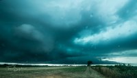
First, here's a look at the sup that would later produce the La Moille and Troy Grove tornadoes. This was shot near Deer Grove IL.
3b71f88026a49968c6d540eb44b29204.jpg


These next two shots are near Manlius IL of the wall cloud/funnel, possible tornado. Should have pumped the ISO way up during this part of the chase, or switched to auto-ISO, but alas, I forgot lol. Hopefully won't make that mistake again.
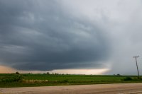
47550db00833c066d7113e25cab7bfec.jpg

f4e03649aabd29d65748f647a89d1aa9.jpg


Time lapse video of two separate sups. First one is the storm that later produces the La Moille and Troy Grove tornadoes. The second is the storm that goes on to produce the Manlius funnel/tornado.
 
Last edited:
I would end up north along with everyone else this day but not before spending time with a few early morning storms to canvas the downstate including this photogenic arcus from east of Springfield that made for excellent time lapse.

IMG_8102a.jpg


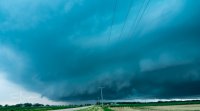
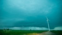
Opting for more discreet cells to the SW of the initial tornado warned at Dixon, the Walnut cell (originally thought La Moille) would not disappoint in terms of structure and additional time lapse opportunity.

IMG_8178a.jpg

IMG_8269a.jpg

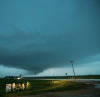
I'm not sure the precise location of the next to give proper descriptive but somewhere near Princeton, the next in line to go tornado warned was a massive CG producer for which I didn't stick around long for. Regret not getting more with this storm given the motion.
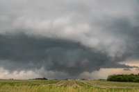
IMG_8440a.jpg

Final storm to the SW of the party would catch the incredible end of day light from... I really don't know or care as it was just peaceful.
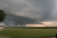
IMG_8489a.jpg


Giving follow after dark, I would fall sorely behind and miss the Pontiac activity. With tripoded 300mm and cable release was however, able to get likely tornado with power flash many miles downstream over Fairbury.

IMG_8636a.jpg
 
Good day all,

I finally got around to posting this, and here is my report for my observations of storms in Illinois on June 22, 2016.

1). June 22, 7:30 PM - Observation and penetration of a very severe and tornadic thunderstorm in Lee County, Illinois near Highway 52 around Amboy and towards Mendota. The storm was an intense HP supercell storm, which contained rain wrapped tornadoes. One of these possible multiple vortex tornadoes were observed in poor visibility from the north in powerful easterly winds (gusting over 70 MPH). The storm contained winds gusting over 70 MPH, small hail, frequent lightning with some close hits, and torrential rains. The storm had a large, wet RFD. Damage was observed near Mendota, particularly to power poles, signs, and trees. Some roof debris and sheet metal was noted across the roadway in some cases. Power was also knocked out and there was flooding. The storm also had a striking visual appearance (stacked plates and striations) looking north or west. This storm was eventually abandoned for another supercell storm to the southwest. Conditions causing the storms were surface heating, a low pressure area, warm front, and upper trough. Documentation was HD video and digital stills. A 2009 Ford Escape was used to chase the storm. A tornado watch was valid for the area until 1 AM CDT the following day.

m17sc26.jpg

Above: Intesifying HP supercell storm near Amboy, Illinois on June 22, 2016.

m17tor69.jpg

Above: View looking south into the mesocyclone near Amboy, IL with an HP storm. Note the strong easterly winds kicking up spray! Most likely a multi-vortex tornado rain wrapped in there. Late on June 22, 2016.

m17tor70.jpg

Above: Backside of possible "bowl" lowering near Amboy, Illinois with a rain wrapped HP tornado to my south on June 22, 2016.

2). June 22, 9:00 PM - Observation and penetration of an extremely severe and tornadic thunderstorm in LaSalle County Illinois from Highway 23 between Ottawa and Troy Grove, and southeastward to near Seneca and Morris on Highway 6 south of I-80. This storm was also a large HP supercell storm. The storm produced several confirmed tornadoes, one weak one observed west of Ottawa, and another significant one near Seneca along Highway 6 at around 9:05 CDT. This was a very large cone tornado, almost a wedge, illuminated by lightning. The storm produced very intense and frequent lightning with many close hits, small hail, torrential rains, and winds gusting near 80 MPH (mainly FFD). The large tornado near Seneca destroyed a house, powerlines (power flashes observed), and flattened crops before evolving to a stove-pipe, then roping out and becoming wrapped in rain. The storm was abandoned as it passed south of Morris, however, a possible tornado was observed again from 30 miles distance as the storm was passing well to the south near Odell and Pontiac while attempting to photograph lightning. This storm also had a very striking visual appearance, much of which was revealed by the continuous lightning. Conditions causing the storms were surface heating, a low pressure area, warm front, and upper trough. Documentation was HD video and digital stills. A 2009 Ford Escape was used to chase the storm. A tornado watch was valid for the area until 1 AM CDT the following day.

m17cg1.jpg

Above: One of many intense CG lightning hits near Ottawa, Illinois after dark on June 22, 2016.

m17tor74.jpg

Above: Ccomposite view of the Lasalle / Seneca, IL tornado by combining two frames with lightning illuminating the foreground and dimly back-lightning the tornado on June 22.

m17tor73.jpg

Above: Large lightning-illuminated tornado in Lasalle County, IL (near Seneca and south of I-80 looking WSW on Highway 6). This was roughly 9:05 CDT on June 22, 2016.

m17pf1.jpg

Above: Power flashes from the Lasalle / Seneca tornado in Illinois on June 22, 2016.
 
Back
Top