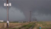
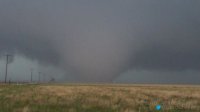
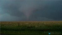
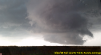
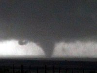
2016-05-22 REPORTS: TX/KS/NE

Joined
Jan 14, 2011
Messages
3,316
Location
St. Louis
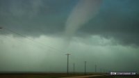
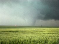
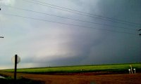
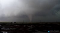
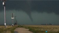
I targeted what appeared to be a remnant outflow boundary or differential heating boundary hanging around the Stratford, TX area. I arrived at Gruver by 2PM and waited there. Initially, I was interested in a storm going up at this boundary's intersection with the dryline near Stratford, but changed my mind once I noticed dewpoints beginning to crater in that area and storms becoming much more robust in the better moisture to the east near Spearman. I was on the Spearman storm early, and watched it go through a couple of RFD cycles, the second very strong, each that produced several funnels. The storm was suffering from upstream convection that would merge with it right as it seemed to be ready to get its act together. Finally, the last in a series of upstream cells was absorbed, and a massive RFD surge began. The first tornado of the day formed quickly just north of FM 759 as a fully-condensed stovepipe:

may2216b.jpg

I was able to get within 1/2 mile of this tornado as it weakened and dissipated:

may2216d.jpg

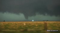
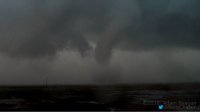
As this happened, the new meso was visible just to the northeast. I returned to the highway and witnessed this circulation rapidly produce a stout stovepipe with power flashes:

may2216g.jpg

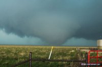
The tornado grew large rapidly:

may2216a.jpg

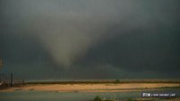
Then transitioned to a carousel of large subvortices, each large cones:

may2216f.jpg

The storm went massively HP at this stage. I drove north into the notch to look back southeast at another strong radar-indicated circulation, but saw nothing more. I bailed from the now-HP storm and headed to Erick, OK for the night.

Video:

And a close lightning strike from one of the dashcams:

Chaser traffic was a "4" on the CTI scale. Definitely a crowd, but nothing unmanageable as you'll see soon: I have archived the entire chase from all 4 dashcams and will put together a timelapse with realtime excerpts once I'm a home on my faster computer.
 
I waited around longer than I should have in Tulia hoping for something to initiate on the dryline, as storms went up off to the east and northeast near or a little east of the caprock. Finally decided to head north to AMA, and from there would either head for the storms to the east or the dryline if something decent went up there. Still nothing but turkey towers on the dryline except way north, so decided to head ESE on 287 to intercept a storm near Clarendon. If I had stayed on 287 I probably would have seen the entire life of the Howardwick tornado, but instead I decided to cut north to 40 - a bad mistake I made due to overestimating the storms movement. As it turned out I saw the last minute or so of the ropeout, but from 15 miles away through the windshield on I-40 is by far not the ideal way to photograph a tornado. Oh well, at least I saw it - for a minute or so.

IMG_6893-cr-e.jpg

IMG_6896-cr-e.jpg
 
Targeted the southern end of the system. My initial target area before leaving for the day was Big Spring, TX with an arrival time of about 3 PM. Just before arriving in Big Spring, cells had started to fire off to the west close to Midland. By the time I got to Big Spring, I blasted straight north through Big Spring for about 15 miles to make a westerly approach and get on the back side of the cells. I followed the dominant cell as it began to turn to the right (East) then eventually took a hard right turn due south.

Prior to the tornado(s) in Big Spring, I had stopped to take a look at radar and determine my next move. As I sat on the side of the road, a violent CG bolt struck very nearby. I didn't think much of it, and continued to look at radar/maps when I glanced behind me and noticed a raging inferno. I continued to progress to the east but determined I needed to turn around back to the west several miles, and drop south to I-20 as I had fallen behind the storms and was cutoff without taking a core.

Once I got to I-20 I continued to move east toward Big Spring, until about 8 miles I noticed what looked like the storm cycling and forming a new rotation right over me. Storm Relative confirmed the new rotation, so I stopped on I-20 and began to look around. I noticed a large debris cloud immediately to my right (south) and this was the Big Spring anticyclonic tornado that destroyed a single home and was on the ground for approximately 6-7 minutes and stood nearly in place.

Here is a video of most of the tornado's life cycle, from tornadogenesis to rope out.


And here is a full chase highlight video:

 
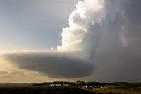
I targeted North Platte and figured I was in good shape when the morning stratus burned off around noon and surface heating was well underway. The dryline was just west of town and storms tried to initiate many times but it seemed mid-level capping was too strong and every updraft would get squashed. Storms finally slowly came to life early evening but each updraft, while vigorous, assumed a barber-pole lp type structure. The final storm that formed had a spectacular presentation, I have included a picture of this storm.

bw.jpg


Still, not a good day as I managed to pick the only target that produced no tornadoes, even the crap looking storms on the coldfront near Valentine dropped a couple.
 
Summary: Saw what was likely two separate tornadoes south and southwest of Lakeview, TX, then was trapped on TX-256 east of Lakeview for two hours by a combination of tornadic debris and floodwater.

While I will share no pictures or video on this post, I got pretty solid video of one of the tornadoes. However, I currently lack software to process the video and I'm not going to load a 21-minute video on YT when less than half of it is interesting. Photos were not very interesting.

Awaited initiation in a wonderfully flat open area SSW of Pampa. Went after the initial storm near Clarendon. It produced large wall cloud northwest of town. However, I could never discern rotation nor saw any funnels from my vantage point along TX-70 north of town. It wasn't long before splits/additional development from the south flew up north to interfere with it. Sensing no immediate tornado threat, I decided to play in the core and sample hail. I barely got even quarter-sized stones out of the several minutes spent in the core. It looked like the storm was continually struggling amidst repeated mergers from the south and southwest, and I had recently noticed the next storm down the line remaining mostly isolated and nearly stationary, so I abandoned that mess.

I decided to head west on TX-256 from Memphis to sample the core of the storm. Several miles along 256 I finally encountered stones large enough to be undoubtedly severe sized, although they were spiky and pretty sporadic. The next hour or more was rather annoying and confusing, as circulations would appear on radar on one scan and be gone one or two scans later, and they were popping up all over the place. I had a view of a broad, but shallow, lowering under the base to my south which would occasionally exhibit noticeable upward motion and even very weak rotation, but then a new scan would come up and draw my attention elsewhere. I kept jumping west along 256 a mile or two every 5-10 minutes as one circulation would appear, then weaken, only to be followed by another generally to the west. After awhile, I started finding myself alternating between mostly calm winds and strong northerly winds, passing in and out of RFD surges.

Finally seeing a more robust and persistent circulation on radar to my south, I headed south on FM-657, then east on FM-1041 knowing I could get back to Memphis that way (rather than having to go back to 256). By the time I reached Plaska I had finally gotten out of the rain. I was not impressed with what I saw. I could not find any concentrated, persistent rotation at cloud base. Having lost hope for the day, I turned back north on FM-2472 back towards 256 with the intent of watching whatever was left fall apart, then getting started back home. It was approaching 7 PM by this time and I had little reason to believe anything tornadic would happen. Boy was I wrong...

I ended up sitting along 2472 just north of the big curve halfway back to 256 for 10-15 minutes. Remarkably, rain was pretty scarce up in there, despite the fact that I appeared to be sitting right along the edge of precip in the notch of whatever hook echo was present. I noticed an inflow tail had formed and was streaming towards the southwest, but it disappeared into a void of precip and lack of cloud base. I saw no rain curtains wrapping, so I did not think there was a tornado in there. The inflow tail was persistent, however, and a more definitive cloud base formed under it over time, although I still could not discern any focused rotation. Eventually I drifted back to the south to get out of the way of some dead trees along the curve. Upon emerging from the trees, I saw the faint nub funnel extending below cloud base in the area where the inflow tail had been pointing. I was able to film the tornado for several minutes along 2472, despite a lack of places to pull off. There was only one or two other vehicles around where I was. My apologies if I blocked their path, but they looked to be filming the same thing I was, so it didn't seem to be a problem to be stopped in the driving lane.

I sensed the precip and strong RFD creeping up behind me, so I started drifting south to try to stay out of the heavy rain and wind. I also didn't think the tornado was going to stay down long, and sure enough, after just a minute or two, it seemed to trend downward in strength. Condensation became intermittent, but wrapping rain curtains remained. I decided I was going to get back down to 1041 after the tornado crossed to keep my view of it. I note on my video as the tornado appears to be weakening that rapid downward motion had formed immediately to my south. Less than a minute later, the winds accelerated at my location, which alarmed me. I wasn't totally sure what was going on. Thinking the tornado may have had a larger circulation than I thought, and thus I had drifted too far south and gotten too close, I turned back north. I got smacked in the face with high wind and large tumbleweeds in strong N/NW winds. When I turned back south, I saw what was likely a separate tornado had formed just east of the road. It took me until the next day watching my video that the increased wind speeds were probably the intensification of the circulation associated with that second tornado, which formed almost on top of me as I watched the first one weaken well to the south. Already on the backside of this second tornado, I pushed south. I witnessed some weak multiple vortex action and perhaps a faint cone, but then I approached downed power lines over the road. This is when it got bad.

I had been pulled into strong RFD with nearly zero-visibility rain and I had no choice but to go back north. The farther north I went, though, the worse the winds and rain got, eventually forcing me to stop and re-consider going back south and driving around the power lines in the ditch. About four cars were there with me, but it became obvious that there was absolutely no path to the south anymore. We were forced to push back north through the intense RFD, which gradually relented after a few minutes of pushing north. However, a new problem had arisen during this stretch - water over the road. I had a few nervous passages just getting back to 256.

Upon reaching TX-256 I knew the east route would be unsafe and plagued by extreme rain and likely hail, and I was no longer interested in sampling hail cores, so I decided to push west in an attempt to get back to 657 to 1041 to round my way back up to Memphis. Going 55-65 mph, I encountered a very large puddle over the highway, throwing muddy water all the way over the roof of my car. My wipers were not sufficient to keep water off my windshield as I pressed on through that puddle, so for several seconds I had no idea if I was even still on the road. Finally I made it back to uncovered pavement, now fully alarmed at how hazardous it had become. Now going much slower, but not even a mile later, I encountered another puddle covering a good 100 m of road ahead of me, and it didn't look good. There was another vehicle on the other side of the puddle flashing their brights at me frantically. I thought turn around, don't drown and gave up on the westward escape. Negotiating that nasty first puddle again, I went back east, but was only able to go a mile or so before encountering a similarly huge puddle over the road eastward. That was it: I was trapped, and it was still raining very hard, so I knew the water wasn't going down anytime soon. I was forced to find a high spot on 256 to sit.

For at least 90 minutes, the heavy rain did not relent. I was trapped there with Stephen Jones, Scott Peake, and Christophe Asselin and his pals who make the Rendevous in Tornado Alley series. After about two hours of sitting and nonstop rain, an emergency vehicle and tractor-trailer showed up and started checking on the road. Once the rain finally let up enough to get out of the car without getting instantly soaked, I found out the road had been completely washed out to the east. The emergency vehicle led a convoy of cars that had made it to this point back to the west, towards Lakeview, as that offered the only escape route, although I was in a sedan, and basically every other vehicle was a higher-framed SUV or truck, and most people were telling me they didn't think I would make it through. Not wanting to spend the night alone on the highway, I followed the convoy west. I made it to Lakeview, but just barely. It was probably that second big puddle that initially forced me to stop, but going through one of them, I felt my tires leave the road surface for a second, which was also the same second my heart stopped. Perhaps dumb, but I saw six other vehicles in front of me make it, so that gave me a little confidence that at least it wasn't a foot deep or something. The road was impassable on the west side of Lakeview, so I had to wait in the church that they opened up as a shelter. About a dozen other parties arrived there, one of which had totally lost their vehicle near town.

The last of the storms (a supercell, of course, which developed behind everything else and basically at sunset and dropped quarter hail on us in Lakeview) finally passed shortly after 9 PM. By 10 PM, with the help of some locals who had made it through the west side of town, I attempted to escape Lakeview and was successful. I made it back up to Clarendon, then I-40 and was able to get home with little trouble after that (the power went out at the Loves in Erick as I was trying to fuel up).

I feel kinda stupid for not having considered how much rain had fallen on the road network I sat on. That section in northern Hall County was basically an isolated road network, having only two roads to cross rivers and escape. Definitely learned some of the downsides to my newfound more aggressive, risky, and hence more reckless, chase strategy. I will definitely be more mindful of this next time.
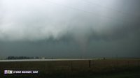
 
Had what you could call a back yard chase on Sunday, just over to Garden City. Maid a bad choose on a road south of Garden to avoid driving thru town, cost us more time I think, so cost us seeing the reported multi vortex NW of Garden. Got N of Deerfield on flooded gravel roads but were very drivable, got close to the circulation on a east west road and had a very brief tornado out in front of us. Then just of to the north a large area of very fast rotation and several small and brief funnels and tornadoes started dropping. Would not call it a multi vortex these were not in the center of the circulation but on the outer edges. Then in the center of it started the bigger one that quickly became the wedge, got rain wrapped very fast and we bailed out because could no longer see anything with the curtains of rain wrapping very fast right on top of us only got a couple of shots of it. because my chase partner did not hit record on video here is what I did get.DSC00908.JPG DSC00908.JPG 20160522_192838.jpg
 
After 6 years of chasing I finally got a taste of some caprock magic. My chase partner Jon Stone and I observed at least 3 tornadoes around the Spearman, TX area. We initially sat around in Cactus while watching storms fire off the dryline near Dalhart and then struggle to get its act together. Jon mentioned something about a boundary that had set up parallel to Highway 287. The dewpoint was at 67 in Spearman at the time and the surface winds were backed while up in Stratford the dewpoint was 59 with surface winds out of the southwest. We needed to get east and we arrived in Spearman in time to catch the supercell that would produce our tornadoes. We waited patiently for the supercell to get organized and when it did we were treated to one of the best shows either of us have ever seen while chasing.

e3cf12bee4da13b73d5b500ae5297a9a.jpg
9176c5675bda79fbd894dd16f0f6d95e.jpg
8b8cc8b893f7a7f9a1efca9fe9db653a.jpg
6c765b4e8142e0aa112067b855d018fd.jpg
630c1646635761649c531db393a38d74.jpg
be16f26eac4b022d6aecebfd07fb8041.jpg

 
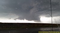
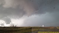
Today was a 700 mile chase with almost all of the action on just a few miles of FM 657 and FM 1041 southwest of Lakeview TX (Hall County). The storm produced rotating wall cloud after rotating wall cloud and we just about wore out the pavement on that section of road. We did see several brief rope funnels, but when it did produce a tornado it was rain wrapped and we couldn’t see it (not to mention we had to watch new wall clouds to our west).

We left the DFW area just afternoon headed towards are target area of Amarillo. We say our first wall cloud to the west of US 287 just before 4:30 PM just as we were approaching Memphis, TX. We almost kept going to get on the storm near Clarendon, but instead we exited at Memphis and took SH 256 west thru Lakeview and turned south on FM 657. For the next 2 hrs and 15 mins we would traverse the same sections of FM 657 (runs north and south) and FM 1041 (runs east from FM 657) over and over. It produced so many rotating wall clouds we lost track and as soon as one formed it became rain wrapped and a new one formed to the southwest. Several formed almost directly over us on FM 657 and we had to drop south several times to keep from being directly under it. Each new one seemed to form closer.

I finally had the pleasure of tagging up with Daniel Shaw. The pace got very hectic with the same pattern repeating over and over only faster and my chase partner and I started to become concerned about the rapid back building and began to discuss if we should bail before we got trapped. It turns out that Daniel had the same concern and at about 6:50 he radios me and says we need to pull up and talk. I’m glad he did, as my partner and I have had somewhat of a flustering chase season (on the right storms, but a lack of roads or taking pics too long kept us from being in the perfect spot) and we would have been tempted to stay. We decide to head south on FM 657, cross the Prairie Dog Fork of the Red River, and then go east on TX 86 to Esteline, and then north on US 287 to get in front of the system again. Before we get to Esteline, we notice four wall clouds to the north of TX 86. Beneath one of them some dust kicked up and we thought we had a tornado, but it quickly spread and we realized it was outflow. Things started to look really bad on radar and Daniel and us both realized we needed a new plan. We turned around and headed west on TX 86 toward Turkey TX. There was some weak rotation near Turkey, but it seemed like the lesser of the evils. Along the way the wind took out a spoiler on the underneath side of our vehicle and we ran over it. We also encounter bad cross winds and water on the road. We ended up driving directly under a rotation we probably should not have, but in retrospect it was a good decision as numerous other chasers got trapped in the area we had left. A little after 8 PM Daniel headed north to get some structure pics and we headed back to DFW. We were delayed in our return due to a storm near Paducah that has some hail in it.

Here are some of the better pics of the day:

20160522_1721_videoFrame.png
Taken at 5:21 looking east from FM 657 just north of the Red River.

20160522_175400_small.jpg
This picture was taken at 5:54 looking west from FM 657. At 6 PM it became rain wrapped. By 6:02 another updraft started to form to the left (southwest). By 6:04 the rain wrapped area disappeared (but so did the original wall cloud) and the new wall cloud to the southwest was rotating.

20160522_1836_videoFrame.png
While watching the wall cloud close to the ground in the background, a new wall cloud formed right in front of us. Taken at 6:36 looking west from FM 657.

20160522_183636_small.jpg
This wall cloud produced a very brief tornado that I didn't capture on video/photo. Taken at 6:36 looking west from FM 657.

20160522_184229_small.jpg
Very brief funnel tries to form almost right over FM 657. Taken at 6:42 looking north on FM 657.
 
This was a challenging, but ultimately solid day. Starting from Dodge, I initially aimed for Perryton, TX, with the explicit intent of doing a data check and being able to drift south and west as the storms fired and came to me. This proved to be a pretty decent call. After gas and lunch, I scooted over to Spearman. The first stuff started to fire about 40 miles southwest of there, so I continued to zero in a bit toward Pringle. I was able to hang out there for a bit before a farmer came along and kicked me out of the tractor parking lot where I'd taken up residence. By that point, the storm had developed enough to look like it would sustain itself, so I shot west and north a bit to regroup. At that time, I almost broke off for the lone storm back by Dalhart, but I told myself I needed to stick with my storm, and drove back through the northern part of the cell I was on. By this time, it had 1" hail, which wasn't the most pleasant surprise.

I broke through and got ahead of it on the northeast side eventually, and was able to see a couple wall clouds under the main base. By this time, things were getting really messy, with storms regularly forming to the south of the main one, and being ingested. That meant dealing with round after round of hail tracking in from the south. While well ahead of the main core, I finally got to the south end of the storm via gravel road, which got consistently muddier with every mile. That was pretty harrowing, especially with the lightning. Getting to pavement again was a relief, but new storms were still forming to the south and being ingested, so rain, hail, and lightning were always a problem.

Things finally cleared out some as daylight started dropping off. The storm took a very deep breath and the stuff forming to the south let off a bit. It developed a broad wall cloud, and many of the chasers who had been escaping east were driving back west toward it. I stayed put, even though that meant not getting very close. The low level jet seemed to crank up very hard on short order, and that coincided with the main tornadoes everybody saw. It went from constant messy ingestion to solid, easy-to-read inflow. The late day intensification of winds in the low levels really did the trick.

I was probably about 3-5 miles from the main action. I saw several funnels and at least 3 of them made it to the ground. The best one was quite interesting. It started as a nice slender trunk, but then showed as a cone, wedge, and multi-vortex as it erratically moved southeast...toward me. During this time, I flagged down a guy who was driving past slowly, by pointing behind him. He didn't seem to know what was happening. He pulled over and then piled the whole family (with young kids) out of the car to look. That was weird. I had to remind him it was coming toward us.

After the main show ended and I could start detecting signs of RFD arriving on my location, I shot east a couple more miles, and pulled into another farm staging lot. By that time, a solid stream of chaser vehicle headlights was approaching from the road I was just on, and the core of the storm filled with rain (or hail). I opted to take the escape route south to Pampa for the night, and get away from the crowd.


I've included a couple of my favorite shots from the main tornado.

_MG_0124.jpg


_MG_0133.jpg
 
Managed to get 4 tornadoes out of the Lakeview, TX storm. Sat in the forward flank and stared Southwest and watched it put down a couple of tubes. Didn't get much in the way of photos, but I did get video. However, the quality is pretty crappy, because I had not yet discovered how to turn off the autofocus when recording video. Thankfully I figured it out before the next chase day.

 
My target was Big Spring, TX, as I liked the dryline bulge, and some other things that I can't even remember at this point! I noticed that almost every chaser was up in the panhandle, but I still felt confident in my target, and enjoyed the fact I wouldn't have to deal with any chaser convergence! It was just me, Ben Holcomb (nice to "meet" you Ben!), and a few others down there!

When cells fired, I got on one near Ackerley, which looked decent, had a wall cloud, but eventually got cut off by the core of the storm to the south. I knew I'd have to get to the tail-end storm. Just north of Big Spring I saw the base to the west. The storm was tracking straight south, so I headed west out of town and got right within the hook. Inflow really picked up, I saw a gustnado, then a brief spin-up, then after going south on 2599 witnessed a multi-vortex from pretty close range, that would then become rain-wrapped. At one point right at I-20 I may have been in the outer circulation of it, as I got blasted by sheets of rain and strong winds. I backed off a bit, then came back down to the interstate. All you could see was a big wall of rain, but the survey shows a very wide swath of damage, so apparently that whole thing was in fact the tornado.

Complete story, pictures, and video here: https://huntfortornadoes.wordpress.com/2016/05/28/chase-log-may-22-2016-big-spring-tx-tornadoes/
 
Curtis McDonald and I targeted the I-40 corridor from Amarillo to McLean. We were right under the base of the initial storm W of Clarendon (3:30-4:00pm) within 20 minutes of initiation, experiencing golfball to tennis ball hail along US-287. The storm's updraft was simply explosive, appearing as crisp and vertical as anything I've ever seen in the Panhandles before. Almost immediately it developed an impressive wall cloud and we thought tornadogenesis was imminent. But just as things were ramping up, another updraft exploded in its inflow. And so began the story of the day.

I lost count of how many new storms developed in the area just SW of Clarendon, near the Donley-Briscoe-Hall Co. corner, over the course of the afternoon and evening. There almost certainly had to have been some type of orographic enhancement that favored this spot in conjunction the day's low-level wind field. Every single time, the new cell would quickly attain 50kft tops on radar, develop a notch and appear primed - only for the process to repeat with a period of 20-30 min, leading to a complete convective mess. Around 5:30pm we had all but given up, and decided to gas up in Clarendon before bailing S for similarly messy storms around Lakeview. No sooner had we finished our pit stop than did a couplet and tornado warning appear to our immediate NW near Howardwick - around where we'd been driving in circles for an hour prior. We raced back up and caught the entire life cycle of the "main" Howardwick tornado around 5:40pm, but most of its cone phase was compromised by poor viewing conditions as we traversed hills E of Greenbelt Reservoir. In hindsight, simply beelining to the park area on the E side of the lake would have been the smart move. We eventually stopped about 2-3 mi. ESE of the vortex as it entered its rope phase, which was perhaps the most interesting and photogenic, featuring clearly visible chaotic descending motion.


Afterwards, the convective evolution in this area immediately reverted to the cluster that had seemed evident beforehand, so we shot S toward Brice. Unfortunately, we were about 5-10 min. too late to be in good position for the strong (but partially wrapped) Lakeview tornado that occurred shortly after 6pm. This became obvious as we attempted to catch the cell from the backside and hook slice, but continually found ourselves nearly blown off the road by RFD and some of the most blinding rain I've seen since... well, most of my 2015 chases, I guess. Before long, the tornado was done, the cell was becoming extremely HP, and we were struggling to make our way back NW from Plaska to TX-256. During that drive, flooding became increasingly worrisome, and by the time we were 1.5 mi S of TX-256 things came to a head: a torrent of clay-red water rushed across our paved N-S road for nearly a quarter-mile stretch that we simply couldn't risk getting caught up in. As a result, we sat helplessly between rushing rapids on either side of us as extremely heavy rainfall continued unabated for over half an hour. Sometime close to 8pm, we finally resigned to attempting the roundabout route S toward Estelline and Childress (since radar indicated temporarily lessening rainfall in that direction). We cautiously made our way down to TX-86, then wasted a good 10-12 mi. getting E toward Estelline before encountering a road block and downed lines. Now after 9pm with twilight fading, our only option was to backtrack SW to Turkey, then make the 60-mile trek back to I-40 at Jericho. We pulled into Clarendon at 10:03pm to find the local Subway locking its doors and unwilling to take pity on us, leading to my first (and hopefully last) ever Allsups dinner on a chase. We made it back to Moore around 1:30am after fighting off a 50-mile stretch of obscene outflow winds from Shamrock to Elk City, which averaged 40-50 mph sustained and blew at least one semi off the road.

All in all, a perilous and exhausting chase day with just about every type of annoyance and hazard imaginable, short of something disastrous like a deer collision. Still, we observed a tornado that was mildly photogenic and reasonably long lasting, which was enough to make it a net positive experience. Seeing images of the more impressive Scott City and Spearman cells on the drive back stung a little, though. Fortunately, the next three days would get progressively better!
 
Jeff Duda said:
While I will share no pictures or video on this post, I got pretty solid video of one of the tornadoes. However, I currently lack software to process the video and I'm not going to load a 21-minute video on YT when less than half of it is interesting. Photos were not very interesting.

Took advantage of a free trial for some simple video editing software to put together a video detailing the highlights from my chase. The camera went off right about the time I became trapped.

 
Good day all,

This is a rather late post, but none-the-less, my reports from near Memphis, Texas on May 22, 2016.

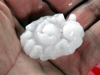
1). May 22, 4:30 PM - Interception and penetration of a very severe thunderstorm near Groom, Texas along Interstate 40 in Carson County. This storm was the left split of a developing supercell storm of which its southern component eventually became tornadic. Mainly large hail was observed from an I-40 underpass, with pieces ranging from quarter to golfball sized. Frequent lightning, heavy rains, and 45 MPH winds were also observed with this storm. Conditions causing these storms were surface heating, a low pressure trough, upper trough, and dryline. A 2009 Ford Escape SUV was used to chase the storms. Documentation was digital stills and HD video. A tornado watch was also valid for the area until 10 PM CDT.

m17hail4.jpg

Above: A piece of large hail that fell near Groom, Texas on May 22.

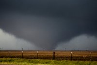
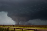
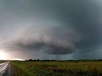
2). May 22, 7:00 PM - Interception and penetration of an extremely severe and tornadic thunderstorm southwest of highway 287 in Hall County, Texas to the southwest of Memphis and near Lakeview. The storm was a cyclic HP supercell storm, forming on the south end of a cluster of severe thunderstorms. This storm developed intense rotation, and at least three large tornadoes were observed with this storm (cone with a small satellite and multi-vortex that nearly became wedge dimensions before becoming rain wrapped). These tornadoes fortunately occurred over open country. The storm also contained extremely heavy rains, causing flash flooding. Frequent lightning with close hits, winds gusting over 60 MPH (especially inflow), and hail up to tennis ball sized was observed with this storm. Conditions causing these storms were surface heating, a low pressure trough, upper trough, and dryline. A 2009 Ford Escape SUV was used to chase the storms. Documentation was digital stills, HD video, and audio. A tornado watch was also valid for the area until 10 PM CDT.

m17sc16.jpg

Above: HP / Classic supercell storm to the west of Memphis, Texas in Hall County. A funnel and RFD can be seen developing in the rotating base of this storm. This was during the evening of May 22, 2016.

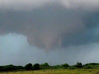
m17tor30.jpg

Above: Possible brief tornado, the first of this storm, west of Memphis, Texas late in the day on May 22.

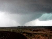
m17tor31.jpg

Above: Tornado widens into a large cone / truncated wedge tornado near Lakeview, Texas.

m17tor26.jpg

Above: Another large tornado southwest of Memphis, Texas and southeast of Lakeview in Hall County. The view is looking SW on May 22.
 
Back
Top