Andrew Livermore
EF0
I know that there is already a thread for reports for this day but in the sticky it says you can post a new thread for the same day if the threads are talking about reports separated by 500 miles. From the first threads report area to this threads report area is 740 miles in between.
It was day 3 of my chasecation and I had to make a decision to either target the slight risk in the DFW area or head north and target a marginal risk in northwestern/north central Kansas. That morning as i was looking at the HRRR and i noticed that a cold front was advancing south where temps in my target area were mid 80's. Dew points were not as favorable as they were mid 40's for that HRRR run. I also looked at what the SPC had for the following days outlooks. Me and my partner both agreed that we did not want to make the drive to the KY/IL enhanced risk for that day. Also with the day 3 outlook showing pretty bleak at the time we knew our days were limited and since we live in eastern NE. So the choice was clear. So we packed up our gear and left the family members house we were staying at in Springdale, Arkansas and made the 7.5 hour/493 mile drive. We were in between Wichita, KS and Joplin, MO when the SPC upgraded the marginal risk for our area to a slight risk.
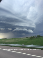
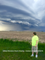
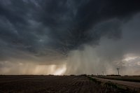
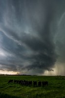
Fast forward several hours where we were about 1.5 hours away from our target area and could see the updraft towers going up. On radar the storms actually looked sad and uneventful. I had the thought in the back of my head that maybe we wasted our time but we pushed on. We came into WaKenney, KS as our storm became severe warned. We took the closest highway north and became one on one with the storm. We approached from the south and waited for the core to pass the road so we could move more north. The core stayed south of the east bound highway we later got on to get ahead of it. It chased us for the next 2 hours/120 miles. While just a couple miles north of the town of Phillipsburg, KS, a wall cloud was reported and later had 2 funnels reported. We could see the wall cloud but we never saw any definitive funnels.
The storm would later try to cross the KS/NE border but died doing so. We were set up in Lebanon, KS to watch it more but ended up abandoning it as it wasted away. We ended up going north to Hastings, NE for the night.
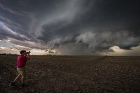
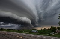
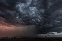
Here is two of the better pictures we captured of this storm.
