• While Stormtrack has discontinued its hosting of SpotterNetwork support on the forums, keep in mind that support for SpotterNetwork issues is available by emailing [email protected].

2016-03-15 REPORTS: IL/IA

Initial target was just east of Hannibal. Storms fired first to the NW, I wanted to wait for storms to fire further south and track into what should have been a better environment. It eventually became clear that may not happen before dark so we raced north to meet the already tornado warned storm that was nearing the IL/MO border. We met the storm traveling north on 336 south of Carthage IL. With the storm to our NW we briefly observed a large cone shaped lowering. I have been waiting for others to confirm or deny this a tornado as we were to far away to see the ground, but I haven't found any other footage or reports from our location. I only noted one other chaser on the side of the road there with us at the time. The feature was visible only a few minutes before disappearing in the rain. Here is a blurry video capture.
tor 2.PNG
 
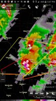
Didn't see any tornadoes, but wasn't a complete bust. Set up shop in the afternoon in Keokuk, Iowa, as I figured there would be storms which would fire just to the Southwest and track Northeast right to me. Storms fired right where I thought they would, and I sat in the Walmart parking lot in Keokuk, waiting for the storms to mature. Two main cells began to strengthen, and were trailing each other. I made my way to the Southeast to intercept the first one. Had pretty nice structure. d060573a25133738903844e375434191.jpg However, by looking at Radarscope, I knew this wasn't the main show. The next supercell was soon to be over me, right behind this one. (I'm driving around the outskirts of Keokuk) Hail on the core of the 2nd cell had signature of 2.75". Here's a screenshot I took of the cell as it approached.938b24ee8d16d66c56066ebafc9b4a32.jpg As I was driving around, attempting to see any lowering feature I could from my position, I quickly realized I was in the direct path of the hailcore. I hurried into town (Keokuk) to attempt to find shelter for my car. I found a selve-serve car wash to huddle under, and right on time. Here's some video of the hail storm I encountered while under the protection of the car wash. (You may have seen my video on The Weather Channel) Check out @clevelandkahner's Tweet: https://twitter.com/clevelandkahner/status/709880890781016066?s=09 Was the end of the chase for me after that cell, as I didn't see necessary to track across the Mississippi into Illinois. However, I missed the chance to see several tornadoes. Oh well, maybe next time

Sent from my SM-N920R4 using Tapatalk
 
View media item 991A frustrating but at the same time relatively satisfying chase for me. I was dead set on chasing the day before and the day of, only to find the guy i was gonna chase with didn't have a vehicle like he said he would. So, after a last minute scramble to obtain a vehicle and finding out i was now chasing solo, I left from Bourbonnais about 2:30, hoping I would be able to get to my target on time. I started out expecting to go to Jacksonville, but once storms finally fired in NE MO, I made the decision to head west from Lincoln towards Macomb. The timing actually worked out quite nice, as I pulled into Macomb right as the easternmost storm started to strengthen. I was chasing solo, and only using an Iphone for radar, navigation AND videos so if I had been doing a better job, I would have taken the road BEFORE Macomb to the North, and then maybe I would have been in better position to get a view of the soon to be tornado. Regardless, north of town I was able to stop and get some good shots of this thing spinning in front of me. View media item 992 View media item 994 Here is a short video clip.
I went up the road just a bit, then turned right to head Eastward. But I had to stop again and snap pictures of this thing, as I was sure it would produce at any moment. View media item 995 View media item 996 Unfortunately, you can see the precip start to wrap in from the left. That would be my undoing. I was not anticipating this becoming rain wrapped. One more short video:
Technically, my last shot corresponds to the time the surveys indicated the tornado actually began. But I am torn as to count this. I did continue east, and North, stair stepping to follow it, but the rain and hail really wrapped in, and more storms were developing along the flank to the southwest. So, I was forced to drop south and hope that "tail end charlie" would strengthen. It ended up being more like "fail end charlie" as the whole series of storms became linear. Ultimately I did meander east/southeast of the line until I got near Peoria. They did tornado warn parts of it off and on but I never saw anything tornadic when stopping to look back. I worked my way towards I74, then skirted the line of storms back up I55 towards home, occasionally stopping for lightning pics, but not getting anything worthy.

Note: Mods: something was wrong with my first post so i copied and edited the content, can you delete my first post since it isn't working properly?
 
Last edited:
Good day all,

I am finally getting around to updating all my chase logs for Spring of 2016. Sorry about the late reply, but here is my two cents on March 15, 2016.

1). Mar 15, 5:30 PM - Interception and observation of a very severe thunderstorm near West Point, Illinois near Highways 110 and 94 in Hancock County. The storm was a classic supercell storm with a rotating wall cloud, and was followed northeastward towards Plymouth before it weakened. The storm core was not directly penetrated, but contained winds near 60 MPH (mainly RFD), heavy rains, occasional lightning, and some small funnel clouds. The storm core had hail to golfball sized, and this was noted covering the ground near Tennessee, IL later in a small swath. The storm was caused by a warm front, strong upper trough, surface heating, and a low pressure area. Documentation was digital stills and HD video. A 2009 Ford Escape was used to chase the storm. A tornado watch was valid for the area until 9 PM CDT.

2). Mar 15, 6:15 PM - Interception, observation, and penetration of a very severe and tornadic thunderstorm from near Carthage, Illinois in Hancock County and points east and northeast along Highways 136 and 9 through Good Hope and Bushnell in McDonough and Fulton counties, and eventually through Peoria along Highway 24 in Peoria County. This storm was a powerful HP / classic supercell storm, which produce 3 tornadoes. The first of these tornadoes was observed passing just north of Carthage as a diffuse, rain-wrapped tornadic circulation. The second storm "cycle" occurred in McDonough County near Blandinsville and towards Good Hope, where an extremely powerful RFD surge to 80 MPH was encountered south of another multi-vortex tornado. A low bowl shaped lowering with intermittent ground circulations was observed before rain wrap ensued again. A final possible tornado, in heavy rain and west of Trivoli, IL, was observed as a large and broad funnel at dark. Extremely heavy rains, frequent lightning, and hail to 2" were observed as well. Winds outside the RFD surges also gusted near 70 MPH. This storm also caused flooding and some damage. The storm passed near Peoria before upscale growth into a powerful MCS / bow segment. The storm was caused by a warm front / cold front occlusion point, strong upper trough, surface heating, and a low pressure area. Documentation was digital stills, audio, and HD video. A 2009 Ford Escape was used to chase the storm. A tornado watch was valid for the area until 9 PM CDT.

3). Mar 15, 8:30 PM - Penetration of a small severe thunderstorm near I-39 and I-80 in LaSalle County, Illinois. This storm was an elevated severe storm on the backside of a cluster of severe storms associated with an occluded cold front. The storm had winds near 60 MPH and hail up to 1". Frequent lightning, with close hits (one about 100 yards from the roadside), and torrential rains were also encountered. This slightly elevated severe storm was caused by an occluded cold front, strong upper trough, and a low pressure area. Documentation was audio. A 2009 Ford Escape was used to chase the storm. A tornado watch was valid for the area until 9 PM CDT.

m17hcrs.jpg

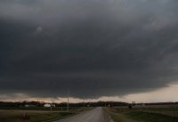
Above: When the sky looks like this - Something is going on with the atmosphere! Mid level ACCAS with convective rolls over IL as upper level trough moves overhead from the west on March 15, 2016.
m17scel1.jpg

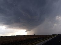
Above: Supercell storm southwest of Carthage, IL on March 15, 2016.
m17tor1.jpg

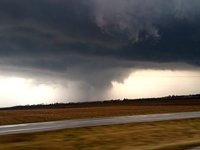
Above: Possible weak and diffuse tornado west of Carthage, IL on March 15, 2016.
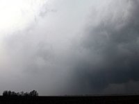
m17tor3.jpg

Above: Possible tornado behind the intense RFD clear slot in McDonough County, IL on March 15, 2016.
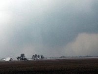
m17tor4.jpg

Above: Closeup of possible tornado in McDonough County, IL on March 15, 2016.
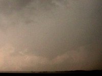
m17tor5.jpg

Above: Another funnel wrapped in rain to my north in far NE Fulton County, IL on March 15, 2016 near sunset. Possible part of the tornado that affected Trivoli, IL.
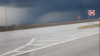
 
Back
Top