Andy Wehrle
EF5
Nick Lorenz and I intercepted the tornado at Hanna City, IL essentially by accident. He couldn't leave work until 4, so we knew we would likely miss something on the way. Once the cells developed in far NE MO on our way down, we could only cross our fingers the show wouldn't be over by the time we got there as they matured and tornado reports came in. There were two main cells in this cluster, the strongest couplet and most of the tornado reports were on the trailing one but I figured the lead cell would eventually intensify as it had unimpeded inflow.
It was on a course that would take it just southeast of Galesburg, so we plotted a route that would allow us to intercept it by going west on I-80 from I-39 at LaSalle/Peru, then exiting on IL-40 to US 34 west and southwest through Kewanee, then south on IL-78.
To our consternation, the lead cell appeared to go HP as we drew near to it, with the couplet buried way back in the rain. Furthermore, a new cell initiated to its south and was on course to crash into it, often the kiss of death for tornadogenesis.
Sure enough, the merging cells appeared to be lining out on radar, so we decided to drop south then blast ahead of them with time to get the car under shelter in case there was hail. We were just planning to let the storms roll over us and shoot lightning on the back side.
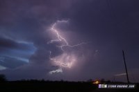
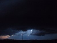
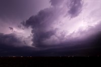
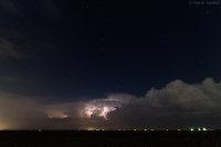
We fortuitously chose the Casey's gas station on the west side of Hanna City. I tried for some lightning on the incoming storm, but was frustrated by a lack of clearly visible bolts, trees in the way and cars exiting the gas station shining their lights into my exposures. This shot, as it turns out, was just about two minutes before the tornado would begin just out of frame to the left.
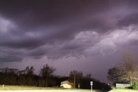 Lightning-Lit Storm, Hanna City, IL 3/15/2016 by Andy, on Flickr
I folded up my tripod and we started to walk back to the car, when we both commented on the fact that the wind was still blowing towards the storm, rather than away from it as we would expect with an outflow-dominant line. However our reaction was more of a "huh, that's interesting" rather than the huge red flag it should have been. Just as we got back to the car, both our cell phones alerted for a tornado warning, followed seconds later by the town's sirens roaring to life. Radar on the laptop showed the merging cells had developed a new inflow notch right on top of us, and there was a pronounced couplet just off to our northwest!
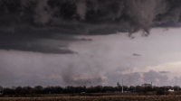
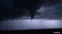
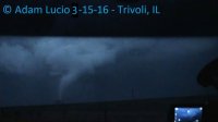
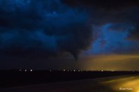
We pulled out from under the gas station canopy, and I pointed my camcorder northwest to capture this in the lightning flashes:
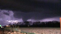 Trivoli/Hanna City, IL Tornado, 3/15/2016 by Andy, on Flickr
This marks my first tornado intercept on a chase!
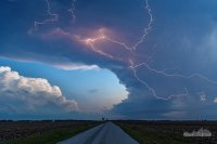
We should have stayed put here, but we tried going east through town and taking the next road north. Unfortunately it had a ton of trees and hills blocking the view to the west, so we hightailed it out of there, racing ahead of the storm on I-74, then north on 39 towards home. We stopped off at El Paso to grab food at the Dairy Queen and try for some lightning. Only got one semi-decent shot as the best bolts always hit milliseconds after my shutter closed on a 4-second exposure.
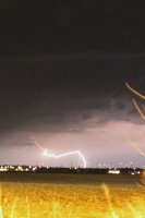 Cloud to ground lightning, El Paso, IL 3/15/2016 by Andy, on Flickr
The spectacular lightning show continued to our east as we headed home on I-39, and I had better luck with some video on my DSLR:
 Lightning Display, Central IL 3/15/2016 by Andy, on Flickr
It was on a course that would take it just southeast of Galesburg, so we plotted a route that would allow us to intercept it by going west on I-80 from I-39 at LaSalle/Peru, then exiting on IL-40 to US 34 west and southwest through Kewanee, then south on IL-78.
To our consternation, the lead cell appeared to go HP as we drew near to it, with the couplet buried way back in the rain. Furthermore, a new cell initiated to its south and was on course to crash into it, often the kiss of death for tornadogenesis.
Sure enough, the merging cells appeared to be lining out on radar, so we decided to drop south then blast ahead of them with time to get the car under shelter in case there was hail. We were just planning to let the storms roll over us and shoot lightning on the back side.
We fortuitously chose the Casey's gas station on the west side of Hanna City. I tried for some lightning on the incoming storm, but was frustrated by a lack of clearly visible bolts, trees in the way and cars exiting the gas station shining their lights into my exposures. This shot, as it turns out, was just about two minutes before the tornado would begin just out of frame to the left.
 Lightning-Lit Storm, Hanna City, IL 3/15/2016 by Andy, on Flickr
I folded up my tripod and we started to walk back to the car, when we both commented on the fact that the wind was still blowing towards the storm, rather than away from it as we would expect with an outflow-dominant line. However our reaction was more of a "huh, that's interesting" rather than the huge red flag it should have been. Just as we got back to the car, both our cell phones alerted for a tornado warning, followed seconds later by the town's sirens roaring to life. Radar on the laptop showed the merging cells had developed a new inflow notch right on top of us, and there was a pronounced couplet just off to our northwest!
We pulled out from under the gas station canopy, and I pointed my camcorder northwest to capture this in the lightning flashes:
 Trivoli/Hanna City, IL Tornado, 3/15/2016 by Andy, on Flickr
This marks my first tornado intercept on a chase!
We should have stayed put here, but we tried going east through town and taking the next road north. Unfortunately it had a ton of trees and hills blocking the view to the west, so we hightailed it out of there, racing ahead of the storm on I-74, then north on 39 towards home. We stopped off at El Paso to grab food at the Dairy Queen and try for some lightning. Only got one semi-decent shot as the best bolts always hit milliseconds after my shutter closed on a 4-second exposure.
 Cloud to ground lightning, El Paso, IL 3/15/2016 by Andy, on Flickr
The spectacular lightning show continued to our east as we headed home on I-39, and I had better luck with some video on my DSLR:
 Lightning Display, Central IL 3/15/2016 by Andy, on Flickr
