R R Smith
EF0
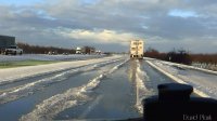
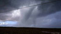
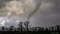
Yet another cold pool post frontal supercell occurred this past Saturday (January 23, 2016) in California's Sacramento Valley just south of Red Bluff. A line of thunderstorms developed from just north of Corning to Redding late in the morning as the Sacramento Valley cleared out and was in bright sunshine. Around 2:30 PM PST, a low topped supercell storm developed just south of Red Bluff. This storm was initially tracking NE quickly became a right mover and ultimately dove to the south. It was tornado warned for a time, producing at least one funnel cloud and dumped significant amounts of hail on roadways including Interstate 5. Plows had to be called out to clear the hail from the roads. The largest hail stone measured was just over 3 inches. The NWS Sacramento did a quick look at rotational velocities which revealed a Vr around 40 kts and given the distance from KBBX radar, this storm was pegged as at least a high-end moderate mesocyclone off of the Mesocyclone Recognition Nomogram chart from Andra (1997). Unusual for California. The supercell persisted for over 3 hours.
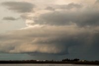
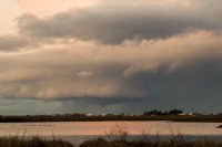
I was unable to chase due to some other commitments but did have an opportunity to photograph the storm near sunset as it drifted south towards my location just east of Willows. The storm was still severe warned and had fabulous structure for a California storm including an occasional wall cloud, brief funnels and bowl shaped lowerings, and a wonderful flanged updraft. The radar grab was taken at 2:57 PM as the storm became tornado warned.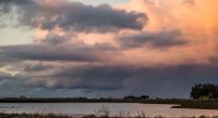
I was unable to chase due to some other commitments but did have an opportunity to photograph the storm near sunset as it drifted south towards my location just east of Willows. The storm was still severe warned and had fabulous structure for a California storm including an occasional wall cloud, brief funnels and bowl shaped lowerings, and a wonderful flanged updraft. The radar grab was taken at 2:57 PM as the storm became tornado warned.


