• While Stormtrack has discontinued its hosting of SpotterNetwork support on the forums, keep in mind that support for SpotterNetwork issues is available by emailing [email protected].

2015-12-23 REPORTS: AR/MS/TN/MO/IL

Joined
Aug 2, 2009
Messages
72
Location
Cabot, AR
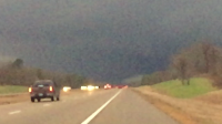
Definitely a career day for me as well as my best chase of 2015. Targeted Clarksdale, MS. Arrived around noon and hung out till storms fired. Storms fired south of me around 2:30 or so and I let the cells come right to me and took off after the first one that took on supercellular characteristics and went severe warned. I headed east to get in position and found a good spot east of Clarksdale near Marks, MS.

I was able to watch the tornado on the ground for close to ten minutes. Very violent with horizontal vortices. Got to check Mississippi as well as the month of December off my chasing bucket list.

26464a522056b2613f2ffd003f09bd5a.jpg

7dcf6fcc2d3d2208dfab61255bbd5817.jpg

9c8300cfd1834231854d8b44a05b600a.jpg
 
I think I was on the same storm as the op. It went warned as it crossed the Mississippi River and had very strong rotation almost the entire width of the state. Very fast moving storm. I saw it just south of holly springs, ms. It blew several cars and 18 wheelers into the ditch and ripped the tops off of pine trees where it crossed the highway. Probably a couple of hundred yards wide.
 

Attachments

  • image.png
    image.png
    1,021 KB · Views: 219
Mods: Please add IL to the title.
I chased the West Central Illinois low-topped supercells today. I picked out a target of Galesburg the night before and got there around 11am to sit and watch conditions evolve. As storms began to fire in Missouri I made the decision to go a little south and begin to pick up on a storm near Keokuk. After gaining a SVR warning I got a good view of the base. The storm itself had two separate areas of rotation at first that would trade off in strength, but neither ended up producing anything more than a wall cloud. 50ab0e97f4b2d1a2bced33edbbd274e0.jpg
As the sun began getting lower, I decided to punch the core of it to get on the backside of it and follow it northeast. After getting through the core and some small hail, I was greeted to one of the most incredible scenes I have ever seen.
3f03b069029d8655ca2e81d2350d65cc.jpg
The sun began to set and lit the backside of the storm a light orange along with one of the most magnificent rainbows I had ever seen. At the same time, I looked over at my laptop to see the new tornado warning with a confirmed tornado on it about 8 miles to my southeast. I immediately drove to the closest clearing I could and could barely make out the distant rope tornado in Sciota, IL.
fd9d44452137f4cd65364e492ea87a89.jpg
Overall, it was an interesting day. Similar as to what I expected, just lacking instability.
 
Last edited:
Visiting family in AL for the holidays, so I took a jaunt over to the other side of Dixie Alley for the day. I'd originally hoped for a target closer to the state line around Tupelo, but reluctantly allowed myself to get baited west until I was near the Mississippi and 3+ hours from home -- *very* rare that such long journeys are warranted in this part of the country (at least in this Plains snob's opinion).

I hung out in Holly Springs for about an hour around 2:30-3pm knowing that the action was likely to begin to my W or SW, but unwilling to commit to a particular area or storm until the picture became clear. At some point it became clear that the Clarksdale storm was the play, and I found myself playing catchup. I finally intercepted the mesocyclone 2-3 mi. W of Sardis. While the Clarksdale-Marks tornado was still ongoing and I was able to intercept up-close, it seemed to be at a relative minimum in visual appearance, struggling to condense as it crossed the road. Seeing video and photos of this same tornado only 5-10 min. before and after (e.g., near Marks and then later crossing I-55 near Como) irritates me... a lot. And I'll just ignore the fact that had I stayed put in Holly Springs, today might've been a top 5 intercept. But I'll still call it a big success for the fact that I've got the elusive December tornado (and a daytime+quality one, at that) and was able to successfully film a tornado in Dixie Alley for the first time, after a few ill-fated attempts in the past.

 
For Illinois:

Originally my target was Cuba, IL and move as needed. However, when I arrived in Galesburg, IL around 1PM I decided to eat lunch and park it for awhile at Hy-Vee. Once the cells began to fire in MO, I decided my original target was not going to do any justice. Around 2:30PM I moved west towards Monmouth, and eventually turned south on some back roads which lead me to LaHarpe, IL. Here I noticed a pretty decent cell. However, I was not pleased with it entirely and decided to move east towards Bushnell. Amazed at the numerous amounts of rainbow displays, and large mammatus looking towards Macomb, I busted through a heavy area of rain to arrive near R67 just south of Good Hope, IL. I looked in my rear view mirror and noticed some sort of lowering. Not clearly seeing it, I decided to head north through Good Hope to get a better view. Immediately peering through the streets to my left I realized it was a funnel cloud. I drove out of town and pulled onto a side road as soon as I could. All in all, I didn't expect to see to much today. I am pleased to see what I did, especially in December.


--Edit: Don't mind my terrible camera skills on this. I was paying more attention to where it was going & rarely looked through the video camera.
 
I didn't chase dixie alley today and stuck with my target that I described on the "event page" leading up to this. I somewhat regret not chasing Dixie Alley because there was a high contrast, long track tornado down there. However, I stuck my target out up here in West Central Illinois chasing a storm from east of Keokuk to about the highway 67 area. Just west of here I noticed a new updraft to the south, which then became tornado warned. We dropped south on highway 67 and quickly gained visual on a tall rope-like tornado which at times was all the way condensed. I managed to get a couple *quality* still photographs once we pulled over. I wish we had been able to drop south sooner though and set up for more stills over what I got. Considering it is December and that was 15 minutes from my house, I will not complain! Not to mention the sunset we got afterwards was absolutely top notch.

Here are a couple very roughly edited stills:

557940da9ce88974a49fc7d514d7a794.jpg
Something seemed to get on my lens here, which irritates me, but whatever.

680e0c7fda1c7c6f0b57746157ecd67f.jpg


And here is an iphone photo I took of the sunset....wow.

2861de8bfca0ca1962b47a2917d895b3.jpg
Reminds me of something I would see in Colorado instead of Illinois.


Anyway that is all I have for now. Merry Christmas to all and to all a good night ;)
 
I chose the northern target yesterday. If there is a backyard play, I will always stay local even if there are better opportunities elsewhere. My target was Hannibal/Quincy. After messing around with severe storms in the STL metro in the morning, I arrived at Hannibal just ahead of the first cell of the day. I set up on the Illinois side of the river. This storm was rather high-based and undercut with outflow as it moved off over Quincy. A new storm to its south looked better, with a large rain-free base and periodic lowerings. I stuck with this one to Liberty.

dec2315a.jpg dec2315b.jpg

I let this storm go for a new tornado-warned cell to the south heading for Meredosia. Despite being on the north side of the storm, I could see nothing happening under the updraft base through the semi-transparent core. I caught up to this storm's updraft just as it completely fizzled at sunset east of Meredosia, ending my chase.

Here is a timelapse from my dashcams:

Despite not coming home with much, it's always great to get in a real mid-winter chase.
 
Last edited:
Chased the northern target in Illinois, and have mixed emotions about how I decided to handle the chase. Initially targeted Galesburg and had to adjust south and west from there. Got a distant view of the base of one cell (the one that @Matt Magiera was initially on as well) and noticed it became rather shelfy after a while.
19cc9735f7a5635623fa0ee3a38218cb.png

A bit later, a Tornado Warning came out for a confirmed tornado on the cell to my south. Here's where my decision-making maybe went out the window. Instead of taking Highway 67, which I was sitting right next to, directly south (which would've guaranteed me a view of the tornado), I decided to race east to get ahead of the storm and hope the tornado was still present as it crossed the east/west highway we were on. As a result, rain blocked the base and we missed the tornado by a minute or less. However, the plan to have the updraft base move across the road just to our west was a success. The supercell lit up bright orange as the December sun set in the background. I was really hoping another tornado dropped, as it would be the shot of a lifetime. This was taken a minute after the tornado lifted, according to time stamps of both photo files and the NWS damage survey. Dang.
c6e328631c9bb2f8a9bc39ab1878f0de.png
Just to our south, a mammatus display dominated the sky.
11afbb3715269de81b54cbd0025002d2.png

A video summary of the chase:

My full chase log: http://gardeningupastorm.wix.com/fa...ped-Supercells/c1kw6/567b7b210cf28854b3918e37
 
Last edited:
Turned out to be a regretful chase for me. My 2015 chase season has been littered with bad decisions! I set out from Dallas on my way up to Indy for Christmas, and was going by Memphis anyway, so it was an easy decision to chase! I started with a vague target of the MS river south of Memphis. Later in the morning I decided on Clarksdale, MS as my target. I had just gotten off I-40 to drop south in the town of Brinkley, AR when my phone alerted me to a tornado warning in my area. I figured I had some time as there was nothing brewing down south yet, so I'd go check it out. I went up north, but the storm gusted out. At that time the two cells behind it looked like they were starting to morph into classic supercells, so I stuck around for those. Long story short, both of those gusted out, too, and by the time I began my trek toward Clarksdale, the first storm had already become severe warned. I lost data on the way, so I had no idea what was going on. By the time I got to the river, I could see the storm in front of me, but there was no way I could catch it. Had the perfect target, and should have seen that tornado, but fooled around with that junk in AR too long! UGH!

In the big picture, however, I realize that this storm had a major impact on many lives, so me not seeing it in person pales in comparison. I'll have more opportunities to see tornadoes, but those folks will never get to see their loved ones again. Looking forward to spring storms on the plains in wide open fields.
 
Felt under the weather the night before, but was feeling better by late morning, so I opted to head to west central IL, as visible satellite imagery showed clear skies in MO moving towards IL. I'm a huge fan of setups with a strong, deepening surface low, and this day only reinforced my fondness for them. Glad I made the trek as I witnessed a slender tornado that was illuminated by the setting sun near Sciota, IL, and am now able to check December off on my months I have seen tornadoes list!
fdc0150ca17496f38054ce8f1b856244.jpg
bbaa2219bf3c1464082567729c330423.jpg
 
Back
Top