John Farley
Supporter
Had a challenging but nonetheless quite interesting chase across eastern CO. Amazing how short a time it took to go from blue sky to storms everywhere. Did not catch any of the several brief tornadoes (though if I had kept going west from Limon instead of diverting south to intercept an isloated cell near Calhan ahead of the main line, I might have gotten the Kiowa one documented by Marcus Diaz), but still some nice storm structure. Here are a few pics; will post a full report as time permits.
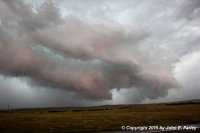
HP meso, from the same storm that produced the Kiowa tornado, later on looking northwest from near Simla. I managed to stay in the notch of this HP supercell from northwest of Ramah to near Matheson before having to bail south.
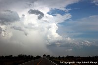
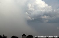
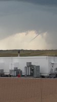
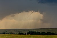
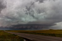
Tornado-warned supercell near Rocky Ford, looking south on route 71. In the lower, cropped/zoomed photo, you can see what may have been a narrow sunlit funnel partially visible above/to the right of the wrapping precip - about even with the right edge of the truck in front of me. This was visible for maybe a minute before it was again hidden by the rain/hail curtain. I could see more of it before I got this picture, but it was already starting to disappear by the time I got the camera out and got the pic. When I crossed the storm's path just south of Rocky Ford, there was a narrow swath of hail accumulation (largest stones around an inch, but this was about a half hour or more after the storm passed) and then a few miles where leaves had been stripped off the trees. Also minor wind damage with small branches down, but nothing more than that.
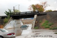
Flooded car in La Junta. "Do not drive into water of unknown depth."
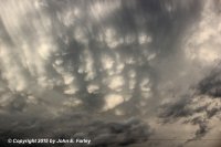
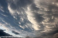
Sunlit mammatus southeast of La Junta. These were from the same cell that was tornado warned near Rocky Ford and that produced the flooding in La Junta.

HP meso, from the same storm that produced the Kiowa tornado, later on looking northwest from near Simla. I managed to stay in the notch of this HP supercell from northwest of Ramah to near Matheson before having to bail south.


Tornado-warned supercell near Rocky Ford, looking south on route 71. In the lower, cropped/zoomed photo, you can see what may have been a narrow sunlit funnel partially visible above/to the right of the wrapping precip - about even with the right edge of the truck in front of me. This was visible for maybe a minute before it was again hidden by the rain/hail curtain. I could see more of it before I got this picture, but it was already starting to disappear by the time I got the camera out and got the pic. When I crossed the storm's path just south of Rocky Ford, there was a narrow swath of hail accumulation (largest stones around an inch, but this was about a half hour or more after the storm passed) and then a few miles where leaves had been stripped off the trees. Also minor wind damage with small branches down, but nothing more than that.

Flooded car in La Junta. "Do not drive into water of unknown depth."


Sunlit mammatus southeast of La Junta. These were from the same cell that was tornado warned near Rocky Ford and that produced the flooding in La Junta.

