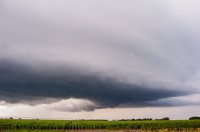
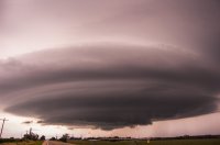
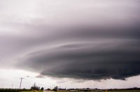
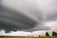
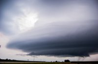
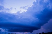
Finally getting around to my pictures I took from this days chase and wanted to share them. This was one of the most enjoyable chases I've had in a long time and I didn't even see a severe warned storm. There was a decent setup across south central Nebraska so I headed that way mid afternoon eventually nearing Hastings Nebraska. A couple of cells had finally popped south and west of Hastings so that was going to be my target. Meanwhile a little cell showed up on radar right near Hastings and I would end up driving right by it. On radar it wasn't visually impressive but it caught my attention as soon as I got close to it. I almost immediately decided that I would stay with this storm, not because it was the strongest on radar but it looked the best in person! Over the next 2.5 hours I slowly moved east with this storm. It was strange, it slowly strengthened when I first came upon it, but once it reached its "strong" intensity, it basically maintained itself over the next couple of hours, never getting any stronger to become severe but never really weakening either. The storm was beautiful though, having a very slowly rotating wall cloud to taking on a small "mothership" shape to producing a few more slowly rotating wall clouds. I only traveled about 30 miles over the next 2.5 hours it was moving so slowly and sure enough as soon as the sun set the storm almost immediately evaporated and I headed home. Took over 100 pictures! 