Dan Robinson
EF5
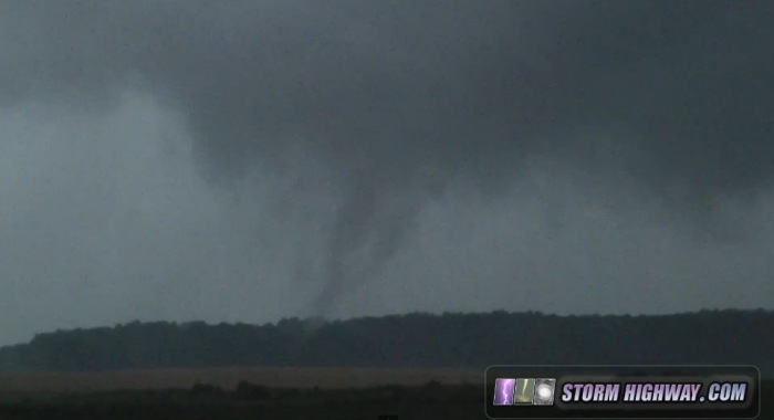
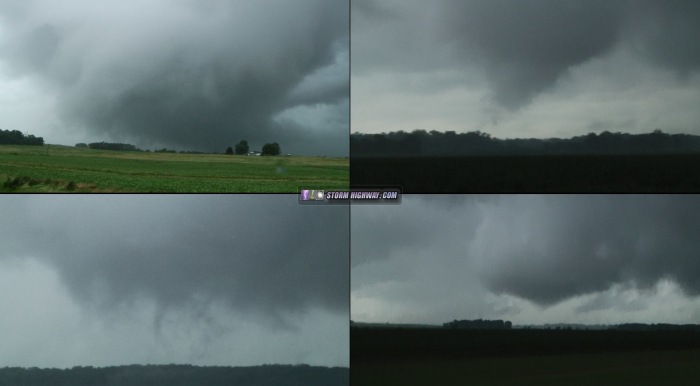
Quite a tornado mini-outbreak in southern IL and IN today from the TC remnants. I managed to score on a low-topped storm at Enfield, Illinois, about 45 minutes southeast of Mount Vernon. This weak tornado was in progress as soon as I gained visual on the base, and the circulation remained strong for another 15 minutes as condensation periodically touched the ground. I made a close approach at one point east of the town, getting a nice view of the RFD-carved meso as it spun its way to the north. The storm had impressive supercell characteristics, with an unexpectedly strong RFD surge pushing a gust front well to the north and east of the meso/tornado.
I followed the storm north to Flora, encountering more and more instances of flooded roadways. I had to call of the chase early and head home due to the flooding making things increasingly impassable, despite another tornadic storm a few miles to the east at Olney.
I called the tornado in directly to NWS PAH, but I never saw a warning nor is this in the LSRs. There were numerous warnings and transient circulations, so that may have something to do with it.
Video:
Here are a few video stills:
