• While Stormtrack has discontinued its hosting of SpotterNetwork support on the forums, keep in mind that support for SpotterNetwork issues is available by emailing [email protected].

2015-06-07 REPORTS: NE/IL/CO

Darren Lo

EF0
Joined
Feb 25, 2012
Messages
39
I started off the afternoon in Oklahoma City following the conclusion of a tour with Tempest. I had a choice of two roughly equally distant target areas, the OK/TX panhandles and the cold front in north central/northeast Kansas. I could reach either by approximately 0Z. I chose to play the cold front, partly because I didn't want to get pulled far west away from possible Day 2 action and my trip back home to the East coast. Dew points on the cold side were in the upper 60's and 0-6 km shear was forecast to be decent, so I figured I might be able to get a tail end supercell.

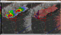
Some models suggested that there might also be convection around Wichita, and around 2230Z, an MCD was issued noting deepening cumulus along a pre-frontal trough from ICT to MCI. I was driving by the largest patch of cumulus at the time and thought the area looked fairly stoutly capped, so I forged onward to Salina where a few isolated cells had just gone up along the cold front. As I approached, both went supercellular with low wall clouds clearly visible from I-135 (sorry, no photos of the eastern cell).
app2sm.png

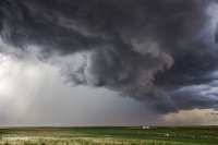
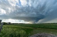
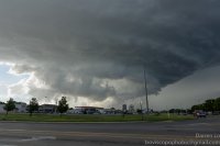
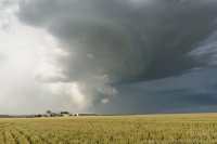
I targeted the tail-end cell on the west and was treated to some nice structure with a well-illuminated base.
20150607-001.jpg

As time went on, the wall cloud almost seemed to be scraping the ground, but I noted that the updraft seemed to have become smaller and weaker, and that there was no flanking line. Although there was rotation in the wall cloud, I figured that no tornado was imminent, especially given the veered surface flow.
20150607-002.jpg

20150607-003.jpg
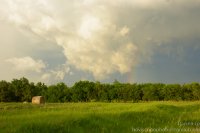
Having solo chased only a handful of times, I was perhaps overly cautious to stay away from the meso and the precip core. Unfortunately, this caused me to get behind the storm on Highway 4 at Elmo. With storm motion around 40 mph to the ESE, I decided not to try to race the storm to the next paved south option at Hope. Instead, I dropped south on 15, meaning my next paved east option was about 9 miles distant. Trying to take a dirt road to the east proved too slow and fruitless. So I followed behind the storm for a while, then said goodbye at dusk.
20150607-004.jpg
 
Mods add IL to title? I chased the line of storms that developed across IL into IN on Sunday. I started from Joliet instead of my normal location, so I was too far north/west to go after the storm that crossed into IN and eventually put down the only daytime tornado of the day, of course. However, I hopped down to Dwight to get on a developing storm that rapidly intensified. It had some ragged, lowered bases (not sure if truly "wallcloud" or not, but no real rotation) and dropped some quarter size hail. I had intended to stay with this storm as it drifted eastward, but very quickly the whole region opened up as storms formed all along the line. I headed east along Route 17 and then had to drop south of it to get out of the developing line.
I did have time to get a few pictures before everything joined together as one big gust front.

This was taken south of Herscher, IL
P6074394 by chris bray, on Flickr

Not long after, I repositioned to the southeast to stay ahead of it. Pano:
IMG_0340[1] by chris bray, on Flickr

Tried getting some daytime lightning but it failed, still pretty though
P6074438 by chris bray, on Flickr
 
sorry, editing issues. Apparently can only do that once....anyway, eventually it became fruitless trying to stay ahead of the line as it stretched from MO to IN, so it overtook me, and I drove back home. Not bad for a local chase.
 
Decided to pursue some developing storms over the Illinois River early in the evening that day. Sat in Varna, IL while waiting for something to happen, and scrambled up and down the line for embedded supercell structures. Eventually found a decent wall cloud west of Benson, IL that another group of chasers were also watching just down the road. Nothing too notable happened, so we headed southeast as the gust front overtook everything. Saw some really ominous shelf structure and glowing blue precip core before it slammed us with what I'd estimate as winds of 60 mph or so. However fast it was, it was shaking our vehicle even though we were facing into the wind. There were quite a few reports of wind damage in Benson and several in Peoria.

My video from Sunday (try to watch in at least 720p):

It's no Oklahoma supercell, but it was pretty awesome for a 30 minute drive.
 
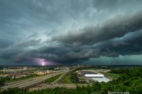
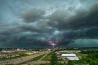
I saw quite a few nice shelf clouds on this day. The first place I went was the top of a bluff in East Peoria. It's one of my favorite spots to watch a storm roll in. At the time there were some reports of 80mph wind gusts with this storm. I shot a time lapse and got a few lucky CG's because the lightning was so frequent.

83ebfa94f145cb2671d6c35313c51927.jpg
Fondulac Drive Storm by Kevin Palmer, on Flickr

447c0922a225b5161a58068834e4bc96.jpg
Peoria Skyline Strike by Kevin Palmer, on Flickr

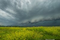
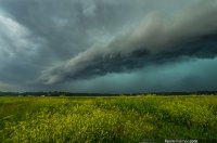
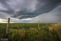
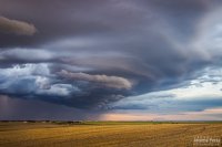
Because of the way the storm was oriented I was able to flee southeast as soon as the rain started. Once I got to Tremont I watched the shelf approach a second time over a colorful prairie.

8a15851a2116904c90a00765213fce01.jpg
Storm on the Prairie by Kevin Palmer, on Flickr

bf368b39140890427583169c7a1f1685.jpg
Shaking Goldenrods by Kevin Palmer, on Flickr

After it started raining I went further south and let the shelf overtake me near Lincoln. At one point the storm started intensifying rapidly with a lot of CG's and it looked like there was a hook on radar. But it was hard to tell because it was nearly on top of the radar site. I didn't see a wall cloud, but I did see some very fast moving, rising scud. This area received over 6 inches of rain in some spots with a lot of flooding and tree damage.
 
Mods, could we please add 'CO' to this one?

Our last chase day on the high plains was also set up to be a pretty marginal day. We headed out of Goodland toward far northeast Colorado and took in some more sights along the way.

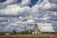
Barn quaintness in northeast Kansas
img20150607-IMG_8067_640px.jpg

We caught our storm of the day near Holyoke as it rolled southeast out of the Nebraska Panhandle. The cell had a buddy to its east that looked better on radar at a few points, but that one was getting seeded and the base was obscured much of the time. We had a really good view on a hilltop south of Holyoke and spent about a half hour watching both cells kick up dust storms as they moved in.

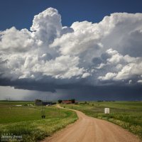
Farm and building supercell south of Holyoke || 2150Z
img20150607-IMG_8077_640px.jpg

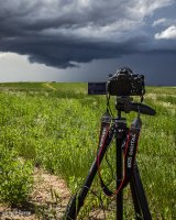
Shooting time lapse || 2200Z
img20150607-IMG_8080_640px.jpg

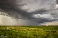
Gust fronts on both cells kicking up dust || 2210Z
img20150607-IMG_8089_640px.jpg

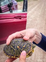
Eventually they swept by just to our north and teased some brief rotation in a quasi-RFD push, at the same time things seemed to be generally gusting out. We paced it along some pretty rugged roads through Alvin and southeast into Nebraska. The west edge of the convection wound down as the eastern cell took over. We were too far out of position on slow, twisty roads to catch it. As we wound our way back to better road options, we paused to get a box tortoise out of the road and get closer look at it.

Gust front with brief rotation in a slot on the leading edge || 2215Z
img20150607-IMG_0912_640px.jpg

My daughter visiting with a Nebraska box tortoise
35275ebfe347a9d15a3cba8f06957d7a.jpg

Some messy convection was rolling east along Highway 36. So we headed back into Colorado between Idalia and Burlington to check out the gust front before ending our trip with great sunset views.

Convection struggling to stay cohesive south of Idalia || 0120Z
ce662682a91a93c5148024880a259f68.jpg

Advancing gust front over Burlington || 0150Z
img20150607-IMG_0964_640px.jpg

Fiery Colorado sunset || 0220Z
97f663e755a3b9f9cffd92eaf5ef608b.jpg

A small bit of twilight convection over far west Kansas || 0250Z
c29e28705798704090ce649cd5bd83ce.jpg

Apart from the rough road patch east of Alvin, the day was pretty easy-going and I had time for a lot of time lapse photography. Those time lapse sequences and other clips from the trip are in the first segment of the 2015 Storm Chase video I wrapped up last month (from 01:17-01:41 and 2:31-2:50).


More/larger photos here: Storm Chase - Holyoke, CO || 6 June 2015
 
Back
Top