2015-06-06 REPORTS: NE/KS/IA/MO/CO

Joined
May 1, 2011
Messages
180
Location
Colorado
Called in an (unofficial) tornado report today. 10:58 pm, a few miles NNW of Decatur Nebraska. (Omaha Indian Reservation) Currently there is a severe Wx report just SW of Macy, I suspect this will be converted to a tornado report.

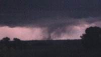
After today's storms we got some dinner in Norfolk and observed the oncoming bow-echo ensue out of the Sioux City area. My chase partner and I photographed a stacked plate meso illuminated continuously by lightning as it changed modes to a shelf cloud! (just east of Pilger) As we attempted to outrun the leading edge/dog leg of the storm we watched several couplets appear on radar. Figuring there was a tiny chance of a tornado in this area we shadowed this feature until we crossed the Missouri River at Decatur. While crossing the bridge. No Joke... Rope tornado! lasted about 3 minutes. 10:58 pm local time. Called it in via 911, however dispatch couldn't figure out where to route us (Bounced between Iowa and Sioux City and Omaha dispatch). I regretted calling 911 and should have just looked up the Omaha NWS number but we were in a hurry to get it reported as fast as possible as it was just a mere seconds outside of the town. Luckily it lifted just in time.
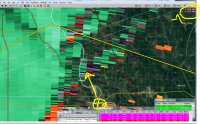
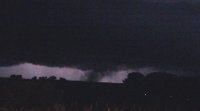
location.JPG tornado1.JPG tornado2.JPG

I followed up by posting on the NWS Omaha FB page, If someone knows someone out of that office that might need the attention of this thread please advise! Thanks!
 
Last edited:
Oh, where do I even begin. Today was an EXCITING day out in the field and much needed at that.

I started off with Dan Barker of Denver, CO after making arrangements on a local fb storm chase group. Dan swung by and picked me up and we headed out east on I-70. Got to Bennett, grabbed a few munchies and we were off. We got a little east of Limon on a dirt road that leads to the Cedar Point Wind Farm just off I-70. Sat there and watched a little nothing storm blossom into a gorgeous wind sheared supercell.
11051926_1653283018239231_6969895917791047590_n.jpg


On radar to the south a nice cell was building coming out of the Black Forest area and looked very promising
11108861_1653282961572570_7460266792532039102_n.jpg


Dan made the call that we would chase the northern cell at 1600 MDT, so we took off up the dirt round into the wind mill farm and the chase was on. We were soon rewarded with a tornado warned cell.

Over the next 3 hours we slipped and slid down dirt road after dirt road, following this awesome storm through torrential downpour, marble sized hail, 60 mph outflow gusts, 2 funnels and some fantastic structure.

10245345_1653282864905913_5717116657573691369_n.jpg


1780902_1653282958239237_7756531077333443230_n.jpg


11391174_1653282851572581_8031006161074004407_n.jpg


Just north of Burlington it started to get its act together real nicely and tried putting a nice elephant trunk funnel down, but it just couldnt quite seem to get there.
11377271_1653282811572585_460274874167484533_n.jpg


We came into Burlington from the north, and stopped at the Shell Station on the south side of I-70 to fuel up. As I pumped gas into Dan's Pathfinder, I kept my eye on the storm. After finishing up, I noticed it was tightening up really good and it started to drop a nice stovepipe funnel and I snapped picture after picture hoping it was going to do it and it came about 2/3 of the way to the ground and then it just stopped and went back up. Seemed like almost everything was there to put a nice solid tornado on the ground and just couldn't do it.
11391301_1653282808239252_6353585324961003551_n.jpg


Dan and I continued on to Kanorado via the frontage road and got plenty of great structure shots before it lost its energy at exactly 1900 MDT.
11406819_1653282901572576_2811201410340126730_n.jpg


We sat around for an hour afterwards watching and hoping for some re-organization but nothing materialized except for this really cool gust front, which had a quick needle funnel on the right side of it that was very brief. It's in this photo but it is very difficult to see (look at the 4 mini-silos, then look between the one and the left end and the 2nd one from the left and straight up and you'll see it barely sticking out below the gust front clouds).
11392783_1653283014905898_6351619539502746458_n.jpg


In the end my tornado drought of 2 years continues, but even though, I was one happy girl on this day. That's the most fun I have had on a chase since I chased a slow moving supercell with Adam Adkins in 2013 up near Sedgwick, CO.

AMAZING DAY for only a 2% tornado threat, slight risk day. :)
 
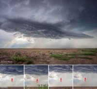
Was just leaving Norfolk for the cell in O'Neill, NE (along with everybody else and their brother) when I noticed a cell going up that was closer to me, straight north of Norfolk. So I retargeted and reached and interesting looking base near Magnet, NE. I followed it NE to Vermillion, SD (where the tornado sirens were going off) but the storm largely seemed to just cycle between getting a half-assed organized lowering that then appeared to be blown apart by the RFD and it would quickly cycle and try again. It seemed to develop the most organized structure just as it was approaching the Missouri River, but the sequence below shows another lowering getting blown apart.

sequence1028.png

I was pretty happy with my positioning during the day, and my target selection ended up being the tail end Charlie of a small line of cells that extended up to SD. Being out in front (east) of the storms that sprouted around that O'Neill storm seemed to be an advantage for it, as well. Just seemed like the ingredients were a bit out of whack on Saturday. Still, it was fun and educational. This weird spring for the central plains continues...
 
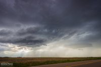
This was the best chase of our five-day trip. After overnighting in the car near Wray, we headed back to a target area east of Denver and spent about an hour with a storm that struggled south of Strasburg. I was unsure about veered wind profiles downstream in the deeper moisture, especially noting SPC guidance that storms would probably tend to grab supercell structures early on before lining out. And that's kind of what this storm was doing. It had joined some friends and wound up on the south end of a mushy line of storms moving to the east and northeast by 21Z. And it appeared to be weakening after that.

Developing storm south of Strasburg || 2020Z
7bb17b1743a2137458154b57ef1f6d39.jpg

So I let it go, figuring I didn't want to waste energy on eventual garbage. Not a good idea, as it turns out. But I was worn out and feeling kind of sorry for myself about missing the Simla storm a couple days earlier and not seeing so much as a cold air funnel on anything yet. As we sat in a spot with horrible data for accessing current radar, I figured the whole day was probably destined to be a wreck of grungy, linear convection. To show how miserable I was making myself, I even mulled the idea of heading into Denver to catch a movie so the whole day wouldn't be a complete disappointment.

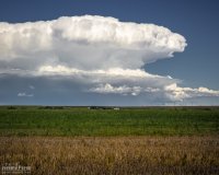
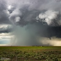
I probably spent a good twenty minutes in my pity party, facing west, watching sad blobs of convection trying to get going over I-20. When I finally turned back 180 degrees, to my immense shock, the departing storm had separated from its linear friends and blossomed into an enormous, incredible mushroom cloud on the eastern horizon. My self pity turned to shock and then anguish. It seemed too far gone to catch up to. I had been re-defeated.

Sudden, explosive convection south of Last Chance || 2200Z
img20150606-IMG_8045_640px.jpg

I'm not sure what kind of soliloquy I was rendering at that moment, but my daughter finally decided it needed to stop. With simple optimism: "We should try to catch it anyway." I love that kid. I'm glad she said it and glad I listened to her. We hopped on I-70 and made our way eastward. The whole time I was working the math of two moving targets and the time/location of intercept. If only the storm would stay interesting that long.

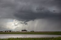
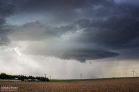
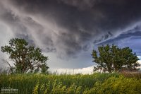
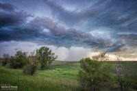
We finally caught up to it near Stratton with RFD action ongoing. Then we got ahead of it a couple miles north of Burlington. There was a sleek, saucer shaped lowering on the original meso with a new base forming to its south. I'm not sure whether that bell-shaped base was receding behind its own RFD curtain or if it was getting hidden by the developing forward flank of the new updraft. Either way, it was the greatest view of a meso handoff I've had so far.

Saucer shaped base north of Burlington || 0000Z
3a1ad0cd9434fc58d8d858bdd8fc2158.jpg

Meso handoff in progress north of Burlington || 0005Z
img20150606-IMG_0453_640px.jpg

We were in good position on a fantastic road grid with an easy-moving storm, so the photo ops were excellent. At one stop, the new base was looking particularly awesome and I stopped to grab shots while the video camera was running. It wasn't until reviewing video later that I realized a cold air funnel had been twisting around for a couple minutes on the west side of the base.

New base and cold air/shear funnel northeast of Burlington || 0013-0016Z
Combo.jpg

We paralleled the storm as it moved eastward. An RFD surge carved an inverted soft-serve ice cream cone into the base at one point. Not ten minutes after that, a glance out the window revealed a beautiful funnel whirling away inside some sort of strange RFD eddy on the south edge of the storm. We pulled over quickly to hop out and get shots. Time was of the essence, so we didn't wind up with the best foreground elements for photos. That issue took a back seat to the fact that we were standing on the side of the road looking up as a gorgeous funnel stared us down. Turning around to find my daughter embracing the outflow topped this off as the best storm chase turnaround ever.

RFD carving the base northeast of Burlington || 0025Z
img20150606-IMG_0470-Edit_640px.jpg

Funnel and core between Burlington and Kanorado || 0035Z
img20150606-IMG_0474_640px.jpg

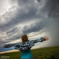
My daughter embracing the outflow as the funnel dwindles || 0035Z
img20150606-IMG_0482_640px.jpg

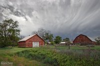
By now, the storm had fallen too far behind the expanding outflow boundaries and started to wither away. So, we paused to photograph an idyllic farmscape south of Kanorado. Then we enjoyed the view of an inbound gust front moving in from Colorado before calling it a night at a comfy hotel in Goodland.

Farmstead southeast of Kanorado || 0120Z
6e3044e9d10d46c4a9f31418a7f24317.jpg

Gust front moving in south of Kanorado || 0150Z
425b4cded4e046702786fcd3869e7a7a.jpg

More/larger photos here: Storm Chase - Burlington, CO / Kanorado, KS || 6 June 2015
 
Back
Top