• While Stormtrack has discontinued its hosting of SpotterNetwork support on the forums, keep in mind that support for SpotterNetwork issues is available by emailing [email protected].

2015-06-05 REPORTS: CO, KS, NE, WY, MT

Joined
Dec 8, 2003
Messages
1,419
Location
Southeast CO
I headed east on I-70 from Limon CO as some activity just east of there strengthened to severe. It seemed to suddenly be two counties to the east, but when I finally caught it I noticed there was another discrete storm further east, so I went after that one. I saw a sign that said that the Vona exit was closed and to use the Seibert exit, so that's what I did.

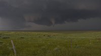
Heading N from Vona I was able (barely) to stairstep NE just behind the storm. Tornadogenesis occurred at 2320Z, +/-, and I observed it until sometime a few minutes after 2332Z, at which time a handoff occurred to the E. That one got reported as a tornado on SN, though I could never see the touchdown. Here are two contrast-enhanced vidcaps from 2325 and 2327Z. I was looking north.

150605_2325.JPG

150605_2327.JPG
 
Caught up to this Cone funnel as it was dissipating. We were scarfing down subway in Bennet at lunch time when this cell went warned and we headed south. Should have been in the vicinity of Franktown, CO. Photos timestamped 18:20z. (well, 3:20 pm EST, if I'm adjusting properly)

10848865_10153396586573033_3598308501367633358_o.jpg


10431206_10153396586658033_3172056543452998665_o.jpg


Once the convergence arrived, the best shot I got of a storm that replaced the initial tornadic cell.

11427402_10153396586338033_1996804137757879090_o.jpg


Stuck with it until about Woodrow, CO. to see this stacked plate rumbling along.

11357214_10153396586218033_8993061644951930513_o.jpg
 
Would have chased the 4th if not for my chase partner (Christina Kaur) who told me she couldn't chase because she had no one to watch her kids (later found out she took her 4 year old out with her and saw the Simla storm and tornadoes anyways, thanks so much, appreciate that). She promised the other night that we would chase Friday. Only she left without me again. Needless to say, I wont chase with her anymore. I have no time for selfish people who think only of themselves. Unfortunately she bagged another tornado and I skunked on my own yesterday. Unbelievable.

Decided to take my car out (against my better judgement but not caring anymore), I ran out east on I-70 to Byers, and jumped 36E and latched onto a nice cell there.
11336883_1652950524939147_8704368619204334860_o.jpg


11054318_1652952078272325_262522311914185052_o.jpg


11143330_1652952141605652_2113656947149757656_o.jpg


Followed this E on 36 till I reached CO-71. Had to make a decision, and my radar showed 2 tor warned cells to the east, and the svr warned cell to the north. But since my data was in a bad area, I thought the cells to the southeast had already died out and that my radar images were old, so I jumped the cell to the north and went up 71.
11270362_1652952211605645_5305818866189519841_o.jpg


11357022_1652952241605642_8990700968063409404_o.jpg


1795208_1652952348272298_2260535676008845957_o.jpg


This proved to be a bad decision and effectively ended my day, as the cell quickly fell apart before reaching Ft. Morgan. I could only helplessly watch my radar and facebook feed as tornado pics poured in from Anton,CO , and then to see my jerk of a chase partner post a tornado pic...was truly frustrating. To think I might of bagged 2 tornadoes the past few days if not for the selfish inconsideration of another.

Just loving the continuation of my 2 year tornado drought. (/sarcasm) :(

I hate selfish people!
 
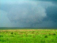
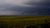
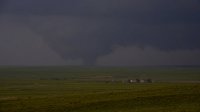
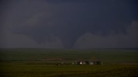
I targeted the Castle Rock area and missed the early tornado by 15 minutes as the storm came off the front range and went tornado warned near Ponderosa Park after lunch. After staying with the storm and then abandoning it as it struggled to get organized, we headed back to Limon for fuel and a pit stop. We watched two cells go up east of Limon, and targeted the cell that developed and moved north of I-70 near Stratton, CO. As we drove north, the cell dropped a large cone tornado that was on the ground for 8-10 minutes, then it cycled and produced a stovepipe and at least 2-3 more brief cones and rope. I was able to get a still shot of several of the tornadoes, but missed getting video of two of them due to driving. I watched a boundary interact with these storms of the GLD radar, which I am certain contributed to the tornadogenesis.
 

Attachments

  • Colorado1.jpg
    Colorado1.jpg
    161.2 KB · Views: 268
  • Colorado2.jpg
    Colorado2.jpg
    91 KB · Views: 291
  • Colorado15.jpg
    Colorado15.jpg
    166.6 KB · Views: 270
  • Colorado16.jpg
    Colorado16.jpg
    104.1 KB · Views: 295
  • Colorado19.jpg
    Colorado19.jpg
    78.4 KB · Views: 257
  • Colorado22.jpg
    Colorado22.jpg
    217.4 KB · Views: 258
Great day in Colorado!

My initial target was the Limon area but got baited west by the first pair of tornado warned storms near Denver. Once development started further east I dumped that cell and made my move. Caught up with the storm west of Cope where I witnessed the first few tornadoes. After that cell started congealing with others around it I changed course to the more discrete beast that would track south of Kirk where, once in position, I began having June 17th 2010 flashbacks. The structure and coloring looked incredibly similar. Thank you, CO...I needed this day after not being able to chase May 19-30th and missing all that action.

Video:

11415468_10152933494248807_5989381237545943688_o.jpg

11402320_10152933494233807_6766257578850424164_o.jpg

11128325_10152933494253807_5545772050790708941_o.jpg

11312624_10152933494243807_5987585207727806052_o.jpg
 
This morning started in Hays, KS and with the 4th on my mind still, I decided to head straight to Bennett, CO for early initiation off the Palmer Divide. Ended up viewing the Parker - Aurora Reservoir tornado from a distance and watched a weak multi vortex transition into rain wrapped tornado. Moved along with the front range storms for too long ignoring the CO plains storms firing to my east. Arrived minutes after the Cope area tornadoes lifted. It takes a special skill to avoid all the photogenic tornadoes I've missed this year.

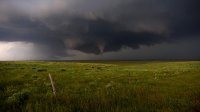
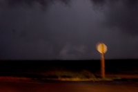
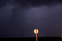
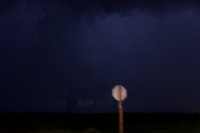
After pretty much calling it a day and heading back to I-70 for the long trip back to Houston, I ended up detouring off of 70 in Oakley to intercept the tor warned supercell moving through Winona - Monument area. I first got a view west of Monument of the tornado seen here (excuse the horrible quality video).

This tornado lifted as I got closer. Another developed north of 40 just to the northwest of Monument. I really need to work on my DSLR shots at night, had no tripod though.
IMG_0797.jpg IMG_0806.jpg IMG_0805.jpg IMG_0804.jpg

Although quite upset I missed the 2 shows in Colorado on back to back days, I guess its kinda cool to see some tornadoes in the plains that 200 other people aren't watching. Seems rare these days.
 
Last edited:

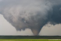
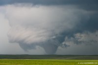
After overnighting in Colby following Thursday's rewarding yet tainted chase, I woke up still undecided on the Palmer vs. the CO/KS border. I'm the master of hedging, so naturally lunch in Limon was in order. Had I raced west from there as soon as the upslope convection near Castle Rock started trending up on radar, I almost certainly could've made the Parker/Ponderosa Park area tornado(es?) that occurred around 1pm local time. Instead, I deservedly paid the hedger's price by waiting for a robust supercellular radar presentation before speeding W on CO-86. By the time I made it through Kiowa and started N on Co. Rd. 49, the show was ending. For the next 90 minutes I joined the hordes in driving aimlessly from one crapper cell to the next in the Larkspur-Bennett corridor, not holding any real hope that something on the order of that initial large tornado would be repeated (given widespread outflow-contaminated air, combined with the preceding low cloud cover all morning).

I guess it was around 2:30pm local when I said screw this, dropping back to Kiowa and then E to Limon once more. At the time, my thought was to put myself in position to blast all the way E to the GLD vicinity if vis sat began showing promise for warm front storms to develop later in the afternoon. I expected that failing that, I'd simply be driving E toward the next day's target. To my surprise, new discrete storms initiated near Limon before I even arrived. The first one looked impressive in terms of updraft intensity on radar and disrupted I-70 traffic with accumulating hail, but its visual appearance didn't keep me around for long. I pressed on, but the atmosphere decided to convect explosively over my head again as I neared Seibert. As most everyone out last week is aware, there was major construction between there and Stratton on I-70, closing the only intermediate exit (Vona) over that 15-mile stretch. I wasn't convinced enough that this cell was legit to exit at Seibert, so I committed to the 15-mile stretch eastbound. As it turned out, this wasn't a bad choice in itself; I exited at Stratton, refueled, and then began pursuing it from the E. It just figures that Vona was closed, because heading N out of that town would've been nearly ideal for a close intercept.

From 4:40-5:05pm MDT, I stair-stepped NW on questionable dirt roads in an attempt to get under the base of the rapidly-organizing supercell. After plenty of white-knuckle driving, I eventually found myself under the meso 7 N of Vona -- but almost immediately had to back off due to the mud (the storm was lifting nearly due N at the time, so the core had just impacted the best viewing area for the low-level mesocyclone). It figures that after a painstaking half-hour spent getting right under the meso, it then dropped a large, photogenic tornado 10 minutes later after I'd been left a few miles in the dust. Perhaps it's for the best; the RFD cut and tornado cyclone were completely rain free for the first 10 min of the Stratton tornado, making for great photo ops. As soon as it touched down, I stopped where I was for tripoded stills; these were from ~8 NNW of Stratton, and 4 W of the paved highway N out of that town.
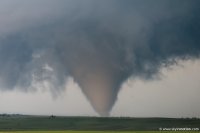
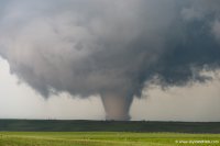
3a299aa73e1b3719fac5519f8dabc86b.jpg

a21317f00b0f861d7970c3914aff016c.jpg

101eb99f81c57a2321e9ce40b61ac47c.jpg

fd386587ddc8764570f9a776bdcf96e7.jpg

The Stratton tornado appeared to be on the ground for at least 15 minutes, but eventually became so low-contrast as it moved N and some rain wrapped around that I couldn't verify the end time. A new meso was already maturing to its E well before dissipation, and dropped an intermittent cone (seen in the video) which eventually touched down briefly as a stout tornado right along the road, giving chasers a nice photo op.

Great chase day that, despite not quite matching its predecessor in Colorado Magic, far exceeded my expectations. This is yet another day where storms struggled for hours and, in combination with significant weaknesses in the environment, gave me the impression that the day was probably over -- only for nice tornadoes to occur later on. It's amazing how many days like that I've had in recent years, and this year in particular.
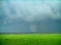
 
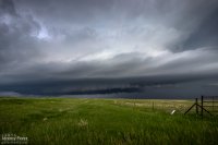
This chase day came after a very late night of bailing out of our hotel as a tornado-warned storm approached Limon at 2:30 in the morning. But any hotel stay is awesome after sleeping in the car the night before, and we were close to our target area between Limon and Denver. Insolation was a problem, but we still wound up on several supercells.
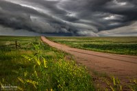
We caught our first two storms on Kiowa-Bennett Road east of Denver. We followed the second one for about an hour. I made an attempt to get ahead of it on Rector-Leader Road, northeast of Byers, but had to back off. The dirt road was turning to mud the further north we went, and gust front moving in too quickly to give it a shot.

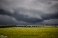
Storm #1 from Kiowa-Bennett Road || 2015Z
img20150605-IMG_7997_640px.jpg

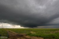
Rain free base on storm #2 from Kiowa-Bennett Road || 2055Z
img20150605-IMG_0364_640px.jpg

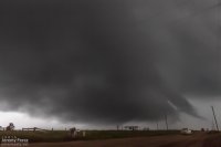
The closest we could get || 2205Z
img20150605-IMG_0374_640px.jpg

Road options wouldn't let us stay on that storm, so we called that one off. While storms 60 miles to the east were getting ready to spin up tornadoes, we waited for another close option to roll up from the southwest. This one was even more strung out, but still beautifully structured as it crossed Highway 36 and morphed into a long shelf north of Last Chance.

Storm #3 crossing Highway 36 east of Byers || 2235Z
img20150605-IMG_0379_640px.jpg

Terraced shelf cloud north of Last Chance || 2355Z
img20150605-IMG_0396-Edit_640px.jpg

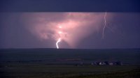
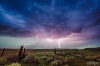
After that, I decided to head east to see if we could thread to the other side of a couple tornado-warned storms near Kirk. It was a long shot, and didn't work out, but we eventually wound up in spectacular country along Highway 385. The lightning show north of Wray wound things down for the day.

Lightning show north of Wray || 0245Z
img20150605-IMG_0419-Edit_640px.jpg

Additional photos and larger versions here: Storm Chase - Northeast CO || 5 June 2015
 
Last edited:
Back
Top