-
While Stormtrack has discontinued its hosting of SpotterNetwork support on the forums, keep in mind that support for SpotterNetwork issues is available by emailing [email protected].
You are using an out of date browser. It may not display this or other websites correctly.
You should upgrade or use an alternative browser.
You should upgrade or use an alternative browser.
2015-06-04 REPORTS: CO, KS, NE, WY
- Thread starter Michael Gavan
- Start date
Patrick Martin
EF4
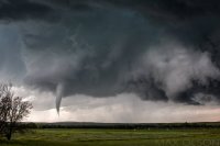
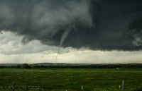
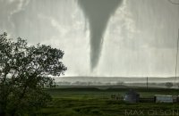
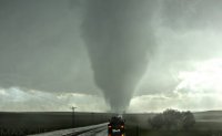
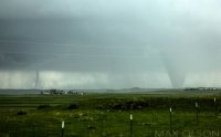
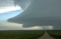
This was one of my top 3 chases overall. My chase partner Chris Strahan and I started our chasecation this day, which was probably fortunate as his mid-morning flight arrival into Denver took a Kansas play off the table. After lunch, we headed down to the Palmer Divide dropping south in Bennett to approach the storm from the west along hwy 24. By the time we got down onto the storm, the hail core across hwy 24 kept us from positioning further east, so we set up 1 mile north of Simla as the storm slowly approached from the north. We were able to watch the entire initial formation and subsequently worked our way south and slightly east on county roads watching the entire life cycle of the storm and documenting multiple tornados, including the anti-cyclonic ones as well. Finished the day with steak dinner in Limon with old and new friends. Truly a great day for us.
The initial formation.
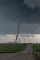
A wider angle view of the 1st tornado
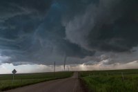
From our position 1 mile south of Simla as it transitions to a stovepipe.
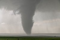
At the point 2 were on the ground at the same time, these were our views. The EXIF data shows the first was at 6:06:50pm MDT, the second was taken looking east at 6:07:06pm MDT.
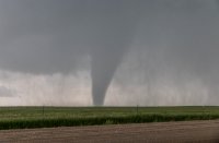
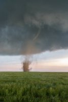
The anti-cyclonic tornado!
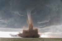
And one of the final tornados
The initial formation.

A wider angle view of the 1st tornado

From our position 1 mile south of Simla as it transitions to a stovepipe.

At the point 2 were on the ground at the same time, these were our views. The EXIF data shows the first was at 6:06:50pm MDT, the second was taken looking east at 6:07:06pm MDT.


The anti-cyclonic tornado!

And one of the final tornados

Late to the storm, fresh from work. Can't believe I live an hour from Simla and didn't make this happen. I ended up seeing the last tornado put down by the storm from the west and afterward saw some amazing structure and colorful skies, and got a few decent photos, so all is not lost - was still an incredible chase and one of my favorite.
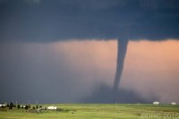
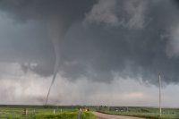
Last tornado from the south west. There were several funnels after this until almost sunset.
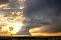
Barber pole updraft to the west at sunset.
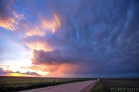
Mammatus to the north.
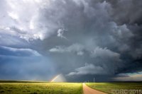
This is the Simla storm from the west as I am trying to make up time on it and get in position. Two tornadoes going on at this time.
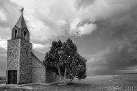
Church near Calhan still west / southwest of the storm. The back side of this storm exhibited all kind of interesting rotation at times. Not a typical storm structure.
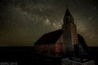
Returned to the same church two days later. Storm chasing is great for scouting photo opportunities.

Last tornado from the south west. There were several funnels after this until almost sunset.

Barber pole updraft to the west at sunset.

Mammatus to the north.

This is the Simla storm from the west as I am trying to make up time on it and get in position. Two tornadoes going on at this time.

Church near Calhan still west / southwest of the storm. The back side of this storm exhibited all kind of interesting rotation at times. Not a typical storm structure.

Returned to the same church two days later. Storm chasing is great for scouting photo opportunities.
Ben Holcomb
EF5
Busted on the N KS target during the daytime, headed west and got on a storm south of Quinter, KS as the sun set. One of the more incredible lightning shows I've seen, and I didn't have a tripod with me. DOH.
Recap at http://www.benholcomb.com/chases/20150604
Recap at http://www.benholcomb.com/chases/20150604
Scott Hammel
EF4
Jeremy Perez
Supporter
On the off-chance someone has had enough of the reality-bending Simla tornadoes (yeah right  ) let me drop a late report in here of our north Kansas chase on the 4th. My morning forecast perusal had dabbed a target option in the Simla vicinity as an 'Upslope Magic' option. But I opted for a Kansas triple point target near Oakley instead. Always making the smart choice.
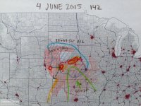
The morning forecast analysis
We eventually drifted even further east to near Zurich where better parameters seemed to be evolving. It wound up being a long wait. This part of Kansas was strikingly beautiful and I wound up with some good photo ops while we waited for the cap to break.
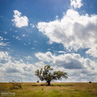
Lone tree and capped sky at Zurich || 2120Z
After more waiting and hoping, and getting hints of amazing things happening in Colorado, we made our way to Stockton. I was really worried the cap was going to win and we were going to wind up with a complete bust. However, as convection started to fire in western Kansas, thin bubbles of cumulus finally started trying to hold their own in our area around 8:30 PM.
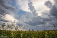
Thin streamers of cumulus finally taking a jab at the cap || 0130Z
We moved back west to view a storm that quickly blew up north of Nicodemus. We stayed on this awesome, nearly stationary lightning producer while grabbing time lapse footage. A nicely lowered base swung into view to our north and lightning told a staccato tale of scuddy, ground-scraping wonders beneath.
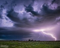
Lightning strike beneath an active supercell north of Nicodemus || 0235Z
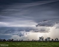
Scary scud & who-knows-what beneath the Nicodemus supercell || 0302Z
A storm further west near Seldon wound up with a tornado warning around this time. We stuck with our storm though because I figured it had as good a chance of doing the same, and it was in a lot better road position for an after dark chase. Despite tantalizing goings-on beneath the updraft, our cell never went beyond a severe warning.
After our Nicodemus storm seemed spent, we slowly made our way westward. I wanted to get back to Limon for the night, but storms were stalking our path back and I didn't want to risk hail cores or worse after dark. So we waited them out and shot a bit more lightning photography.
Roll cloud/shelf cloud and lightning lurking over our way to Limon || 0340Z
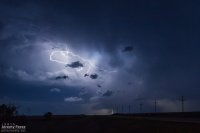
We made it to our Limon hotel around 2AM just in time for a cell to go tornado-warned to our west as it headed straight for town. So we got back in the car, tired and cranky, and headed south of town to let the storm move through.
Although I have gnashing-of-the-teeth over missing the Simla storm, we really had a good chase—as long as I can forget that other thing happened . Congratulations to everyone who targeted and experienced that storm—the photos and reports are awesome and inspiring!
More photos and larger versions here: Storm Chase - Nicodemus, KS || 4 June 2015
The morning forecast analysis

We eventually drifted even further east to near Zurich where better parameters seemed to be evolving. It wound up being a long wait. This part of Kansas was strikingly beautiful and I wound up with some good photo ops while we waited for the cap to break.
Lone tree and capped sky at Zurich || 2120Z

After more waiting and hoping, and getting hints of amazing things happening in Colorado, we made our way to Stockton. I was really worried the cap was going to win and we were going to wind up with a complete bust. However, as convection started to fire in western Kansas, thin bubbles of cumulus finally started trying to hold their own in our area around 8:30 PM.
Thin streamers of cumulus finally taking a jab at the cap || 0130Z

We moved back west to view a storm that quickly blew up north of Nicodemus. We stayed on this awesome, nearly stationary lightning producer while grabbing time lapse footage. A nicely lowered base swung into view to our north and lightning told a staccato tale of scuddy, ground-scraping wonders beneath.
Lightning strike beneath an active supercell north of Nicodemus || 0235Z

Scary scud & who-knows-what beneath the Nicodemus supercell || 0302Z

A storm further west near Seldon wound up with a tornado warning around this time. We stuck with our storm though because I figured it had as good a chance of doing the same, and it was in a lot better road position for an after dark chase. Despite tantalizing goings-on beneath the updraft, our cell never went beyond a severe warning.
After our Nicodemus storm seemed spent, we slowly made our way westward. I wanted to get back to Limon for the night, but storms were stalking our path back and I didn't want to risk hail cores or worse after dark. So we waited them out and shot a bit more lightning photography.
Roll cloud/shelf cloud and lightning lurking over our way to Limon || 0340Z

We made it to our Limon hotel around 2AM just in time for a cell to go tornado-warned to our west as it headed straight for town. So we got back in the car, tired and cranky, and headed south of town to let the storm move through.
Although I have gnashing-of-the-teeth over missing the Simla storm, we really had a good chase—as long as I can forget that other thing happened
More photos and larger versions here: Storm Chase - Nicodemus, KS || 4 June 2015
Colt R Forney
EF0
Only a few months late in posting  haha. I have been dormant from Stormtrack for several years and just getting back to being active.
We chased the day before (June 3) in eastern Wyoming, witnessing a possible tornado near Hartville, WY after dark and then booked it down to Greeley, CO where we stayed that night. The thought of playing the warm front in north-central KS was very tempting with those crazy parameters and we almost pulled the trigger on that play. Luckily, we decided to stay and play the Palmer after doing some serious thinking about blowing off the Palmer in the past, with lesser parameters and getting burned. Parameters were also quite good for CO. So, we decided to go out on a limb and setup near Kiowa, CO and hope we made the right decision.
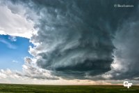
The first storm went up and died rather quickly just west of Kiowa, with a new updraft exploding to our east, north of Matheson. This storm turned into a beautiful LP, but was small and had that look of "I'll be pretty, but not a tornado producer".
Here is a shot of the LP north of Matheson, CO:
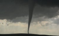
This storm slowly died as it got absorbed by the developing, much stronger updraft, just to it's west. We blasted west and got into position about 2 miles north of Simla and sat there for 15 min or so before the first tornado touched down. I only have video grabs as I was focused solely on filming.
First tornado north of Simla:
We then dropped south and stopped about 2 miles south of Simla for the second significant tornado:
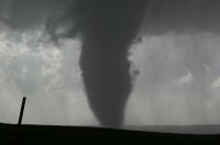
We witnessed a brief anti-cyclonic tornado to the east of this one that lasted about 8 seconds and was no more than a dust whirl. As we kept dropping southeast with the storm, tornadoes kept developing to our left and right! Cyclonic and anti-cyclonic alike. At one point we were directly between the cyclonic and anti-cyclonic tornadoes.
This anti-cyclonic tornado touched down not too far to our east and surprised us.
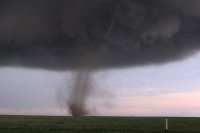
While this was in the rain to our west.
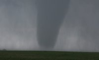
This tornado had my jaw on the ground and I couldn't believe what I was looking at!
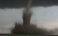
We saw 8 tornadoes in total. This was a day that will not be matched anytime soon I'm sure.
Here is a link to our full length video from this day:
We chased the day before (June 3) in eastern Wyoming, witnessing a possible tornado near Hartville, WY after dark and then booked it down to Greeley, CO where we stayed that night. The thought of playing the warm front in north-central KS was very tempting with those crazy parameters and we almost pulled the trigger on that play. Luckily, we decided to stay and play the Palmer after doing some serious thinking about blowing off the Palmer in the past, with lesser parameters and getting burned. Parameters were also quite good for CO. So, we decided to go out on a limb and setup near Kiowa, CO and hope we made the right decision.
The first storm went up and died rather quickly just west of Kiowa, with a new updraft exploding to our east, north of Matheson. This storm turned into a beautiful LP, but was small and had that look of "I'll be pretty, but not a tornado producer".
Here is a shot of the LP north of Matheson, CO:

This storm slowly died as it got absorbed by the developing, much stronger updraft, just to it's west. We blasted west and got into position about 2 miles north of Simla and sat there for 15 min or so before the first tornado touched down. I only have video grabs as I was focused solely on filming.
First tornado north of Simla:

We then dropped south and stopped about 2 miles south of Simla for the second significant tornado:

We witnessed a brief anti-cyclonic tornado to the east of this one that lasted about 8 seconds and was no more than a dust whirl. As we kept dropping southeast with the storm, tornadoes kept developing to our left and right! Cyclonic and anti-cyclonic alike. At one point we were directly between the cyclonic and anti-cyclonic tornadoes.
This anti-cyclonic tornado touched down not too far to our east and surprised us.

While this was in the rain to our west.

This tornado had my jaw on the ground and I couldn't believe what I was looking at!

We saw 8 tornadoes in total. This was a day that will not be matched anytime soon I'm sure.
Here is a link to our full length video from this day:
Bob Schafer
EF5
I posted my Simla video last night. Why now? Long story, but here it is for anyone who's interested. It also has a short segment of the June 5 "Vona" tornado. Seen more than enough "Simla" already? Well, there is some unique stuff on here you haven't seen before:

