• After witnessing the continued decrease of involvement in the SpotterNetwork staff in serving SN members with troubleshooting issues recently, I have unilaterally decided to terminate the relationship between SpotterNetwork's support and Stormtrack. I have witnessed multiple users unable to receive support weeks after initiating help threads on the forum. I find this lack of response from SpotterNetwork officials disappointing and a failure to hold up their end of the agreement that was made years ago, before I took over management of this site. In my opinion, having Stormtrack users sit and wait for so long to receive help on SpotterNetwork issues on the Stormtrack forums reflects poorly not only on SpotterNetwork, but on Stormtrack and (by association) me as well. Since the issue has not been satisfactorily addressed, I no longer wish for the Stormtrack forum to be associated with SpotterNetwork.

    I apologize to those who continue to have issues with the service and continue to see their issues left unaddressed. Please understand that the connection between ST and SN was put in place long before I had any say over it. But now that I am the "captain of this ship," it is within my right (nay, duty) to make adjustments as I see necessary. Ending this relationship is such an adjustment.

    For those who continue to need help, I recommend navigating a web browswer to SpotterNetwork's About page, and seeking the individuals listed on that page for all further inquiries about SpotterNetwork.

    From this moment forward, the SpotterNetwork sub-forum has been hidden/deleted and there will be no assurance that any SpotterNetwork issues brought up in any of Stormtrack's other sub-forums will be addressed. Do not rely on Stormtrack for help with SpotterNetwork issues.

    Sincerely, Jeff D.

2015-04-11 REPORTS: TX/KS/CO

Joined
Aug 16, 2009
Messages
814
Location
Amarillo, TX
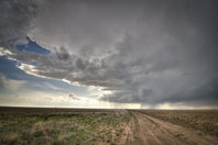
I had been watching this day very closely for a while. Definitely had the makings of an isolated, but big time Caprock supercell type day. I actually started this day in Tulia, thinking initiation would be further south. But after a few scans, and nothing on satellite, it was clear the storm on the TX/NM border was going to be the big one. The only reason I knew that was because it was going into horrible terrain/network in the Canadian River Valley. Road construction down to one lane (highway 385 N of Vega was 1 lane, pilot car/flagman), and just overall bad road options almost blew my day completely. But luckily, I got out ahead of the storm south of Borger when it was at it's peak intensity. We stayed due east of it, flirting with massive hail. But oh did it pay off!

Here's the supercell as we saw it south of Borger.
full


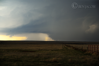
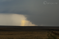
Rain wrapped tornado here. Time is 7:05 PM CDT. The wall cloud was visible as we first got on the storm. A couple minutes later this feature came out. I was hesitant to say it was a tornado so I started putting the puzzle together. The lighter area on the left definitely had a surging look to it, and the tornado didn't seem to move from left to right so much. The inflow was very strong as this time as well. We watched this for about 3 minutes before the rain totally shielded the tornado. Its a damn shame there's no east/west roads out that way!
full


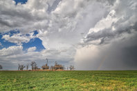
After getting ahead of the storm again, it showed it's awesome updraft again west of White Deer in the wind farm. Interestingly enough, some of the windmills were still spinning.
full


Finally, we couldn't get south fast enough to where we weren't so close to the storm. But couldn't pass up this amazing sunlit updraft/anvil structure south of Pampa. Great way to cap off a great day!
full
 
Could we add KS to the report thread?? Shouldn't be too many reports--i only saw 3 other chasers all day. Guess you have to be nuts to
drive 600 miles on a 2% day, but I'd have to be an idiot to pass off a slight risk in CO on my day off, and Id rather be crazy than stupid!
So started off chasing the cells in Baca county, one cell quickly became dominant and later tor-warned in Stanton County, here
it was before it went crazy from the Santa Fe Trail.

moscow1.jpg

This was about 10 miles west of Moscow...U road i believe...or it could have been T...all those letters just blurred together.
A brief tornado was apparently observed shortly before this (report said a couple miles west of here--im looking west in the
photo. Great start to the season, good to shake the rust off! Beautiful storm, and quiet roads!

moscow4.jpg
 
Also chased the storm north of Amarillo.... Left Norman at about 150 and got to Amarillo right as the storm was starting to look really beefy. Considered staying south in hopes of more storms in a slightly better environment, but luckily we pretty quickly decided to play on the north storm. Got some incredible structure and it was a great chase day after busting Monday, Tuesday, and Wednesday...

11052019_10206238866548970_5427802685125574861_n.jpg
11159557_10206238867028982_2768552826140328222_n.jpg
11133735_10206238867388991_5357634179427722026_n.jpg
11009110_10206238867548995_439026184918584482_n.jpg
 
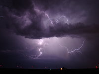
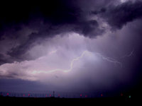
Chased the storm in SW Kansas at about the time of the tornado report was about 10 miles NW of Moscow, very strong inflow winds picked up out of the SE for a short time lots of dust and tumbleweeds, never did see a tornado. But did run in to some big hail for a short time. Got a few lightning pictures on the way back to Dodge.DSC00216.JPG DSC00227.JPG DSC00231.JPG DSC00235.JPG
 
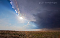
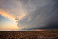
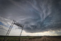
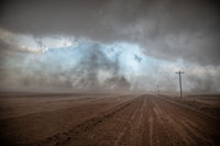
Took to the high plains of eastern Colorado and western Kansas Saturday in hopes of catching a lone photogenic storm. The only candidate was this storm in Baca County, Colorado. It wasn't exactly what I was hoping for but seeing how the only other storm was just north of Amarillo I figured it would have to be the one. The storm strengthened once it crossed the state line into Kansas and produced a brief tornado along with golfball sized hail. In the first image taken from the Konantz cemetery, which sits on the state line, the storm had all but completely stopped producing precipitation. Once in Kansas, the inflow and RFD both kicked up huge amounts of dust which made seeing any storm detail difficult unless you were right under the meso. The tumbleweeds were quite impressive.


_DSC9221And8more-2-Edit-Edit-Edit-5.jpg DSC_6760-Edit-5.jpg _DSC9203And8more-Edit-5.jpg _DSC9258And8more-Edit-5.jpg
 
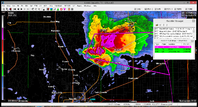
I left work from Wichita Falls around 2pm and blasted my way towards Amarillo. By the time I made it to Amarillo the storm had gone severe warned and was making its way to Fritch, TX. I drove up 136 to intercept near Lake Meredith/Fritch then the storm went tornado warned. I was driving so it was hard to see exactly what was going on, by the time I made it to Fritch the core began to get close to me. I continued east towards Borger to avoid the precip and the storm was starting to move more to the southeast. I made my way south of Borger and watched the storm approach and this was when I saw this feature that I thought might be a tornado. It quickly got wrapped around the downdraft on the right side of the photo. I've included a closer crop and my location. Did anyone else see anything like this. It was rotating pretty quickly, but again, got wrapped up in rain so fast I had a very small glimpse of it. From there I chased the HP monster south of White Deer, TX before heading home after an amazing sunset. I'll have more pics and video to upload later, but it was an excellent chase and it sure felt good to be out in the panhandle again! 113.png web_t.png web_tc.png
 
Back
Top