• While Stormtrack has discontinued its hosting of SpotterNetwork support on the forums, keep in mind that support for SpotterNetwork issues is available by emailing [email protected].

2015-04-08 REPORTS: KS/OK/MO

Joined
May 1, 2004
Messages
3,417
Location
Springfield, IL
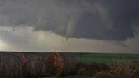
@Jenn Brindley and I caught a developing supercell several southwest of Medicine Lodge, KS. THe roads are nonexistent in that little stretch on 160 between Coldwater and Medicine Lodge but we found a decent gravel road and got a few miles south of the highway into the inflow notch. At 6:52 we had rapidly spiraling rain bands under the north end of a horseshoe updraft base. There was about a minute of condensation and debris as a brief tornado developed. The sun came out immediately behind the storm with a brilliant rainbow and white bowl funnel. I thought we were going to get a Mulvane-esque tornado there for a minute but it didn't condense. I hope our shots of it turned out.

We let the meso cross the road to our east as we got back on 160. Dramatic churning, gnarly mass of cloud immediately in front of us as the RFD whipped us with some golfball hail. There was a distinct smell of chewed pine, so something crossed there, but there wasn't much of any debris in the road.

Brief tornado sw of Medicine Lodge, KS at 6:54 pm:
1508111_10152835322847843_3623101986325421799_n.jpg
 
I'll have to upload what few photos I have later. Got absolutely skunked on this one. Originally bit on the initial northern storms NE of Woodward but at crunch time decided to drop south towards the Camargo storm instead of heading north to Hardtner, KS. One of the most god awful decisions I've made in awhile. Got to the Camargo storm late, saw a brief attempt at a funnel cloud before the storm completely fell apart visually and on radar. Stopped in Clinton and didn't even bother sticking around for the after dark for the tornadic supercell that went just north of town. Sucks to bust but at least there's more on the way.
 
Like James, we waffled back and forth between the northern cell and the southern cell. We made two attempts on the northern cell but talked ourselves out of going after it. Eventually went after the southern one. Was also a little late getting on it (we could see the core of it from 40 miles away as we approached, but we could not see the full extent of the updraft until we were just about on it as it began to die). Near Seiling we thought we saw some quick rotating bits of the wall cloud, but nothing substantial ever presented itself. We got some nickel to quarter sized hail as the storm died, but that was it for us. Went back to Enid to eat dinner and then noticed the new cell back near Clinton getting interesting.

Overall a very frustrating chase for us. This event had so many problems including predictability. It was just really difficult to predict what was going to happen given the differing model forecasts. Also it became pretty clear by mid-afternoon that the widespread thick high clouds over much of OK and TX were killing off the event. With the cap in place like it was we needed to get into the mid-upper 80s to even have a chance at uncapped surface-based convection. The only place that even came close to happening was right along the boundary across NW OK. However, the T/Td spreads were a little high near the northern storm. Plus, seeing it backbuild and rebuild so many times, we figured it would start going outflow dominant and would not be a serious threat. After all, it first developed right on the front and it never really looked good on radar until it finally started to produce, well after it had begun interacting with the front.

As to the after-dark storm that supposedly produced a tornado (I've seen lots of indications from others that the tornado report was incorrect), I'm completely at a loss. CIN was building back as early as 6 PM. With as much in place as there was by 7-8 PM, I have a hard time believing any updraft would've been strong enough to fully lift SB parcels enough to get tornadic rotation at the ground.

BTW, after finishing dinner in Enid, we drove back south with a semi-intention of heading west from Kingfisher to meet up with it somehwere near Watonga. Of course, by the time we had reached Kingfisher, it showed signs of losing organization. We just continued on back to Norman at that point.
 
We ended up moving west from our original target and made our way to Hardtner, KS and had to made a decision of moving north and sticking on a less than impressive cell that was squeezed between two larger cells, with the one to our west about 30 miles through mainly muddy roads. We decided to head west and ended up on the storm that produced the tornado near Protection and Buttermilk. Followed it back through Medicine Lodge and onwards to Kingman, ultimately stopping in Wichita to rest and get ready for tomorrow's chase.

[Broken External Image]:http://i57.tinypic.com/33tnyhk.jpg
 
Held onto our beliefs too long that Winfield to Eureka would be productive, and by the time we decided to head west to Medicine Lodge we were well after the party. I split from the other 4 in our motley convoy in Conway Springs, heading north as they tried to get to Rago. We watched the system north of Goddard for a good amount of time, and a few times it dropped a wall cloud but nothing more before dark set in. At 8:30, though, we definitely did see a large rope west of Colwich, we just couldn't confirm it was on the ground due to darkness, terrain and trees.
Jeff, I understand your trepidation, but I am 99.98% certain it was on the ground for a good 2-3 minutes, maybe more. It kind of reminded me of the May 10, 2014 Severy, KS tornado, there was no possible way Severy formed like it did, yet it did.
Hopefully our video will shed a decent image, I'll have to wait a day or so before she gets it all uploaded.

Overall, better than nothing, nowhere close to what many believed, but slightly worse than I anticipated. Still, felt good to get out, stretch the legs, see old friends and curse others 150 miles away lol!
 
Easy target and easy chase today. Even though the day didn't pan out as expected, I still had a great time - the Midwest is like another Great Plains to me. I awoke at daybreak to do a final data check to make my Plains/Midwest choice. With 40-45kts of WSW 500mb flow overtop of at least 2000 j/kg surface CAPE, backed surface winds in Missouri and Illinois and either an outlow boundary or warm front to choose from, it was an easy decision to stay in the Midwest. When there is a potential tornadic supercell environment close to home, I'll chose it over the Plains, even if the Plains targets are better in quality. I targeted the supercell tracking along an outflow boundary into the STL area at midday, opting to wait for it on the Illinois side of the river rather than intercept on I-44. As it turns out, the storm turned hard enough that I ended up catching it in Perryville, MO. Unfortunately, the storm became outflow dominant as soon as it moved out of the virtually unchaseable region between I-44 and I-55. I observed some interesting structure at a distance with a great CG barrage, then some murky structure in the rain as it was on its last gasps. I went back into St. Louis for some lightning photography to close out the day.

Images (click for larger versions): CG barrage and distant flanking line. The meso of the storm was deeply buried in the rain on the right side of this image.


Structure as the dying meso became visible in the heavy rain at Perryville. Not much left of it here.


Back in STL:


Congrats to everyone who scored in the Plains today!
 
Last edited:
First off, great job by those who scored in Kansas. I know that had to take an incredible amount of patience to stay on that cluster until the magic hour.

So we departed AMA knowing we'd be in NW OK somewhere. I was with my gf, as well as @Mark Eslick and @Tyler Hudson for the day. After chatting with @Wesley Luginbyhl, we decided to stay in Seiling, OK for most of the day. I couldn't understand the amount of chasers was out on I-35, as it seemed obvious initiation would be damn near the OK/TX state line. Anyways, we had lots of initiation in the eastern panhandle, as well as initiation just to the west of Seiling. These towers would eventually go on to produce the tornadoes near Medicine Lodge. We decided to bite down on the storm south of us rolling out of the panhandle. After some traversing through the grids near the river, we were treated to a nice RFB with some weak rotation near some ragged wanna-be wall cloud. We then backtracked the storm north and east near Camargo. Along the way, the storm went beast mode. This was perhaps top 3 in terms of structure on any storm I've EVER chased. This is what all you guys that couldn't make up your mind missed before that storm crapped the bed. This storm was GORGEOUS before that point.

IMG_7773-L.jpg


IMG_7777-L.jpg


After nearly getting stuck in some mud with some 4x4 Jeeps (I drive a FWD Fusion), we ended up watching the last cycle near Seiling again. The idea was to then try to intercept the storms coming out of the panhandle again. But as we approached, the storms looked elevated to me. Looks like everything was rooted above the boundary layer as some of the soundings suggested. So we strolled through Elk City looking for food. Sure enough, the storm 20 minutes from us went tor warned. By that point, the whole fiasco with the mud and frustration as to why our storm died off, we couldn't be assed to chase it. We unwound at Rib Crib and made our way back to AMA. Despite no tornado, still an awesome chase for me!
 
It was a good and bad day for me.

I'll start with the good.

I'm not 100% certain, but I think I possibly seen the tornado that Skip posted in the original post... from much further away.

DSC_0027(2).JPG

I was SW of Medicine Lodge (just north of Hardtner) at the time it was taken... right at 6:54 pm. I'm not sure if I can call this my first official tornado or not since I can't clearly see it on the ground. Either way, I was pretty pumped at the time.

And now for the bad.

I realized today just how far away I am from being as good of a chaser as I want to be.

I can't forecast whatsoever.
I just can't drive my car close enough (due to worries of hail damage).
My photography skills need a lot work.
 
Ended up with a target of Seiling yesterday, betting on the dryline, but keeping the boundary in reach. Got into Seiling around 1-2 and hung out at the park for a while. Thought this slide (which is about 15' tall) was a good omen, but not good enough apparently. We watched initiation from this park. Felt great to be in the warm sector again.
ZQ5FmOBJh-3Y4reu1ZFLTXNICTe5ry8JLstppYrTKo8=w671-h894-no


I broke for the Camargo storm about 20 minutes after Marcus so he got to enjoy the show a bit longer than me, but that storm was worth the drive to OK. I know what killed the storm though. Me, since I had really great position on the storm west of Camargo. Had a great view down on the Canadian River with straight road to take me in close if needed, but it wasnt to be. Below is a short video from the dome of the storm at it's peak. You can see the small RFD cut and funnel that I believe prompted the warning. My internet was real spotty in there so not sure when that was issued. I did have a nice little circulation pass right overhead west of Vici as the storms last attempt at a wall cloud fell apart.


A shot I took of the storm when it was still 10 plus miles west of Camargo right after I got on it.
DSC_1062_1.jpg


I am 2 for 2 on structure this year at least.
 
All day I kept telling myself I should go out chasing but I stayed home and just watched radar. I wanted to watch that front to see if it would move north enough to put Wichita in the tornado risk and sure enough it did. Man that front went north fast! I saw the supercell southeast of Coldwater but stayed home for whatever reason. It slowly started moving its way east northeast towards Sedgwick county. The storms then seemed to start weakening a little bit and about the time I noticed that, I believe it was the ICT NWS that put out a little discussion saying they expected storms to continue to weaken and that the environment the storms were heading into wasn't great. Right after that came out I noticed a shower down by Norwich, Ks getting stronger. Even though it was weak it just had that "look" to it. It slowly started getting stronger and developing some weak rotation so my father and I headed out just west of Goddard to watch it move in. Ended up reporting a rotating wall cloud to the NWS and then about 10 minutes later witnessed a elephant trunk tornado 6 miles northwest of Goddard, Ks. This was on the old circulation on the back side of the storm. It roped out fairly quickly. In the new circulation there was a very large cone funnel that was close to touching down down but never did. Not too bad for a 45 minute chase 5 miles west of your house!

Tornado.jpg Funnel.jpg
 
Despite not being overly enthused about the days prospects, primarily unfavorable wave timing among several other well advertised "issues" I was itching to get out and had the calendar pretty open and figured if nothing else it'd be a good test run to revitalize the thoughts and processes that relapse over the winter months.

Started the journey with initial target of Wakita area, arrived early and met up with Friends Jeff and Kathy along I35. In an effort to keep the elevated convection with the lead shortwave honest, I skirted just a little East and following lunch in Arkansas City watched the initial storm become severe near Cedar Valve. From there it was becoming more clear how the day was going to unfold as the OK Mesonet along with short term guidance indicated a second surge of high Theta-E riding significantly increasing backed winds across W OK. You could clearly see the boundary intersections out near Buffalo, and with 80/65 obs with 090 winds gusting to 20kt right ahead of 89/30 obs with 240 winds gusting to 40kts...it was clear we wanted to be on the boundary near the interesection. The initial convection never rooted and moved just N of the boundary, which was evident by the non existent winds, but it was also clear with the LLJ increasing the boundary was in flood mode and would continue surging NW, thus from Alva we worked to continue NW as the storm near Buffalo was showing signs of organizing.

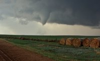
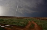
The road network was certainly difficult, the only option to get to where we needed to be was an open range network of roads that had seen heavy rain, but they were navigable and led right to the storm as it quickly began to organize SSE of Coldwater. It was a beautiful tornado over wide open range country, and I was able to watch without seeing a single car or person the whole time, just the birds chirping (a tough feat these days)

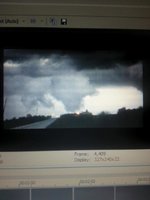
Couple video grabs until I get pics and video uploaded...

st1.jpg

st2.jpg

st3.jpg

st4.jpg
 
Three tornadic storms in two days, not a bad start to the season! Yesterday was a bad day for a few reasons (photography, forecasting, wallet), but good in that we decided to stay on the northern cell and were able to catch the Medicine Lodge tornado. My favorite part of the chase? We opted not to get on the chase train and hop on 160, instead we went west about five miles south of there on a smaller road, Hackberry Rd, that appeared to have no north/south options. The north roads there were just unmapped, and we ended up on easily the most beautiful road that I've seen in Kansas. I'm not sure if it was a mine or what, but I will eventually try to add some photos when I have more time. The county emergency manager even pulled up and complimented us on our finding of the road and told us how to find our way out to go north to Medicine Lodge. We were able to catch a distant view of the tornado Skip and the other core punchers had a much better view of, without the hail damage.

Afterwards, we continued east to try and get an after-dark view of the newly developed cell headed towards NW Wichita. About 30 minutes later, I saw what appeared to be a tornado on the ground backlit by lightning. Shortly after stopping and seeing it had gone back up, there was a "confirmed" tornado report somewhere around Colwich. We drove through there to make sure there was no damage, but the towns looked untouched. Hard to pick out any tornado damage in the dark, but if there was any it was minimal, so I'm suspicious about that tornado report. However, the three other people in the car also saw the funnel that appeared to be on the ground. I saw a photo floating around of a tornado around Colwich, just can't remember who posted it. Luke got a high exposure photo that appears to show that funnel on the ground, so for those of you who are curious, I'll upload it as soon as I get it.

Two tornadoes or one? I'm counting it as one right now, until I get confirmation on that Wichita tornado. Overall, a successful day, but most of my photos are crap thanks to bugs on the windshield, no time to stop, etc. This goes down as the earliest tornado I've seen in a year. Still have a lot to learn, but what a fun day! Good luck to those of you out today.
 
Last edited:
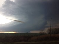
Like a lot of others, I sat back along I-35 a lot longer than I should have. I just didn't think that cluster near Medicine Lodge was going to do much. Eventually I rolled over that way as it was clear nothing was going to fire in my location. I was very surprised at the nice structure this storm produced. I got a few decent pics. A frustrating but decent first chase of the season. I can't confirm any tornadoes, but the 3rd pic leaves a lot to the imagination.


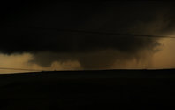
I arrived east of Wichita at about 8:15 PM just in time to watch the Medicine Lodge storm begin to loose steam. The storm had shed several smaller cells, one of which quickly developed into the dominant supercell in the area. By 8:25 the storm was ready to produce, and I headed north out of Garden Plain keeping about a mile south of the rear flank. The wall cloud dropped a very tidy cone tornado, just as the updraft of this small storm began to disappear completely. I managed to catch some long-exposure shots of this feature and was amazed when the wall cloud disappeared entirely, leaving a very skinny, naked "funnel" of a mesocyclone extending into the storm from what used to be the base. In less than 5 minutes, this mesocyclone was gone and the tornado had roped out completely. In 30 minutes, the cell was gone.

Here are some photos of the last visible spinup east of Wichita as it proceeded towards the town of Colwich.
Its worth noting that this is my first post, and I am welcome to advice via PM.

16472695914_933763d143_b.jpg

16472697754_5a12372744_b.jpg
16474990113_4a20e189b2_b.jpg
 
Back
Top