Dan Robinson
EF5
This event had some potential in its eastern MO/IL sector. The initial drawbacks were the sinking cold front and lack of a strong low to the west to help back our low levels. What ended up nullifying any tornado risk here was persistent clouds and rain early in the day, which greatly limited our available instability. If not for that, I believe a couple of the storms I saw yesterday would have had a decent shot.
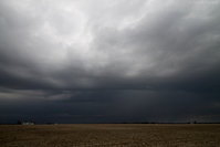
Initial storms early in the afternoon were high-based and bland, but by late afternoon I started seeing surface-based updrafts south of I-64. Two storms passed just north of Sparta, IL, the first presenting a strong RFD surge on radar before I could get a visual on it. This first storm rapidly weakened as I approached it. I observed this second storm trailing just behind the first:
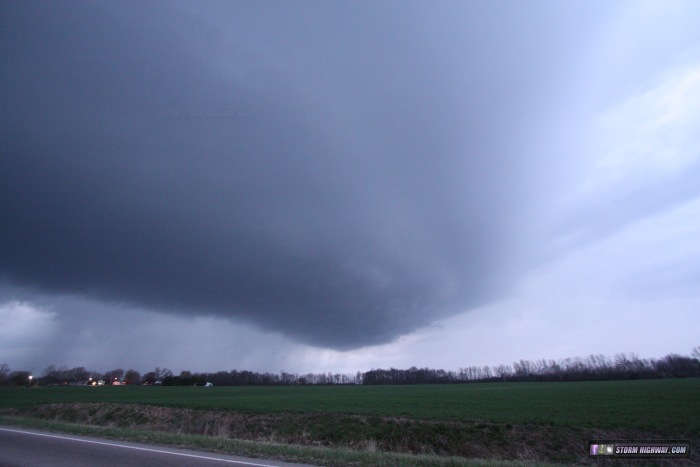
The updraft of this second storm was rounded with a weak RFD cascading on the back side. It had strong enough inflow to turn winds southeasterly just ahead of it (the ambient surface winds were southwesterly). It didn't produce much lightning until moving off to the northeast near Coulterville.
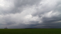
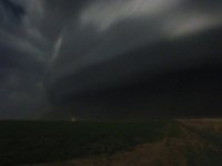
The next round arrived after dark and was a little more interesting. These appeared to be mostly elevated supercells passing south of the STL metro. This one at Fayetteville, IL had a pronounced VIL spike at the time of this image (a 2-frame panorama stitch):
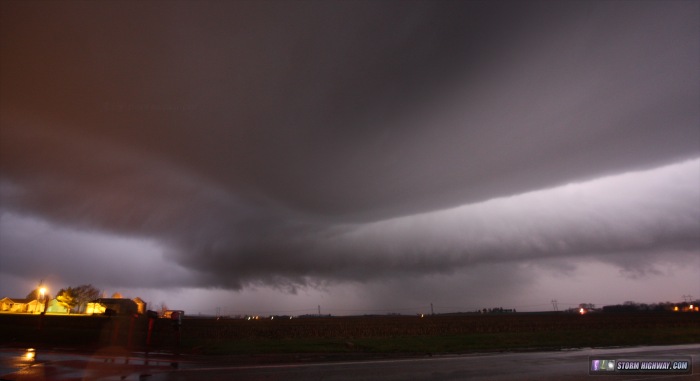
The long arcus was feeding into an area of broad rotation on the left. On radar, a RFD surge eastward was noted in the area to the left of this image. The area on the left side passed directly over my location in Fayetteville. Prior to the main hail/rain core arriving, I experienced a rapid wind shift from southerly to westerly as heavy rain began, followed about 30 seconds later by a instant shift to northerly with a fine mist/fog moving rapidly. At this time I could see visually I was in a precip-free notch, and on radar, a pronounced RFD surge was visible essentially overhead. The SRV image at the time showed a broad circulation centered just north of the road and tracking east all the way to Okawville. I hesitate to call this a couplet, but at times it seemed to be approaching this definition. I was quickly overtaken by the RFD precip core at St. Libory and couldn't get a visual on anything happening to my north.
In all, an interesting day that almost lived up to its potential.
Initial storms early in the afternoon were high-based and bland, but by late afternoon I started seeing surface-based updrafts south of I-64. Two storms passed just north of Sparta, IL, the first presenting a strong RFD surge on radar before I could get a visual on it. This first storm rapidly weakened as I approached it. I observed this second storm trailing just behind the first:

The updraft of this second storm was rounded with a weak RFD cascading on the back side. It had strong enough inflow to turn winds southeasterly just ahead of it (the ambient surface winds were southwesterly). It didn't produce much lightning until moving off to the northeast near Coulterville.
The next round arrived after dark and was a little more interesting. These appeared to be mostly elevated supercells passing south of the STL metro. This one at Fayetteville, IL had a pronounced VIL spike at the time of this image (a 2-frame panorama stitch):

The long arcus was feeding into an area of broad rotation on the left. On radar, a RFD surge eastward was noted in the area to the left of this image. The area on the left side passed directly over my location in Fayetteville. Prior to the main hail/rain core arriving, I experienced a rapid wind shift from southerly to westerly as heavy rain began, followed about 30 seconds later by a instant shift to northerly with a fine mist/fog moving rapidly. At this time I could see visually I was in a precip-free notch, and on radar, a pronounced RFD surge was visible essentially overhead. The SRV image at the time showed a broad circulation centered just north of the road and tracking east all the way to Okawville. I hesitate to call this a couplet, but at times it seemed to be approaching this definition. I was quickly overtaken by the RFD precip core at St. Libory and couldn't get a visual on anything happening to my north.
In all, an interesting day that almost lived up to its potential.


