Zack Cooper
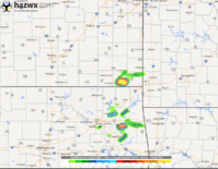
EF2
I'm watching Thursday pretty closely for possibly my first chase of the season.
Over the past day or two the NAM and GFS have been trending away from a good event and more towards a cold front only setup east of I-35 in mainly Oklahoma.... but I haven't lost faith just yet.
The 12Z nam and 4km came in with a slightly further west boundary and a pretty favorable environment for severe storm formation along and just east of i-35 from Denton TX to south of Norman.
Previous runs have had issues with veered sfc winds, but along the boundary some localized backing may occur as is evident on the 12z NAM and the latest GFS as well.
Along the boundary, I expect mid 60's dews should be easy to achieve and the atmosphere should be very unstable with sbcape to at least 2500 j/kg.
Not sure storms will fire before dark, but if they do and we can get localized backing of the winds along the boundary... wouldn't be surprised to see a decent severe event. And if it's not too far east and trends in a positive direction, I'll give it a shot.
")