• While Stormtrack has discontinued its hosting of SpotterNetwork support on the forums, keep in mind that support for SpotterNetwork issues is available by emailing [email protected].

2015-04-02 EVENT: TX/OK

Joined
Apr 3, 2010
Messages
120
Location
Shreveport, LA
I'm watching Thursday pretty closely for possibly my first chase of the season.

Over the past day or two the NAM and GFS have been trending away from a good event and more towards a cold front only setup east of I-35 in mainly Oklahoma.... but I haven't lost faith just yet.

The 12Z nam and 4km came in with a slightly further west boundary and a pretty favorable environment for severe storm formation along and just east of i-35 from Denton TX to south of Norman.

Previous runs have had issues with veered sfc winds, but along the boundary some localized backing may occur as is evident on the 12z NAM and the latest GFS as well.

Along the boundary, I expect mid 60's dews should be easy to achieve and the atmosphere should be very unstable with sbcape to at least 2500 j/kg.

Not sure storms will fire before dark, but if they do and we can get localized backing of the winds along the boundary... wouldn't be surprised to see a decent severe event. And if it's not too far east and trends in a positive direction, I'll give it a shot.
 
Cap looks like something you'd see in June right now ahead of the dryline. Those veered-SW 850s really look like they'll provide too much of a hindrance before dark even if the MLCAPE values aoa 2500 j/kg get realized tomorrow across E OK. I wouldn't doubt a few decent storms right at sunset tomorrow with mid-level cooling/dropping sfc temps, but where it is and how early in the year it is makes me question whether or not I want to chase it.
 
This event has caught my eye over the past few hours. The 12Z and 18Z NAM have started to make this event look better than it had before. Furthermore, the 18Z GFS is coming on board suggesting there may be a decent play across C/E OK. The SREF is also onboard with this scenario. This could end up being something of a sleeper event.

First of all, moisture quality looks to be pretty high...and deep. There's currently a pretty deep and rich moisture plume across the western Gulf into TX, OK and some points north and east (per SPC mesoanalyses). There's really nothing coming through to clear out that moisture tonight. The models have been progressively backing off on the timing of the front through the southern plains. Earlier in the week they had it going through Norman early in the day Thursday. Today's models have it not even reaching Norman until a secondary impulse brings a stronger front through on Friday. This second impulse is going to cause lee cyclogenesis back in SE CO during the day Thursday. Given the presence of the lead front it takes some time for the mass fields to respond to this new development, but towards 00Z there are indications of the winds backing across OK as the new low deepens to the west. Mid-level (i.e., 500 mb flow) is forecast to steadily pick up to over 50 kts over much of OK by 00Z, and it is out of the west, thus providing for decent directional and speed shear. Granted, winds are pretty veered once you get above the surface. Regardless, the 15Z SREF suggests effective shear will easily exceed 40 kts and threaten 50 kts. Hellicity values aren't super impressive, but they're high enough to perhaps get the job done producing low-level mesocyclones.

I think the biggest problem with this setup is capping. There is going to be a fair amount of CIN to contend with, and there won't be a ton of large-scale ascent to support the huge erosion of the cap, nor will there be a particularly strong surface trigger (the front looks to wash out throughout the day and there doesn't look to be a ton of convergence along the dryline that sets up). Some of the convection-allowing models that reach out far enough certainly don't think there will be any fun tomorrow except well north of the warm sector (where surface based instability will be absent).

Anyway, not high probabilities, but if something manages to pop it could be pretty good.
 
After looking at the 00Z NAM and NAM4, I'm still very much on the fence with this setup... really like the environment tomorrow along I-35.... but nothing to really fire off storms.

The 12km NAM is even more capped than previous runs, but continues to show a great environment for rotating updrafts if storms do form. The NAM4 is finally firing off a little convection in N Texas and the SREF is doing the same thing, which does excite me a little bit.

Guess I'll wait until early in the morning to make my decision on this one, but if I do head out my preliminary target for now is the Denton, TX area or northward to the OK border where thermodynamic profiles look the best and for now it looks like the best odds of storms forming are there as well.
 
00Z NAM shows some serious loaded gun soundings IMO down near Gainesville. Cap and trigger seem to be the downsides, and I feel like this setup will probably end up going to waste. I may try and eat dinner at Two Frogs in Ardmore just to hedge my bets ;)
 
Looking like the main forcing for ascent already passed through and the gradual influence of the main jet further west may not be enough even with the sfc cyclone deepening throughout the afternoon into the evening. It's gonna be a damn shame if this stays capped considering how amazing this would be setup if there was more mid-level support.
 
Looking like the main forcing for ascent already passed through and the gradual influence of the main jet further west may not be enough even with the sfc cyclone deepening throughout the afternoon into the evening. It's gonna be a damn shame if this stays capped considering how amazing this would be setup if there was more mid-level support.
Cap is looking pretty stout at this point. Anything that does go up could go up quickly and we could get some big hail out of it. There's some disagreement among the models with surface, 925 and 850 winds, that also matters significantly the mode of svr weather in the event there is enough forcing to overcome the cap.

Anything that does go up could go up quickly though...tough forecast for SPC given the potential in the atmosphere.
 
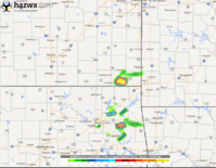
The 18Z Rap forecast has a loaded sounding located far NE OK at 01 Z. If the HRRR is on point, it is has cells moving that environment around the same time. The forecast sounding is supportive of a possible strong tornado. Anybody heading there?
 
Probably should add Kansas to the title since the AccuWeather tornado prediction model has a big one developing in the next 30 minutes...
 

Attachments

  • Capture.PNG
    Capture.PNG
    367.4 KB · Views: 201
It appears that the first cells are trying to make a go of it near Pittsburg, KS and Independence, KS. I am somewhat surprised that SPC hasn't issued the watch yet. Stay safe out there, folks.
 
Back
Top