• While Stormtrack has discontinued its hosting of SpotterNetwork support on the forums, keep in mind that support for SpotterNetwork issues is available by emailing [email protected].

2014-04-17 REPORTS: KS/OK/TX/CO

Joined
Aug 9, 2008
Messages
356
Location
St. George, KS
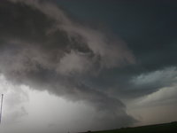
Not too much to share but did get the tornado southeast of Goodland. Started the day out near Oakley and watched weak cells come and go. Looked like the lack of shear was allowing the updrafts to collapse on themselves without ever developing effective inflow. Finally storms started to organize, but It was a mishmash of semi-organized updrafts. While several "lines" or organized cold pools pushed NW consisting of multiple cells, we decided to drift northwest with them. It was hard not to bite on that supercell near Garden City, but wanted to stick closer to the low. Also thought that Increased moisture from nearby cells would aid In effectively lowering cloud bases. While underneath the furthest southeast "cold pool" we noticed a more substaintial base from a far with several weak lowerings to the northwest. We kept an eye on it while just messing around with the line. It quickly latched on to a previous outflow from an earlier cell and was able to produce rather rapidly. A brief cone turned into a needle and was on ground for maybe 3-5 minutes with a persistent funnel/rope out for another 5-10. Was pretty but distant.

No complaints on a little luck. Was nice to grab a tube!

Chip
IMG_20150418_102712.jpg
 
No tornado for me, but one of my more enjoyable chases. Almost didnt chase, but changed my mind at 12:30 and was able to get out of Amarillo by 1pm. Met up with @Marcus Diaz in Lakin. A town that sounds their sirens for a fire. We had towers going up with the sirens going off. That is small town KS for you. Waited for the Garden City storm to become dominate and drove right up under it as it started to hook. Had a couple wall clouds with it and some decent rotation, but moved out of the good shear too quickly. Still worth the drive. Here is two shots from the chase, the other can be found at this link - https://www.facebook.com/media/set/?set=a.10103075384252197.1073741879.9609344&type=1&l=c1faa7ea5d

DSC_1884_zpsepp5trmb.jpg


DSC_1874_zpszcnwz7i0.jpg
 
Not much to add to @Wesley Luginbyhl except we decided to let the storm core us in Ransom. Copious amounts of hail covered the highway with a max size of 1.5".

IMG_8056-X2.jpg


Then on the way home, I decided to shoot for some lightning. Ended up getting something way better than that. Some amazing astro pics with the storm near Jetmore, KS.

IMG_8063-X2.jpg
IMG_8076-X2.jpg


Not a bad little chase in the cold core sector. Although if I had stayed with my original target of Leoti, I might've been in reach of the tornado near Goodland.
 
Sat east of Burlington most of the afternoon, it was very hard not to bite on the Garden City cell, but staying closer to the low paid off. We got on the Edson, KS storm and saw the tornado as it was roping out, awesome shot of it Chip!
11169955_829221313819885_4991831916698907582_n.jpg
 
Had to go to Garden City for work Friday on the way back watched storm form near Charleston, when back in Dodge picked up my son and headed out. First went east a cell near Spearville had a lowering on it with rising scud. but it died out fast. So it was oops should of went west, so it was catch up time, did not catch up with the storm until it was west of Ness City. At times lots of rotation under the base but never could tighten up, did think we saw a funnel driving north on 283 but could not make out any rotation, so could of just been scud.11116539_967177299981938_8524064801355067299_n.jpg
 

Attachments

  • DSC00244.JPG
    DSC00244.JPG
    1.9 MB · Views: 138
Followed the storm as it came north from Ness City. It was still going good at 9:30 p.m. in Rooks County. Saw many funnels/scuds? throughout the whole time period. Looked like funnels, but they never came fully to the ground except the one that might have near Ransom in pic. Nice 1st chase of season. 2015-04-17_19 47 17.jpg
 
Back
Top