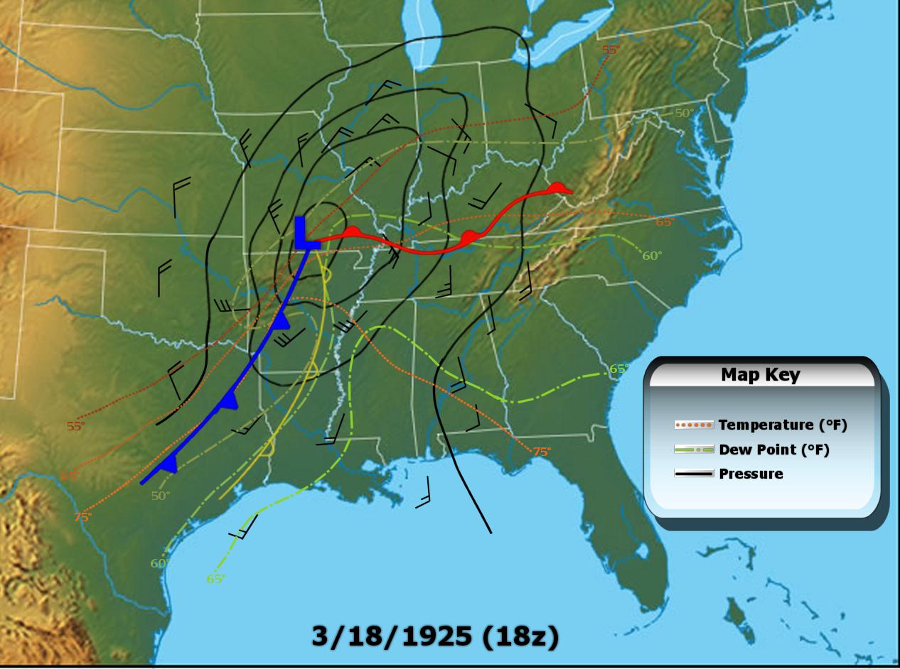
I wasn't sure where to put this, but this seemed to be the most logical place. I've been working on a blog post about the Tri-State tornado and I put together this map of surface conditions at 18z, or about an hour before the tornado touched down. I see a new paper was just published from the reanalysis project, which is excellent timing, because now I can check it out and see how far off the mark I am.

Anyway, here's the map:
The warm front was lifting north at the time, and by the time the tornado struck temps ranged from low to upper 60s, with dews generally from mid-50s to low 60s. Many areas only saw a couple hours of sunshine between the stratiform rain in the early morning and the outbreak after noon. The tornado obviously formed rather close to the sfc low, probably just on the cool side of the warm front, and stayed in pretty much the same relative location until it eventually got too far out ahead and ran into cooler air in southwest Indiana. Seems to have been a pretty textbook high-shear, low-CAPE day. The rest of the outbreak was quite impressive as well, and probably substantially larger than we know.


