gdlewen
EF4
I'm not sure this qualifies as an "EVENT", and since it bears on @Mike Smith 's discussions of NWS Tornado warning procedures, I'm posting it here.
One of the cells that moved through Owasso, OK last night developed a strong mesocyclone that intensified as it moved W-to-E south of Owasso. As the circulation passed, winds increased from the south and then shifted rapidly to northerly. At the peak, the sound of wind and wind-driven rain drowned out the thunder from frequent cloud-ground lightning. (No longer any need to clean my exterior windows.)
I am posting the Tulsa TDWR because it is more nearly south of Owasso than is KINX, so the storm motion is more normal to the radar scan direction. That is to say: the fact that RadarScope doesn't offer storm-relative radial velocities for TTUL is less of an issue when interpreting the velocity pattern. The center of rotation passed about 1.5 miles south of my house.
I think this velocity pattern "suggests" tornado and I do wonder why no warning was issued. (The gate-to-gate velocity difference, based on the RadarScope display, is about 110MPH. Also, the lowest scan is sampling the atmosphere at a height of about 500ft at the very "center" of the circulation.)

Tulsa Nexrad (KINX) radar at this time had trouble with the radially-outward winds over the Turley-Owasso area:

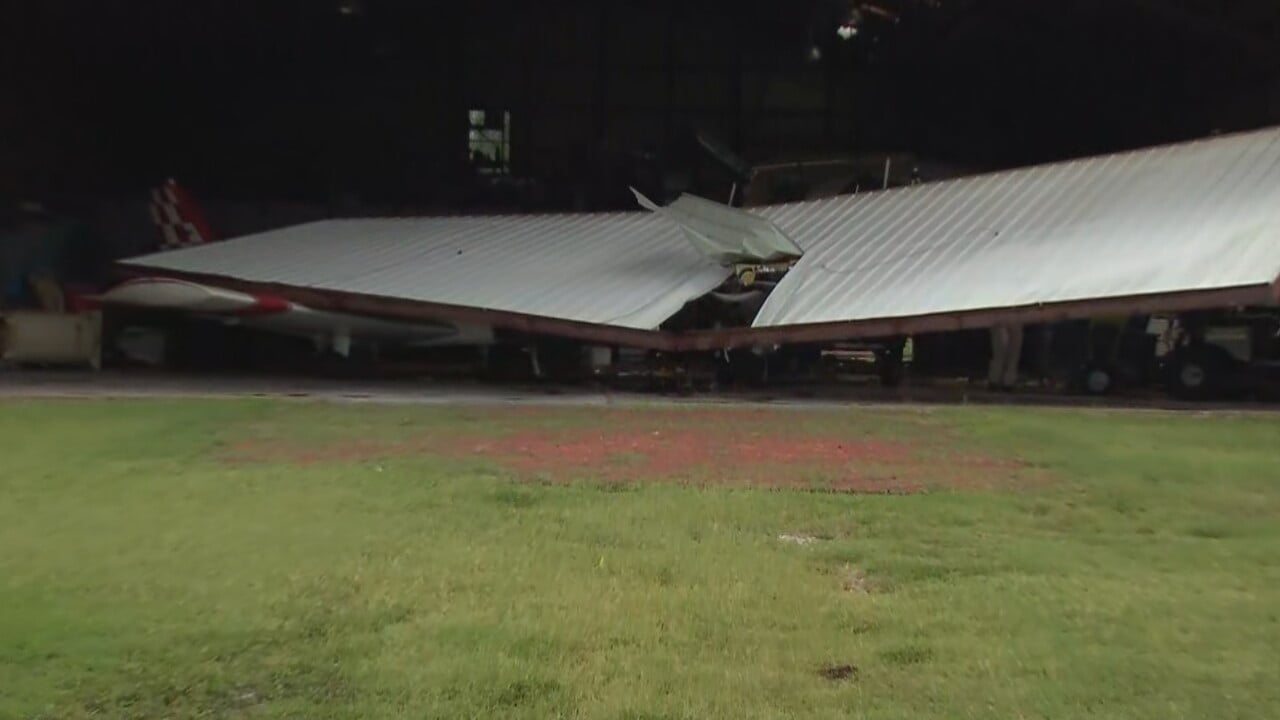
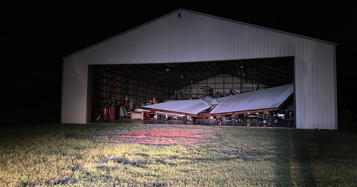
Trees and power lines are down all over Owasso, and there is a swath of storm damage from Turley across Owasso, which, obviously, could be due to straight-line winds. The winds snapped off about a dozen of my fence posts, with the most obvious indication of strong northerly winds seen below:

My instinctive response is that this was too short-lived an event for a warning. Perhaps 20-30 minutes from the time it caught my attention to the point where proximity to the KINX site made it hard for me to interpret what I was seeing.
Is that a fair response? I haven't been in a WSO office during bad weather for many years, but I have no problem remembering how crazy things got. Also, it's easy for me to focus on a given feature in the overall system of cells and supercells and stay with it, since I am a "fixed target" with a limited "region of interest", while the WSFO has responsibility for the entire county and beyond.
It will be interesting to see how this is handled when storm damage is surveyed.
One of the cells that moved through Owasso, OK last night developed a strong mesocyclone that intensified as it moved W-to-E south of Owasso. As the circulation passed, winds increased from the south and then shifted rapidly to northerly. At the peak, the sound of wind and wind-driven rain drowned out the thunder from frequent cloud-ground lightning. (No longer any need to clean my exterior windows.)
I am posting the Tulsa TDWR because it is more nearly south of Owasso than is KINX, so the storm motion is more normal to the radar scan direction. That is to say: the fact that RadarScope doesn't offer storm-relative radial velocities for TTUL is less of an issue when interpreting the velocity pattern. The center of rotation passed about 1.5 miles south of my house.
I think this velocity pattern "suggests" tornado and I do wonder why no warning was issued. (The gate-to-gate velocity difference, based on the RadarScope display, is about 110MPH. Also, the lowest scan is sampling the atmosphere at a height of about 500ft at the very "center" of the circulation.)
Tulsa Nexrad (KINX) radar at this time had trouble with the radially-outward winds over the Turley-Owasso area:
Trees and power lines are down all over Owasso, and there is a swath of storm damage from Turley across Owasso, which, obviously, could be due to straight-line winds. The winds snapped off about a dozen of my fence posts, with the most obvious indication of strong northerly winds seen below:
My instinctive response is that this was too short-lived an event for a warning. Perhaps 20-30 minutes from the time it caught my attention to the point where proximity to the KINX site made it hard for me to interpret what I was seeing.
Is that a fair response? I haven't been in a WSO office during bad weather for many years, but I have no problem remembering how crazy things got. Also, it's easy for me to focus on a given feature in the overall system of cells and supercells and stay with it, since I am a "fixed target" with a limited "region of interest", while the WSFO has responsibility for the entire county and beyond.
It will be interesting to see how this is handled when storm damage is surveyed.