Largest/and or tallest Storm You ever Witnessed

  • Thread starter Thread starter Simon Timm
  • Start date Start date

Simon Timm

Mine was the classic supercell that spawned the devastating Stoughton, Wisconsin tornado.(used for my icon) Its tops broke 60,000 feet.
 
For me, 72,000 ft at Clark AB, Philippines in March 1982, measured by an FPS-77 radar. But it goes to show that storm tops are largely a function of tropopause height in addition to CAPE, as these storms didn't produce anything except the usual torrential rain and lightning. A lot of storms went past 60,000 ft often, and 45,000 ft was considered pretty normal. In the U.S., sometime in Aug or Sep 1986 I heard the Weather Channel discuss a late summer storm near Charleston SC that was topping at 72,000.

I haven't really heard of anything higher than this that specified an actual date.

It would be interesting to hear if the 6/15/92 Beloit KS storm had its tops actually measured, as (1) it was from the pre-WSR-88D era, (2) it was in the summer season, (3) it was notoriously beefy and tornadic, and (4) people in other threads noted particularly amazing lightning displays in this storm, suggesting quite a bit of the storm was above the -20C level (just speculating here). I bet it came pretty close to 70,000, if not past it.

The newer WSR-88D's are notoriously poor at obtaining accurate echo tops as you're basically measuring the height of a VCP elevation coinciding with the storm, rather than having a human work the RHI (antenna up-down) scope and actually measure the storms like in the old days. One step forward, one step back.

Tim
 
I should also add that it's possible that Bangladesh may have the highest tops in the world. I've actually seen some soundings from that area showing CAPE values of over 8000 in May, and there you have a subtropical troposphere during the warm season. Too bad there's not much of a radar network. It may be possible to do some detective work with IR imagery, but that may not help much if you're talking about overshoots into an isothermal stratosphere.

Tim
 
So Tim V; wasn't the Greensburg KS a monster as far as width?
I don't remember what Mike Umschied's report said for height; but many other factors such as shear (and other leading factors) were supposed to be off of the hook. A really dynamic storm - yes?

I think the tallest storm I saw this year was E of Oneil NE; I think it was 56k feet...
 
Mine was likely the supercell up by Thedford NE...June 4, 1999. That storm exploded and had so much violence in the upward motion that it had double roll backs...and this was not mammatus or backshear. The spectacular supercell generated a long tracked tornado too in Cherry Co. NE. This was easily the biggest topped supercell I have witnessed.
 
http://www.extremeinstability.com/04-7-12.htm

Radar indicated 65-70,000 foot tops on that storm for an hour, July 12, 2004(one image showing that from Plymouth State on there as well as the maxed out VIL image). I think Omaha's sounding had 5,800 MLCAPE. This was west of Omaha a couple hours. Temps were mid-upper 90s with upper 70 dews. I seem to recall Omaha having a TD of 81 this same day. All I know is it was hot as hell sitting there watching it produce a tornado in one spot for 20 minutes, in a car that the AC would kick off if I wasn't moving. The "beaver tail" on the thing was even convective. It was sick at one point, a crazy wall lined up e-w pulling west into the supercell. Easily one of my favorite intercepts. Though in a way it sucks, because once you see something cool like that, you think every extreme cape and 15-20 knots of 500mb flow can do it again. Leads to lots and lots and lots of wasted summer gas thinking it will do it again. The storm moved southwest while anchored to a boundary, which helped with its storm relative shear.

There was really only one point when one would even notice it was really really tall. I had to fly southeast to get to another road to go south and back southwest. As I got out from it a bit it was pretty cool to look at. Just a very fat and long/tall updraft leaning east.

I should redo that account with bigger and better images now that I look back at it, as well as more text.
 
Last edited by a moderator:
Mine was the classic supercell that spawned the devastating Stoughton, Wisconsin tornado.(used for my icon) Its tops broke 60,000 feet.


Here's some pics from Stoughton on Aug 18, 2005....
The first pic I was NE of Busseyville on Cr A North of 106 at 1855hrs. The next pic I pulled off of 26- due East of Lake Koshkonong at 1919hrs.
One fatality that day. :(
Laura
 

Attachments

  • Aug 18 1855hrs.jpg
    Aug 18 1855hrs.jpg
    8.5 KB · Views: 134
  • Aug 18 1919hrs.jpg
    Aug 18 1919hrs.jpg
    7.9 KB · Views: 125
Mid 80's there was a cell in the SSW that was high but obviously very distant from here. It was pre internet (for me) and such and so I didn't know till I asked the next day and I heard the it was in central OK. At that time it was told it was in the upper 70's, quite a monster. I don't know if there is any way to figure out what it really was at this point.
 
May 23rd, 2002 Pampa Beast.

May 23rd, 2002 Pampa Beast.

That was the largest individual cell, with the most frequent lightning I've seen. Producing tornadoes and monster hail with very high VIL numbers, I'll bet this storm was really up there. I don't have any specific data on the storm, but Chris C. might, since he, Jeff Gammons and I were together on that storm.
 
August 4, 2008... with 8000+ CAPE and an equilibrium level near 100 mb, these storms were topping over 65kft. This was by far the best lightning display I have ever seen. Check out the youtube vid. The picture below the sounding is from the 2nd round of storms that moved through after the tornadic derecho. Even with the worked over air it was ingesting it still had an awesome light show and structure.
ILX_00_obs.gif


bscrp0.jpg


May 30, 2003 though small by comparison was the highest storm i've personally witnessed. It was one of those rare opportunities where there were no low clouds obscuring the structure and you had a view all the way to the top. Located in Decatur as the most significant action was at least 20 miles N near Clinton, the counter clockwise movement of the updraft coupled with the clockwise motion of cirrus discharge was mesmerizing. Though i'm sure i've seen taller, this one sticks out for being virtually overhead.

Talk about humble beginnings, shot on an Aiptek mini pocketcam :)
004.jpg
 
Awesome to see someone post a view of convection from that day! That sounding from ILX was thermodynamically the most impressive of the year, hands down, and one of the most impressive I've ever seen. I'm not sure why the SPC event archive always gives higher MLCAPE computations than other sources such as NSHARP (which gave 7600 rather than 8800)... regardless, ridiculous BL moisture (that you probably wouldn't see outside of the corn belt) and huuuuuuge total/low-level instability that day. Davenport's sounding was nearly that ridiculous as well.

August 4, 2008... with 8000+ CAPE and an equilibrium level near 100 mb, these storms were topping over 65kft. This was by far the best lightning display I have ever seen. Check out the youtube vid. The picture below the sounding is from the 2nd round of storms that moved through after the tornadic derecho. Even with the worked over air it was ingesting it still had an awesome light show and structure.
 
Is there a list or log somewhere of storm height or width? I'd have to look up some storms to see the tallest I've been on. I was on the one Brian mentions in '99 - Thedford, NE. I suspect / assume the Hoisington storm that produced the F4 was very tall as the storm was a dynamic monster. I recall the Almena, KS storm that produced an F4 was around 65,000.
 
There's no such list that I know of. The only source I'd trust is the 1960s-1990s RAREPs from the -57 and -74 network, but I don't know of any archive for that data (amazing that NCDC allowed so much data from the FAA 604 circuits to perish). I could theoretically do this for the NIDS RAREPs, but I don't trust the output, it's not that accurate because of the scan strategy, plus I'm not sure if the WSR-88D is prone to sidelobe contamination from hail and what the RAREP algorithms do about it.

Tim
 
Good day all,

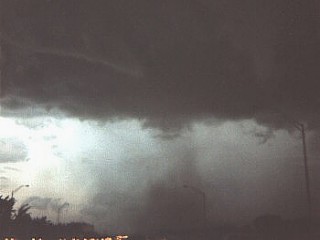
Personally: 67,000 feet in Florida on July 7, 1987 ... Storm had golfball hail and tornado (below).

p070787a.jpg


From a pilot I knew: 76,000 feet (Over Vietnam in the early 70's) ;-)
 
Back
Top