Bill Tabor
EF5
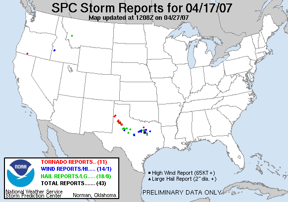
I thought it would be good to start a thread on landspout tornadoes since April 17th we apparently had a number of them.

What is the state of the art in regards to forecasting them and detecting them?
What features were in place April 17th that indicated a number of these might pop up?
How easy is it to detect them by radar? Can they be detected by radar?
I might note that the 17th these were expected to be low topped storms, but not low topped supercells.
Also I find it interesting that the SPC log for that day lists a number of the tornadoes as 'landspouts' or 'cold core tornado'. Is the public and spotters now sophisticated enough to know the difference and report them accordingly?
http://www.spc.noaa.gov/climo/reports/070417_rpts.html
