GRLevel 3??

Joined
May 8, 2016
Messages
21
Location
Eddy, Texas
Right now I am running the trial version of GRLevel 3 and so far I have been under impressed. Half the data I see is also the same as on wunderground.com. So I have a few questions about it before I commit to buying GR3, otherwise I will probably end up using GRLevel 2 Analyst even though I have heard it is a data hog.

1. Can I display visible satellite imagery?
2. Is it really worth $80 for the same data wunderground.com is giving out?
3. What are the advantages of using this opposed to other free radar sources?
4. Is the 3D volume scan on GRLevel 2 actually helpful?

Here are just a few of my questions about this program and I will probably post more later on in this thread.
 
1. It's a radar program, not a satellite program.
2. YES YES YES
3. You can customize it to your liking. Color palettes, etc...
4. YES

If you are wanting this for chasing, good luck using GRLevel2. It will be a data hog.
 
I use GRLevel3 and personally think it has definitely been worth it. Have you used any of the placefiles you can find from several different sources because they will let you overlay just about anything you want (I use AllisonHouse which is perfect for me but does require a subscription). I just wanted to reply to help out because I was under impressed back when I first used GRLevel3 as well until I discovered just how useful it could really be.
 
Last edited:
Thanks for the info. Dustin Knight I have not used any overlays (nor do I know how). Do you know of any free basic overlay sources I can use?
 
Wunderground does have base velocity and storm velocity, but it does not have dual pol or a couple of the other capabilities. But are those couple of extra capabilities worth $80 so I can have them all in one place. Online I can get dual pol free.
 
Honestly you could search for "GRLevel3 placefiles" and find quite a few sources that will have most of what you need but I know that http://redteamwx.com/ and http://wilmingtonwx.com/ have always worked pretty well for me and have a lot of very useful things to overlay (I believe WilmingtonWx has a Visible Satellite Placefile also). As I mentioned earlier, I personally think a subscription to Allison House is worth having for a number of reasons but certainly not a necessity. I just enjoy being able to integrate GRLevel3 with AH's Data as well as F5Data, and being able to get it all from one source.
I'm only speaking for myself obviously and I know that you can find a lot of good radar products with other software or on public sites but I really am partial to GRLevel3.
 
I'll be honest, I don't use GR2A now. I've tried it before and can't complain at all about it as a program but I've never used it for chasing, mainly because of what Jason Boggs said about data. I use RadarLabHD+ (comes with a subscription to WeatherTAP.com) for Level 2 data. It doesn't have the Volume Rendering you get with GR2A but it has several useful "overlays" built into the program and, in my opinion has a lot to offer on it's own. I'd be happy to help you with any questions you have about these programs in more detail if you need it so feel free to ask.
 
GR2Analyst's volume explorer is useful for identifying severe hail events. If you're skilled at it you can do this in realtime.
 
Absolutely worth $80. I love having 2 windows with reflectivity and SRV open, plus my GPS location being shown on screen so I can tell exactly how far away I am from the circulation in a rain-wrapped mess, or the hail core. To me there's no question it's 1000x better than wunderground. I'd pay more than $80. It's probably my most important tool when chasing. I used COD weather for vis sat.
 
Thanks Matt Hunt. I did not know that the radar displayed my location and that will definitely be helpful to have!

Not only can it show you your location but you can import road shapefiles that will give you a mapping overlay as well.

http://www.meteor.iastate.edu/~slincoln/GRS/shapefiles/

Your position will not only show in relation to the storm but you’ll be plotted on a mapping grid that I’ve found very accurate for navigation.

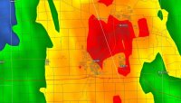
GR3 grab.jpg

While I use multiple sources for navigation I’ve found when the chase is on I rely and utilize the mapping on my radar almost exclusively with an occasional reference to Delorme & Google Maps. I agree with Matt, GR3 is the most important, useful tool I use when chasing. If I were forced to restrict myself to one resource on a chase it would be GR3. Not only is the combination of radar & navigation an extremely valuable tool, you can also get storm reports plotted as they are registered, SPC outlooks & mesoscale discussions, weather feeds that include frontal positions, lightning, observations and more. All these tools and resources in one neat little package for less than the cost of one night at a decent hotel. Definitely worth the price and far beyond what Wunderground can offer for chasing purposes.
 
how do you link location data to gr level 3? moving to Oklahoma and would love to be able to use this feature for navigation if nothing else...like there are no storms along the route since my gamin unit just bought the farm and managed to get seriously lost last night and just now found a hotel to get a few hours of sleep to try again
 
Back
Top