sam.leisenring
Enthusiast
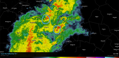
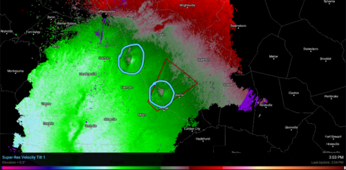
During Sunday's severe weather, I noticed these two strange looking thunderstorms on radar in central Georgia. As you can see, one was tornado warned and the other was not. It's weird to me because they both appear to be rotating clockwise, which is in the opposite direction that you would expect. Can someone confirm this or am I just stupid XD
Attachments
Last edited:
") You are looking at base velocity, so the storm's motion is not be considered, but we can tell by the bright greens (strong outbounds) next to the weak areas is implying counter-clockwise rotation. At that distance from the radarsite you aren't getting a good view of the low level structure, and it's not a very strong rotation, so what you consider a hook echo probably is not.
You are looking at base velocity, so the storm's motion is not be considered, but we can tell by the bright greens (strong outbounds) next to the weak areas is implying counter-clockwise rotation. At that distance from the radarsite you aren't getting a good view of the low level structure, and it's not a very strong rotation, so what you consider a hook echo probably is not.