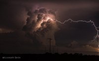
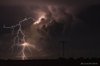
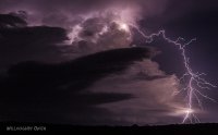
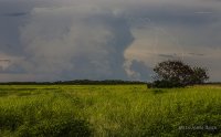
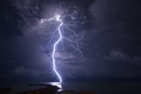
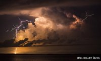
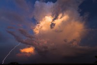
"Bolt from the Blue" clear-air lightning event in NT Australia, 4/6/2015

Joined
Jan 14, 2011
Messages
3,337
Location
St. Louis
I came across these images of a remarkable "bolt from the blue" clear-air cloud-to-ground lightning ("dog leg" in Aussie slang) event in Australia's Northern Territory on April 6:

https://www.flickr.com/photos/lou1003/17035011486

https://www.flickr.com/photos/128667232@N07/17059820722/

That first image is one of the longest horizontal distances away from the Cb I've seen documented in a photo.
Yeah, it's pretty interesting. Usually ones that far away are from the anvil.
 
I take a lot of lightning shots while out on storms. I not 100% sure this picture is real. It looks like a stacked shot. Two or more pictures merged together. The suspicious area is the dog leg turn. The lightning at this point has an increase in intensity that you just don't see along a cloud to ground strike. A very beautiful shot but don't think its real. You can make fantastic shots by putting your camera on a tripod and loading up shots then back at the computer stacking strikes on top of each other to get the strike you want. Just my opinion anyway.
 
The photos appear to be authentic. Another photographer posted shots of the same event from a different angle and distance. These type of CGs do tend to branch more on their downward trajectories.
 
I think they're real. When I lived in Tampa, I would see this all the time. Tampa, being pretty much ground zero for the U.S. and lightning, has some of the most amazing displays I've ever seen. I remember one time in 2011, I was sitting on the back porch explaining the difference between positive and negative lightning to my roommate, and as if on cue, a storm about 40-50 miles away unleashed a bolt very similar to the photos above. It shot out almost horizontal from the tower and cut down at a near perfect right angle, from my estimate, about 5-10 miles away from the cell. If anyone is ever looking to take a trip to photograph lightning, I highly endorse St Pete to Orlando (I-4 corridor) between June and September. Even the small pulse storms put out an unreal show of power.
 
I have seen these a number of times, though not usually so far from the storm. Some storms seem to produce quite a few of them, while others produce none. One storm I was watching near Edwardsville, IL some years ago produced several of them in a short time. It was daylight, but you could clearly see them coming out of the sides of the tower and doglegging toward the ground. I have always wondered why some storms produce multiple incidences of this, while most produce none. Most be something different going on in the atmosphere, but I really don't know what. Does anyone know of any research on this? I am not talking so much about the intense positive bolts that come out of the anvil of some storms far from the main precipitation area, but rather about these dog-leg bolts from what seem to be fairly young storms.
 
I don't understand what causes these bolts, but I have some observations. They are more common, as John said, with brand-new updraft towers that are isolated and strong. They seem to occur when the top of the rising Cb tower is approaching and/or just reaching anvil level. I have also seen them occasionally when a new updraft lobe goes up rapidly on the flank of an existing storm or MCS. My guess is that they are following the electric field lines of the thunderstorm's charge reservoir (picture a magnet in the sky with the field lines radiating from the poles). I haven't seen much in scientific literature on these, other than most suggest they do originate in the positive charge region. However, they do seem to have negative leader-like stepping/branching behavior. I'll have to do some searching to see if anyone has done a paper on these.
 
Hi,

I was on the storm that Dan posted in the first post, inland of Darwin. Absolutely real. Kicked myself for not being that smithen wider! That storm was SPITTING them out.
47f17c57e4238cc1bfa2e904e69cb522.jpg

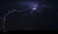
Here are a few more examples I've taken here:
ad793c102163e982391e00efeb3c2f9c.jpg (Same storm)

3fe1d6f4591f8041b4210b2c74be4642.jpg

7c20f12844ce3b7e6536100f14b79a7b.jpg

5420cfa455ec31a5cfa2bfa2d2b74f79.jpg

26ec8122f4efd5cc015b6d7ab66be08b.jpg[

[url=https://flic.kr/p/gJ4DZn]126bf4403eccef655dbee6c0a6fc71bd.jpg

2286435417a2cb69b0371ccb4ce03ee7.jpg

98ebd71f870ece7c808fe2c4b95ae87e.jpg

Chased tornado alley a fair few times but can't recall seeing lightning like this shooting out so far away from the updraft. El Reno (May 31 2013) and Selden KS (June 4 2015) had great lightning shooting out, but I can't recall anything more than about 10 km / 6mi. Seeing photos out of Florida and it greatly reminds me of Darwin with consistent sfc dewpoints above 24C / 75F.

Yep, as Dan says we find them on strong new erupting heads... we generally only have a 5 minute opportunity to shoot this lightning as storm matures. We do notice a couple of tell-tale signs that a big one will lobe out shortly:

*Updraft head 'blinks' a few times with IC and increases in prevalence like a lightbulb.
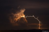
*One or two 'cow-horns' (another term we've coined) lightning strokes come out of the updraft into the air (exactly like in the x photo, to the right.)

From these signs we know it's 'getting ready' to put a big one out. Often, it happens.[/url]
 
Hi,

I was on the storm that Dan posted in the first post, inland of Darwin. Absolutely real. Kicked myself for not being that smithen wider! That storm was SPITTING them out.
View attachment 11346

Here are a few more examples I've taken here:
View attachment 11347 (Same storm)

View attachment 11348

View attachment 11349

View attachment 11350

View attachment 11351[

[URL='https://flic.kr/p/gJ4DZn']View attachment 11352[/URL]
[URL='https://flic.kr/p/mVhHUp']
[URL='https://flic.kr/p/8VTyVT']
View attachment 11353[/URL]
[URL='https://flic.kr/p/mVhHUp']
[URL='https://flic.kr/p/dyX52o']
View attachment 11354[/URL]
[URL='https://flic.kr/p/mVhHUp']
Chased tornado alley a fair few times but can't recall seeing lightning like this shooting out so far away from the updraft. El Reno (May 31 2013) and Selden KS (June 4 2015) had great lightning shooting out, but I can't recall anything more than about 10 km / 6mi. Seeing photos out of Florida and it greatly reminds me of Darwin with consistent sfc dewpoints above 24C / 75F.

Yep, as Dan says we find them on strong new erupting heads... we generally only have a 5 minute opportunity to shoot this lightning as storm matures. We do notice a couple of tell-tale signs that a big one will lobe out shortly:

*Updraft head 'blinks' a few times with IC and increases in prevalence like a lightbulb.
*One or two 'cow-horns' (another term we've coined) lightning strokes come out of the updraft into the air (exactly like in the x photo, to the right.)

From these signs we know it's 'getting ready' to put a big one out. Often, it happens.
[/URL][/URL][/URL]
[URL='https://flic.kr/p/mVhHUp'][URL='https://flic.kr/p/mVhHUp']


Crikey! Awesome pics!
[/URL][/URL]
 
Holy s--t, Willoughby. Those shots are amazing! You should've entered some of them in our 2015 Shot of the Year contest that we had just a few weeks ago.

Again, incredible!
 
Whatever the cause, Aus seems to get a lot of them!
I'm 'following' several people on Flickr who almost routinely catch B.F.T.B lightning.
I'm 99% certain they are authentic - not everyone can be an Evil Photochopper.
 
Sick shots dude...probably the best lightning shots I've ever seen.

I'm going to speculate based on what I know of lightning polarity, that these are almost certainly all positive strikes, which possess roughly 10x the electrical current that negative strikes do, and therefore they would probably also make a hell of a noise. These type of strikes also only account for 10% of all CG strikes, and usually occur in severe (supercell) storms, in the trailing regions of QLCSs, near mountain tops or in winter (when the + region is closer to the earth). Note to self - when watching equatorial thunderstorms don't be outside within 10 miles of the storm! :)

In the usual thunderstorm "dipole", the top of the storm is positively charged (where the cloud consists mainly of ice crystals), while the main bulk of the storm below is negatively charged. An induced positive charge at the surface also follows along under the cloud like a shadow, which is where the majority of negative CGs occur. This is also why positive strikes don't tend to strike directly beneath a thunderstorm - instead they are very tall (explaining the strength of the current), originating from high in the cloud and then outward some distance from the cloud, where the ground has its usual negative charge again after the storm passes.

I am willing to bet this is the reason we see the "dog leg" shape, due to the current of the stroke flowing around the positively charged ground/electric field below the storm. Sure, the majority of discharges probably occur as IC strokes between the + and - region, but in a super strong updraft tower when charge separation is occurring at its most intense (as you mentioned when they tend to happen), a few zots shoot out and away from the storm. It probably has to do with updraft strength, or even sheer depth of convection (which in the tropics can be an excess of 60Kft) in tropical thunderstorms. Again, just long-winded speculation!
 
Back
Top