Tim Vasquez
EF5
- Joined
- Dec 4, 2003
- Messages
- 3,411
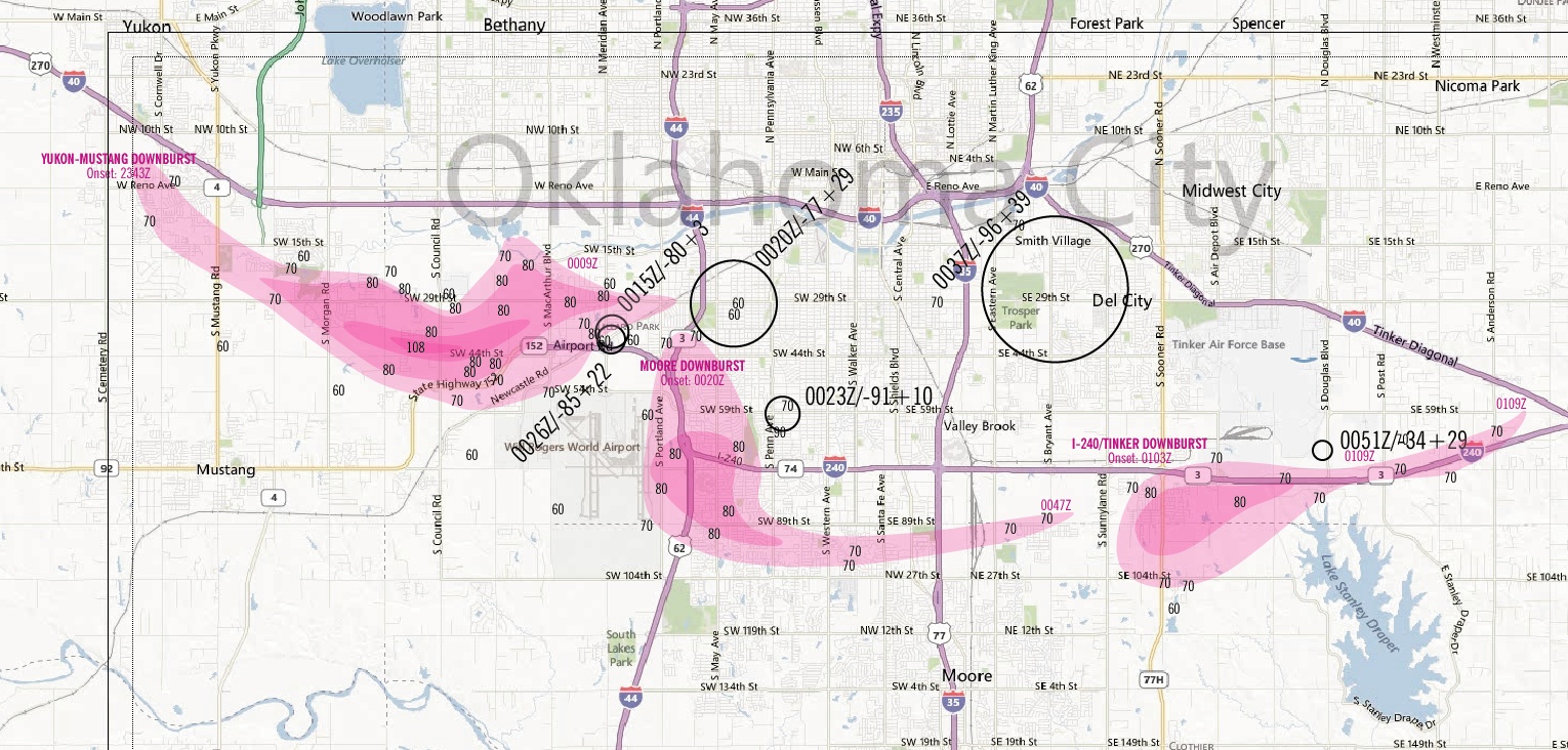
I composed these maps Saturday. I caution that these are DRAFTS since my time was cut short due to previous travel plans to San Antonio and I haven't yet really explored the fine scale structures in the storm. The maps are based entirely on circulations as interpreted from the KCRI and KTLX radar imagery, and aren't refined with any ground survey data. For the text blocks I chose to use ground relative radial velocities.
High winds (along either KCRI or KTLX radial) and significant circulations.

(click to expand)
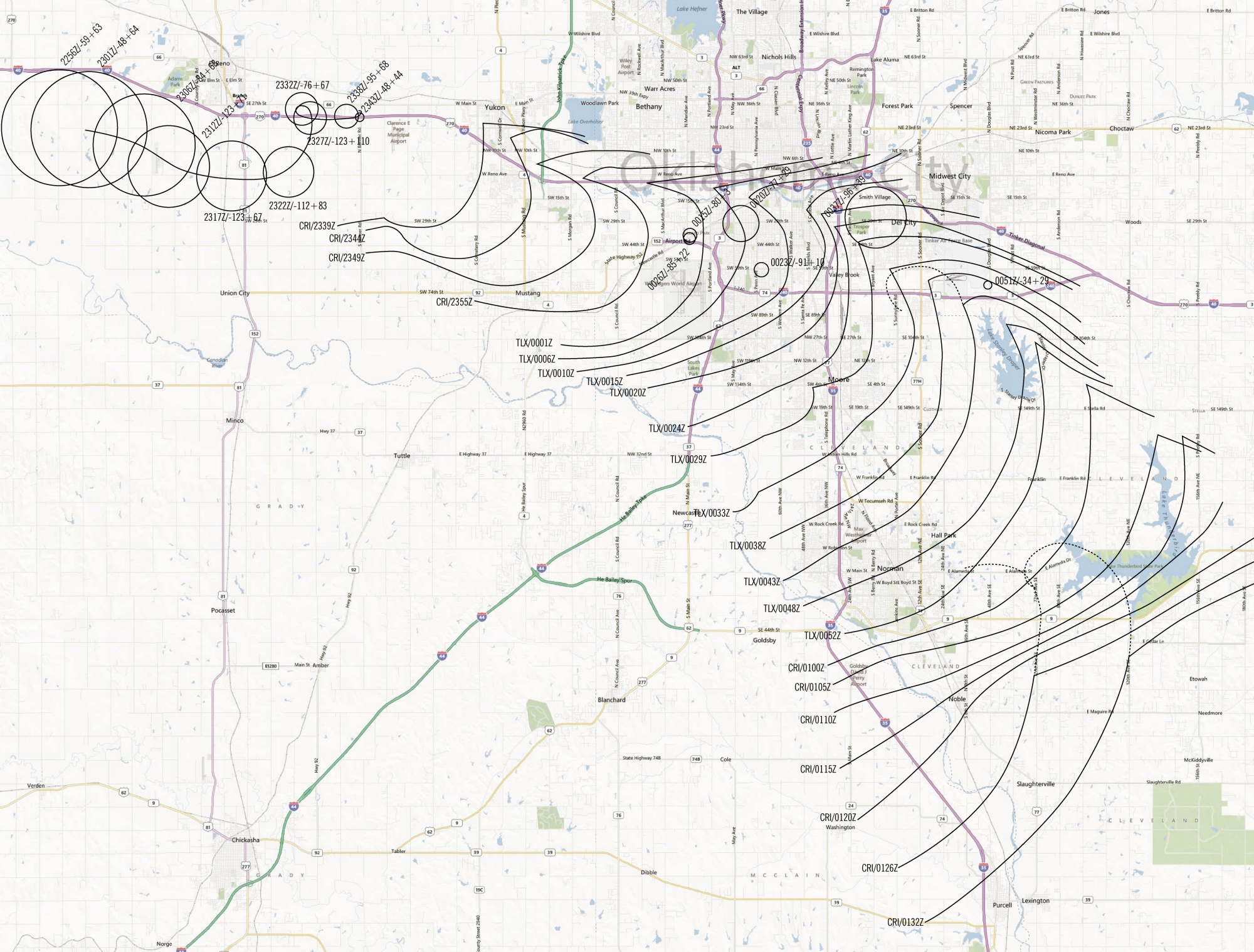
Outflow outer leading edge isochrones as interpreted from KCRI and KTLX spectrum width and reflectivity. Circle diameters intersect max +/- radial velocity, so are proportional to circulation size and does not indicate whether it is a tornado or not.

(click to expand)
There you can see slowing as the storm goes through two later tornadic phases: one in S OKC and the other in east Norman.
Tim
High winds (along either KCRI or KTLX radial) and significant circulations.

(click to expand)
Outflow outer leading edge isochrones as interpreted from KCRI and KTLX spectrum width and reflectivity. Circle diameters intersect max +/- radial velocity, so are proportional to circulation size and does not indicate whether it is a tornado or not.

(click to expand)
There you can see slowing as the storm goes through two later tornadic phases: one in S OKC and the other in east Norman.
Tim
Last edited by a moderator:


