Andy Wehrle
EF5
A late report, mainly due to this chase having that extra sting for me of targeting somewhere further afield that didn't produce tornadoes, while storms closer to home did. I even said when I started the event thread that if CAMS trended toward a stronger signal of discrete cells occurring in southern Wisconsin, I would have to strongly reconsider my plan of going to Iowa. Well they did, but I found the lure of better terrain in Iowa too great to resist and the environment looked pretty much the same to me on forecast soundings. I thought conditions were generally favorable for supercells and tornadoes, with the caveat of mediocre at best low to mid-level lapse rates (generally 6-6.5 degrees C/km).
I thought near Waverly-Waterloo looked good, and headed out along US Highway 20. A storm started to get going a little to the west, although the radar signature remained a bit anemic (perhaps struggling with those poor lapse rates) and it didn't have a warning on it, not even a SVR. However, I decided to give it time as it was the only play within reach, and a prominent wall cloud was visible beneath the base as I got a view along 120th St. just east of L Avenue south of Parkersburg (infamous of course as the site of the deadly EF5 in May, 2008).
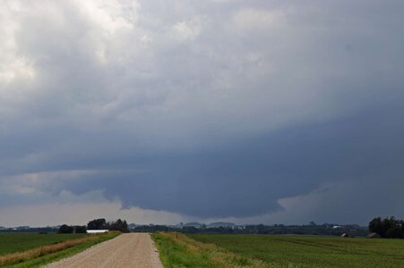
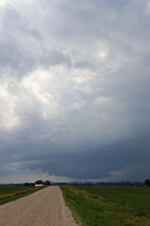
Jumping ahead of the storm, I set up to shoot the wall cloud again off Westbrook Road between New Hartford and Cedar Falls. Here it displayed perhaps its most impressive appearance, with streaky rain curtains beneath and an RFD cut apparent, as well as a possible bowl lowering/funnel. However velocity still did not appear that tight on radar and there was still no warning of any kind on the storm.
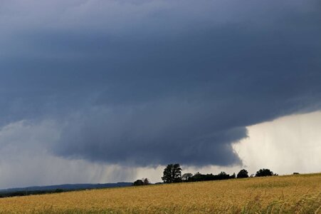
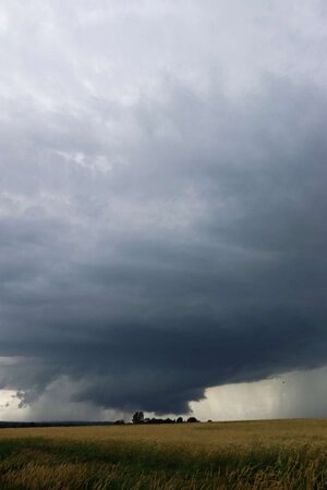
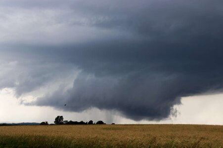
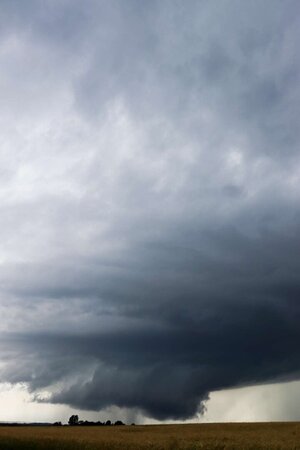
I continued pursuing the storm eastward in the area between US-20 and IA-3, mostly using Cedar Wapsi Road. The storm eventually picked up a tornado warning, but I never got a view of anything more impressive than the above wall cloud. I headed into Oelwein to take IA-3 east from there, getting stuck in blinding rain from the forward-flank core until I was able to gain enough distance on the area of interest to drop south in front of it, using IA-187 from Maryville.
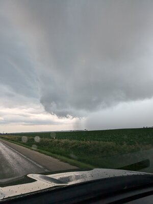
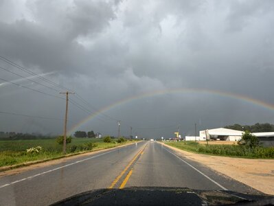
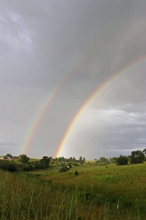
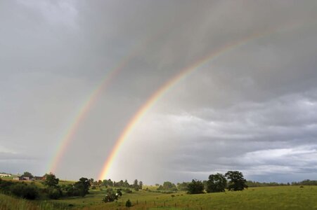
Here I mistakenly took County 57/120th St., which looked like a nice, paved east option. It was...until it passed through the middle of Backbone State Park, becoming lined with a solid tree canopy on both sides and with multiple hairpin turns that couldn't safely be taken at much more than 20 MPH. This put me solidly behind the storm and it was probably during this time when some other chasers observed a large funnel cloud with it. At this point I essentially gave up, only keeping with the storm because it was going the same way I was to go home. I saw a couple of large rainbows on the back side of it, a horizon-spanning one near Edgewood, IA and then a double one as I was almost home; between Mineral Point and Dodgeville, WI.
Meanwhile, a couple of earlier discrete cells had tracked through southern Wisconsin, one putting down several tornadoes including a couple of strong, damaging ones in Argyle and Janesville. These were rain-wrapped, however, it also produced a more visible one near Belmont which had a photogenic "sidewinder" rope-out, seen by a few chasers.
I thought near Waverly-Waterloo looked good, and headed out along US Highway 20. A storm started to get going a little to the west, although the radar signature remained a bit anemic (perhaps struggling with those poor lapse rates) and it didn't have a warning on it, not even a SVR. However, I decided to give it time as it was the only play within reach, and a prominent wall cloud was visible beneath the base as I got a view along 120th St. just east of L Avenue south of Parkersburg (infamous of course as the site of the deadly EF5 in May, 2008).


Jumping ahead of the storm, I set up to shoot the wall cloud again off Westbrook Road between New Hartford and Cedar Falls. Here it displayed perhaps its most impressive appearance, with streaky rain curtains beneath and an RFD cut apparent, as well as a possible bowl lowering/funnel. However velocity still did not appear that tight on radar and there was still no warning of any kind on the storm.


I continued pursuing the storm eastward in the area between US-20 and IA-3, mostly using Cedar Wapsi Road. The storm eventually picked up a tornado warning, but I never got a view of anything more impressive than the above wall cloud. I headed into Oelwein to take IA-3 east from there, getting stuck in blinding rain from the forward-flank core until I was able to gain enough distance on the area of interest to drop south in front of it, using IA-187 from Maryville.

Here I mistakenly took County 57/120th St., which looked like a nice, paved east option. It was...until it passed through the middle of Backbone State Park, becoming lined with a solid tree canopy on both sides and with multiple hairpin turns that couldn't safely be taken at much more than 20 MPH. This put me solidly behind the storm and it was probably during this time when some other chasers observed a large funnel cloud with it. At this point I essentially gave up, only keeping with the storm because it was going the same way I was to go home. I saw a couple of large rainbows on the back side of it, a horizon-spanning one near Edgewood, IA and then a double one as I was almost home; between Mineral Point and Dodgeville, WI.


Meanwhile, a couple of earlier discrete cells had tracked through southern Wisconsin, one putting down several tornadoes including a couple of strong, damaging ones in Argyle and Janesville. These were rain-wrapped, however, it also produced a more visible one near Belmont which had a photogenic "sidewinder" rope-out, seen by a few chasers.
Last edited:
