Caleb O.
EF0
Ah yes, nothing to see here folks, just your average, completely normal stormtrack reports thread in *checks notes* "WA...?" As in Washington State? That Washington State? Believe it or not, against all odds (climatological and otherwise), three days ago I had the opportunity for that most elusive and rare treat for a Seattle based storm lover: a backyard chase.
The past couple days had been exceedingly hot, a persistent ridge was baking the Pacific Northwest with mid to high 80’s heat, quite unusual for this time of year. The heat wasn’t dry either, as it usually is when it gets this hot, rather that morning I noticed that the air felt sticky and heavy, and sure enough, dew points were climbing into the low 50’s. This would lead to CAPE values in the lowlands west of the cascades approaching 3000 J/kg in some areas, high values anywhere, but even more so in Washington of all places. All that was needed was just a little bit of upper-level support, and sure enough, models had a very subtle low-pressure center moving through Southern Washington. This, combined with natural rising motion produced by the cascades would be enough for some thunderstorms, which would initiate off the mountains and slowly meander westward.
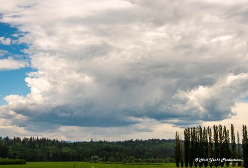
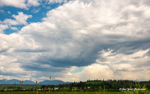
The best parameters were south of the Puget Sound down past the Tacoma and Olympia area, but I didn’t exactly feel the need to drop 2-ish hours south and brave the infamous rush hour traffic of that region, so I decided to stay up north in the Snoqualmie River Valley near Duvall, which is five minutes away from where I live and provides some of the best viewpoints in the region. Around 2:00, thundershowers started to go up, so I hopped in my car and after a 10-minute drive got to my favored viewing spot. Right in front of me was a nice little shower that I got to see develop with an inflow base and then eventually die as the updraft gave out. I heard thunder a couple of times and even saw some lightning bolts, plus I got a nice timelapse of the downdraft dump. I shot a couple more thundershowers and cumulus towers that bubbled up, but by 4:30 it looked like any chances of more convection in that area had been killed as the anvils from previous storms were blocking any more storms from forming, so I called it a day, happy with the shots I had gotten.
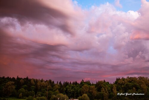
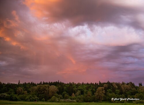
Miraculously though, things weren’t quite done yet. At 8:30, right in the middle of golden hour, an outflow boundary from stronger storms to the south came through a still rich convective environment in my area. I looked out my window and saw a stunning updraft bathed in gold, pink and orange colors go up right over my house and I knew I had to get back out there and get some more shots. As I arrived in the valley, one of the most beautiful scenes I’d ever seen while storm chasing unfolded in front of me. It was one of those rare occasions where there was so much amazing stuff happening in front of me, I didn't know where to point my camera. Words don’t quite do it justice, so I’ll just post the pictures and let you guys see it for yourselves. Outflow boundaries quite often cause magic in the plains, and it looks like they can work the same wonders even in Washington!!
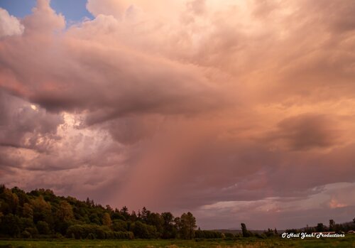
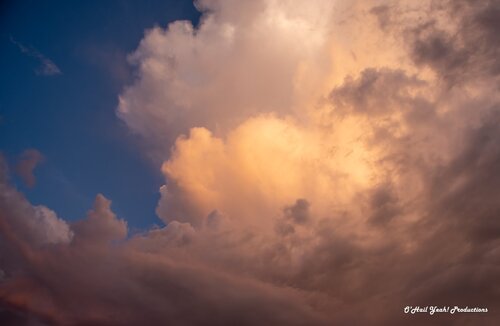
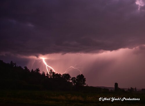
As the sun set, the lightning really started to ramp up, and before me unfolded the best lightning display I’ve seen in the state of Washington since the Enhanced risk day on May 30th, 2020. A cell to my south was really going nuts, spitting out bolts every minute or so, and I got a few nice lightning shots.
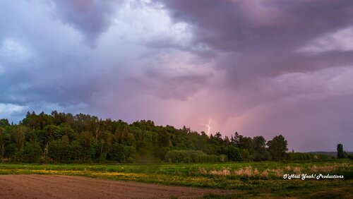
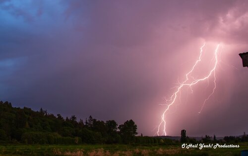
It was a great day and one I'll remember for a while. Attached below is a link to my YouTube channel with the timelapse videos I got, go check it out!
Backyard Chase | A Short Film - YouTube
The past couple days had been exceedingly hot, a persistent ridge was baking the Pacific Northwest with mid to high 80’s heat, quite unusual for this time of year. The heat wasn’t dry either, as it usually is when it gets this hot, rather that morning I noticed that the air felt sticky and heavy, and sure enough, dew points were climbing into the low 50’s. This would lead to CAPE values in the lowlands west of the cascades approaching 3000 J/kg in some areas, high values anywhere, but even more so in Washington of all places. All that was needed was just a little bit of upper-level support, and sure enough, models had a very subtle low-pressure center moving through Southern Washington. This, combined with natural rising motion produced by the cascades would be enough for some thunderstorms, which would initiate off the mountains and slowly meander westward.
The best parameters were south of the Puget Sound down past the Tacoma and Olympia area, but I didn’t exactly feel the need to drop 2-ish hours south and brave the infamous rush hour traffic of that region, so I decided to stay up north in the Snoqualmie River Valley near Duvall, which is five minutes away from where I live and provides some of the best viewpoints in the region. Around 2:00, thundershowers started to go up, so I hopped in my car and after a 10-minute drive got to my favored viewing spot. Right in front of me was a nice little shower that I got to see develop with an inflow base and then eventually die as the updraft gave out. I heard thunder a couple of times and even saw some lightning bolts, plus I got a nice timelapse of the downdraft dump. I shot a couple more thundershowers and cumulus towers that bubbled up, but by 4:30 it looked like any chances of more convection in that area had been killed as the anvils from previous storms were blocking any more storms from forming, so I called it a day, happy with the shots I had gotten.


Miraculously though, things weren’t quite done yet. At 8:30, right in the middle of golden hour, an outflow boundary from stronger storms to the south came through a still rich convective environment in my area. I looked out my window and saw a stunning updraft bathed in gold, pink and orange colors go up right over my house and I knew I had to get back out there and get some more shots. As I arrived in the valley, one of the most beautiful scenes I’d ever seen while storm chasing unfolded in front of me. It was one of those rare occasions where there was so much amazing stuff happening in front of me, I didn't know where to point my camera. Words don’t quite do it justice, so I’ll just post the pictures and let you guys see it for yourselves. Outflow boundaries quite often cause magic in the plains, and it looks like they can work the same wonders even in Washington!!


As the sun set, the lightning really started to ramp up, and before me unfolded the best lightning display I’ve seen in the state of Washington since the Enhanced risk day on May 30th, 2020. A cell to my south was really going nuts, spitting out bolts every minute or so, and I got a few nice lightning shots.


It was a great day and one I'll remember for a while. Attached below is a link to my YouTube channel with the timelapse videos I got, go check it out!
Backyard Chase | A Short Film - YouTube
