KenMcWatters
EF1
An unusual January storm chase! Around noon storms began firing near the triple point near the KS/OK border N of Tulsa. Per SPC at least 2 confirmed tornadoes occurred between Nowata, OK and Coffeeville, KS. That supercell moved almost due east toward Miami, OK. Meanwhile another low-topped supercell developed to the south, maturing near Vinita, OK where it crossed I-44. It became tornado warned at that time, and also became the dominant cell in the area.
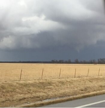
I chased east of Vinita toward Afton, where I saw a thin white funnel descend from the back edge of the storm. I could not see if it made ground contact, and within a few minutes it roped out and dissipated. Pictures are below, taken about 4 miles to its SW.
I drove through Afton and continued east, where I soon saw pea to marble sized hail partially covering the ground. A fun start to the storm season!
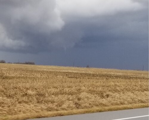