Ethan Schisler
EF5
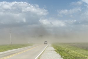
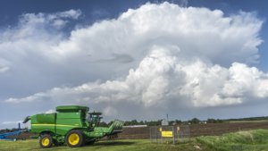
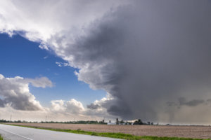
So I've got some catching up to do on reports, I've been out chasing the past few days and on this particular day, my expectations weren't high. High resolution models were showing storms breaking out across much of Iowa into Western Illinois by early to mid afternoon and I figured the storm mode would be messy. I left Galesburg around noon and targetted around the Iowa City area where I eventually was baited northward by some developing storms on the northeast side of the low. I followed these almost to Waterloo where I decided that the storm motion wasn't favorable for tornadoes up here and the cloud bases extremely high (moisture mixing perhaps?). I bailed south and eventually arrived on a tornado warned supercell outside of Muscatine, Iowa where it pretty much died in front of my face. Additional supercells were firing on its flank however and down into Northeast Missouri. I figured these would have the best shot and indeed they did. I hadn't shot any photos up to this point, so I arrived on the first REAL storm of the day southwest of Wapello around 6:30PM.
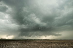
Supercell outside Wapello, Iowa around 6:30PM
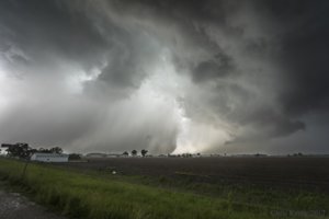
Eventually shortly after that, I moved a little bit south to get out of the precipitation where I observed what was an EF-1 tornado just south of Riverside, Iowa. Originally I wasn't convinced this was a tornado because the motion was slow, yet still rotating. The tornado circulation appeared quite broad and I probably wouldn't have guessed it to even reach that intensity until I saw the damage survey.
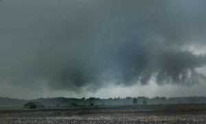
Stovepipe tornado and inflow tail south of Riverside, Iowa with a barn in the foreground.
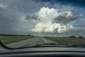
The tornado just more or less fell apart after a few minutes, I drove south a couple miles and decided the storm was probably done and appearing mostly outflowy. So I dropped southwest to a new supercell storm that had developed. It didn't produce a tornado that I'm aware of, but it produced a spectacular RFD cut and mesocyclone pretty much right above me and down the road I was on, I was convinced for a few moments that we were close to getting a significant tornado. I eventually lost the lowering as it crossed the MS river and there isn't another crossing until Muscatine which was about 25 miles up, so my chase day was effectively over at this point. Another tornadic supercell had developed in Western Illinois out of my reach, but it managed to produce several tornadoes close to where I live (just north). Yet another close call for my area in what has been an active few years.
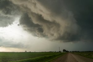
Developing RFD cut outside of Morning Sun, Iowa
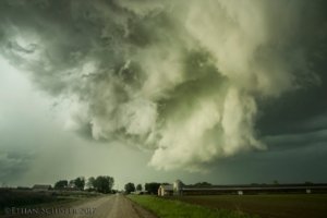
Mature mesocyclone just up the road from me. It never produced a tornado to my surprise and knowledge.
Well that wraps up another successful local chase day. The next day I headed out to Kansas for what was anticipated to be a high end severe weather day. I'll have more on that next.....

Supercell outside Wapello, Iowa around 6:30PM
Eventually shortly after that, I moved a little bit south to get out of the precipitation where I observed what was an EF-1 tornado just south of Riverside, Iowa. Originally I wasn't convinced this was a tornado because the motion was slow, yet still rotating. The tornado circulation appeared quite broad and I probably wouldn't have guessed it to even reach that intensity until I saw the damage survey.

Stovepipe tornado and inflow tail south of Riverside, Iowa with a barn in the foreground.
The tornado just more or less fell apart after a few minutes, I drove south a couple miles and decided the storm was probably done and appearing mostly outflowy. So I dropped southwest to a new supercell storm that had developed. It didn't produce a tornado that I'm aware of, but it produced a spectacular RFD cut and mesocyclone pretty much right above me and down the road I was on, I was convinced for a few moments that we were close to getting a significant tornado. I eventually lost the lowering as it crossed the MS river and there isn't another crossing until Muscatine which was about 25 miles up, so my chase day was effectively over at this point. Another tornadic supercell had developed in Western Illinois out of my reach, but it managed to produce several tornadoes close to where I live (just north). Yet another close call for my area in what has been an active few years.

Developing RFD cut outside of Morning Sun, Iowa

Mature mesocyclone just up the road from me. It never produced a tornado to my surprise and knowledge.
Well that wraps up another successful local chase day. The next day I headed out to Kansas for what was anticipated to be a high end severe weather day. I'll have more on that next.....

