Ethan Schisler
EF5
Today was a pretty decent chase day across Southeast Iowa and West Central Illinois. My chase group and I managed to "score" 2 tornadoes, however there was a lack of satisfaction as we didn't get much photographical evidence of either. Anyway here is the story....
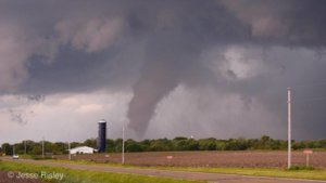
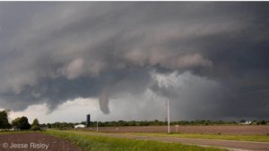
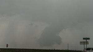
We started the day off eating lunch in Galesburg, I noticed an outflow boundary bisecting most of West Central Illinois. By 1:30pm updrafts were already starting to get established in Warren County, IL where this boundary was located. Temperatures on the north side of the boundary were a solid 10-15 degrees cooler than the south side, so I knew this is where we needed to be. We played with the Warren County storm for about 5 minutes and noticed it was trash. We piddled around on the back roads making it back to 34 and then west of Burlington towards a beast that had developed outside Birmingham, Iowa. This road network issue is probably what cost us a closer view of the "Salem, IA tornado". Anyway we made it almost to Mount Pleasant up Highway 34 when we got a view of the storm's base from about 10-12 miles out. It was a classic supercell initially with very little precipitation obstructing my view. We could see a cone/stovepipe tornado off to our southwest, however by the time we pulled over, the tornado had either roped out or became totally rainwrapped/occluded. I took this right around the 3:00 oclock time-frame...
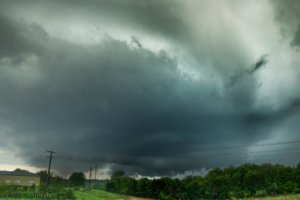
I'm thinking this was about the time the tornado lifted or so. It was a shame that we couldn't get up there sooner for a more quality shot, but I guess a tornado is a tornado. My friend and fellow chaser Jesse Risley got some excellent footage of this particular vortex. Hopefully he posts his report here, not to speak for him!
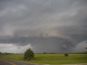
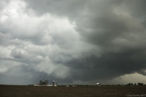
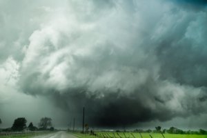
Anyway, I followed the storm further east, through a couple more cycles and it wasn't really producing. We would get these large RFD surges and then precipitation overtakes us and then a new cycle. The most impressive photo of the day was just outside of Mount Pleasant, Iowa. We came in on the back side of the storm's mesocyclone and got an incredible view of a carved out meso, something you would except to see a wedge under. I couldn't verify a tornado under this, but it wouldn't have surprised me at all. It even had the "ghost train"/RFD inflow jet ahead of it that you would expect. So cool to see, so close to home.
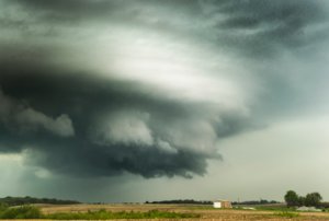
We gave the storm a little more chance, but unfortunately our road network wasn't working well so we got back to highway 34 and crossed back into Illinois at Burlington, Iowa. We headed north to intercept the tornado warned storm one last time near Keithsburg where it exhibited dramatic supercell structure.
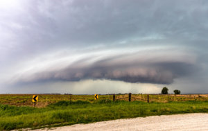
It was at this point that the storms were starting to congeal together and form a line, so we decided to head back towards home and get a few shelf cloud shots along the way. Mother Nature had other plans....
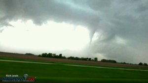
Going back through Monmouth on Highway 34, we noticed that rotation was starting to increase on the leading edge of the squall line. So we decided to divert south and east and eventually ended up between Galesburg and Abingdon in Knox County. This is where I looked out my drivers side window and saw TWO funnel clouds at the same exact time basically rotating around each other.
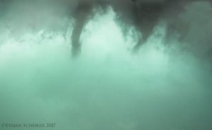
These eventually congealed together and moved east, I thought they dissipated.....however about 2 miles up the road and to the right off highway 10, we noticed an incredible surge of wind (probably close to 70 miles-per-hour) and then shifting directions, I looked out the window and saw the funnel briefly touchdown in the field next to me to my north and was throwing small pieces of debris. I submitted a report to SN and continued east, abandoning the chase near Knoxville, IL.
While some may scoff and say, you got plenty to show for today's chase.....yes I did get some awesome photographs, however I failed to document the two tornadoes that we did see. The second one I can't really blame myself because it was so quick and I didn't expect that, I thought the storm was undercut, but obviously not. The first one, it was so far away I was skeptical and that got the best of me, until I realized it was a tornado based on other chasers that were closer.
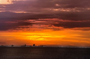
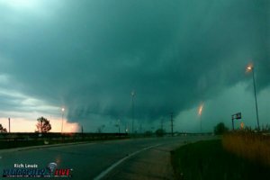
And to top it off, no good chase day is complete without a great sunset. I like the fog on the ground from the recent rainfall and the warm front being in the area.
We started the day off eating lunch in Galesburg, I noticed an outflow boundary bisecting most of West Central Illinois. By 1:30pm updrafts were already starting to get established in Warren County, IL where this boundary was located. Temperatures on the north side of the boundary were a solid 10-15 degrees cooler than the south side, so I knew this is where we needed to be. We played with the Warren County storm for about 5 minutes and noticed it was trash. We piddled around on the back roads making it back to 34 and then west of Burlington towards a beast that had developed outside Birmingham, Iowa. This road network issue is probably what cost us a closer view of the "Salem, IA tornado". Anyway we made it almost to Mount Pleasant up Highway 34 when we got a view of the storm's base from about 10-12 miles out. It was a classic supercell initially with very little precipitation obstructing my view. We could see a cone/stovepipe tornado off to our southwest, however by the time we pulled over, the tornado had either roped out or became totally rainwrapped/occluded. I took this right around the 3:00 oclock time-frame...

I'm thinking this was about the time the tornado lifted or so. It was a shame that we couldn't get up there sooner for a more quality shot, but I guess a tornado is a tornado. My friend and fellow chaser Jesse Risley got some excellent footage of this particular vortex. Hopefully he posts his report here, not to speak for him!
Anyway, I followed the storm further east, through a couple more cycles and it wasn't really producing. We would get these large RFD surges and then precipitation overtakes us and then a new cycle. The most impressive photo of the day was just outside of Mount Pleasant, Iowa. We came in on the back side of the storm's mesocyclone and got an incredible view of a carved out meso, something you would except to see a wedge under. I couldn't verify a tornado under this, but it wouldn't have surprised me at all. It even had the "ghost train"/RFD inflow jet ahead of it that you would expect. So cool to see, so close to home.

We gave the storm a little more chance, but unfortunately our road network wasn't working well so we got back to highway 34 and crossed back into Illinois at Burlington, Iowa. We headed north to intercept the tornado warned storm one last time near Keithsburg where it exhibited dramatic supercell structure.

It was at this point that the storms were starting to congeal together and form a line, so we decided to head back towards home and get a few shelf cloud shots along the way. Mother Nature had other plans....
Going back through Monmouth on Highway 34, we noticed that rotation was starting to increase on the leading edge of the squall line. So we decided to divert south and east and eventually ended up between Galesburg and Abingdon in Knox County. This is where I looked out my drivers side window and saw TWO funnel clouds at the same exact time basically rotating around each other.

These eventually congealed together and moved east, I thought they dissipated.....however about 2 miles up the road and to the right off highway 10, we noticed an incredible surge of wind (probably close to 70 miles-per-hour) and then shifting directions, I looked out the window and saw the funnel briefly touchdown in the field next to me to my north and was throwing small pieces of debris. I submitted a report to SN and continued east, abandoning the chase near Knoxville, IL.
While some may scoff and say, you got plenty to show for today's chase.....yes I did get some awesome photographs, however I failed to document the two tornadoes that we did see. The second one I can't really blame myself because it was so quick and I didn't expect that, I thought the storm was undercut, but obviously not. The first one, it was so far away I was skeptical and that got the best of me, until I realized it was a tornado based on other chasers that were closer.

And to top it off, no good chase day is complete without a great sunset. I like the fog on the ground from the recent rainfall and the warm front being in the area.

