• A student is looking for help on tropical cyclone prediction. Please fill out the survey linked to this thread: https://stormtrack.org/threads/storm-and-hurricane-intensity-prediction-survey.32957
  • After witnessing the continued decrease of involvement in the SpotterNetwork staff in serving SN members with troubleshooting issues recently, I have unilaterally decided to terminate the relationship between SpotterNetwork's support and Stormtrack. I have witnessed multiple users unable to receive support weeks after initiating help threads on the forum. I find this lack of response from SpotterNetwork officials disappointing and a failure to hold up their end of the agreement that was made years ago, before I took over management of this site. In my opinion, having Stormtrack users sit and wait for so long to receive help on SpotterNetwork issues on the Stormtrack forums reflects poorly not only on SpotterNetwork, but on Stormtrack and (by association) me as well. Since the issue has not been satisfactorily addressed, I no longer wish for the Stormtrack forum to be associated with SpotterNetwork.

    I apologize to those who continue to have issues with the service and continue to see their issues left unaddressed. Please understand that the connection between ST and SN was put in place long before I had any say over it. But now that I am the "captain of this ship," it is within my right (nay, duty) to make adjustments as I see necessary. Ending this relationship is such an adjustment.

    For those who continue to need help, I recommend navigating a web browswer to SpotterNetwork's About page, and seeking the individuals listed on that page for all further inquiries about SpotterNetwork.

    From this moment forward, the SpotterNetwork sub-forum has been hidden/deleted and there will be no assurance that any SpotterNetwork issues brought up in any of Stormtrack's other sub-forums will be addressed. Do not rely on Stormtrack for help with SpotterNetwork issues.

    Sincerely, Jeff D.

2017-03-26 REPORTS: KS/OK/TX

Joined
Jun 16, 2015
Messages
476
Location
Oklahoma City, OK
This was a last minute decision at chasing, as I wasn't particularly impressed with the setup until Saturday. Even then, there were big questions about moisture return and the lack of appreciable moisture likely played a role in limiting tornado activity. (although 00z obs did show a pool of near-60F dew-points in south-central Oklahoma in the vicinity of a tornadic supercell.)

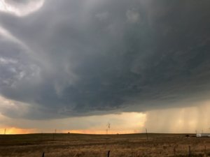
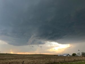
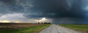
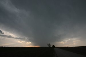
I was on an initial supercell near Pauls Valley for a while and aside from some mildly interesting scud, the storm was too elevated to do anything worth pursuing. I decided that the tail end storm in central Oklahoma might be worth following. (early in the chase, I contemplated North Texas, but felt that it was too conditional to justify rushing down there) For a while, there was nothing all that noteworthy, until the cloud bases clearly began to lower after 7 p.m. and some lower level rotation was noted.

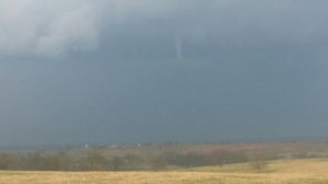
This first clip shows a funnel and otherwise inconclusive/possible tornado around 7:18 p.m., two miles east of Ada, Oklahoma, as listed in the SPC storm reports:

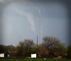
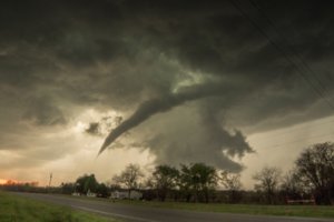
This next clip features a more conclusive tornado, about 10 minutes later, five miles east of Ada.

I got closer and closer to this storm, but hail was all I saw as daylight gave way to post-sunset darkness and the storm became more elevated. These mark my first tornado(es) of the year and I'll take it given that we're not even to April yet and an active early severe weather season continues.

Not a great photo by any means, but something more to remember this chase by:
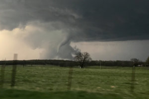
ada_tor.jpg
 
Interesting chase. Short and fun up to a point. Storms behaved oddly.

Didn't leave OKC area until 4 PM after seeing first storm develop. Stuck with it from near Pauls Valley to east of Byars. It exhibited strong cloud base rotation that was pulling up scud, but it would've been a stretch to have called it a low-level meso. It dropped generally sub-severe hail on us northeast of Pauls Valley. By the time we got to US 177 east of Byars the storm's base had gone featureless. There was a very obvious and large horseshoe base, but absolutely no lowerings or features of any kind. The storm also appeared to be fighting a bit with outflow coming from the storm to the south, so we eventually bailed for that one.

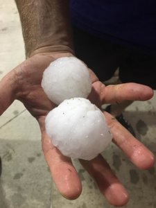
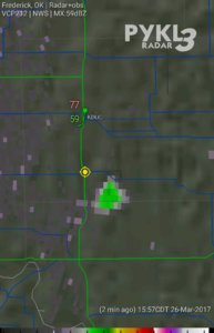
We got to Ada well before the brunt of the storm got there. We sat in Ada for a long time wondering if the storm was going to just die. It really seemed to struggle to maintain itself for awhile. Thinking we would give the storm one last glance before giving up, we ventured east of town on OK-1. On the east side of town we suddenly had large hail falling on us. Probably mostly ping-pong sized, but some of the stones were getting large enough to worry me. We also saw the storm had suddenly pulsed up and appeared to show rotation southwest of us, but due to trees and hills, we had a poor view, so we ventured east a bit, pulling off on Lovelady Road. About a mile south of OK-1 we were busy watching another example of cloud base rotation with scud pulling up into it when we noticed a horizontal tube below cloud base to the southwest. After a few moments of uncertainty, we noted dust at the ground and realized we were looking at a (likely non-supercellular) tornado.

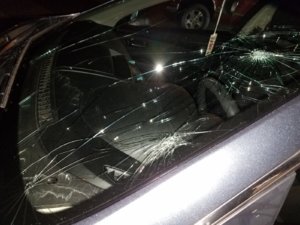
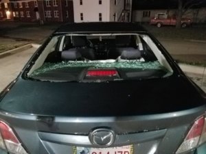
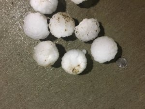
We let the non-tornadic rotation cross the road to our south, then turned around to get back to OK-1. On the way there, more hail. It quickly got larger. By the time we were going east on 1, the hail became large enough to cause damage, cracking my windshield. Then another crack. Suddenly we were frantically searching for shelter. We found a private residence off the highway with an awning and space under it and pulled under it. The owner was there and allowed us to sit under it as baseballs began pelting the ground and the awning. It was incredibly loud. He said we had to leave when his wife showed up, and within 60 seconds she came in. We had no choice - we had to back out and expose ourselves to the barrage. It wasn't 10 seconds before the first stone fully penetrated the rear windshield. Then another one. Within probably 30 seconds most of the rear windshield was gone. We moved back west to get out of the hail, taking more damage to both front and rear windshields in the process.

20170326_204819.jpg 20170326_204753.jpg

Oops. Lesson learned I guess. Shoulda just stayed on that N-S Lovelady Road and gotten in behind the circulation.

I bought this car in 2013 with hail dents already on it. I've definitely put it in hail since then, and a few instances of up to goflball sized, but nothing significant ever seemed to come of it. As of this chase, I'd say this car is officially christened as a chase vehicle. My first broken windshield (on a personal vehicle). Badge of honor I guess (wish it wasn't going to cost me hundreds).
 
Last edited:
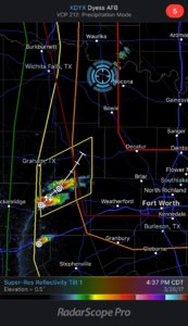
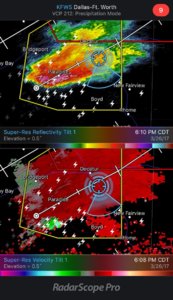
I ended up choosing at the last minute to take a run at the Denton, TX tornado warned storm. I headed W on Justin Road from I-35E until I was just within the tornado warned box and just SE of the area of rotation.

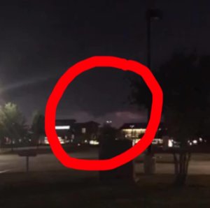
We glimpsed what appears to be a small wall cloud with a funnel, so I pulled into a parking lot to see if we could get out and get some pictures. Within seconds of us all exiting the truck, Mother Nature decided she wanted to throw ice at us. I parked us right behind the main body of a gas station and angled my windshield towards the canopy. Luckily, the only damage I took was a few dents and a broken mirror.

17435874_1626926073991154_3144239507061761734_o.jpg 17499504_1327207467370323_2253864019972365358_n.jpg

17424782_1327207450703658_6150179806414044786_n.jpg
 
Last edited:
I had a fun chase yesterday. I targeted Comanche, OK. By the time I got there, I only waited around 15 or 20 minutes before the first storm fired.

7f131ba0aad9eb4e6881420b4c720d46.jpg

I chased it until it produced a funnel over the Canadian river.

50dc733e1f99695eef6380c173475256.jpg

I have better pictures and video of the funnel on my tablet, but in the end it only went 1/3 of the way down (if you saw McGowan's pic it's better).

Then, I bailed south to Ada just in time to get a look at the horizontal funnel/tornado. My tablet video of that is crappy and I didn't have time to get a shot with my phone. So no pic of that. But, all in all a great chase.

Sent from my SAMSUNG-SGH-I337 using Stormtrack mobile app
 
I don't normally post chase accounts on here, but I'm really pleased with how it turned out yesterday.

@Greg Blumberg, my wife and I originally targeted Ardmore, OK and went west towards Wilson, OK. After waiting around for a while for some solid initiation, we went after the cell by Elmore City and Pauls Valley. We chased that to I-35 and then decided to bail on it, since it was running out of CAPE. We bailed south to the cluster near Davis, which at the time was kind of an unorganized blob. Our hope was that it would organize over time, given the favorable environment, wider CAPE axis, and unimpeded flow from the south. It gradually got its act together, though we were relatively unimpressed until a short way southwest of Ada, when it started rotating and producing funnel clouds. We followed it from behind until we got to Ada, then took OK-3 to get south of it. That took us a little far away, but we were able to get a low-contrast view of the tornado(es) east of Ada (picture below shamelessly stolen from my wife).

20170326_ada_tor.jpg

We managed to get back behind it on OK-1 and followed it a little ways east of Ada. We encountered quite a bit of hail fog due to the large amount of hail the storm dropped. At that point, we were losing daylight, though we were in a nice position to see the mesocylone (and another possible funnel) backlit by lightning, given the lack of precip in the RFD. Being huge fans of quitting while ahead, we decided to let the storm go. We waited a bit for the left movers in southern OK to pass behind us and then went back to Ada for dinner. We were back in Norman at 11pm.
 
We left the house about 3:15PM (a luxury from living in the region, I guess) and slid on over to Ringgold, TX along US-82 so the we had a northern route and could play either side of the Red River. We bit on first storm firing up by Duncan, OK, but quickly realized at radar speed estimates, it was going to be a serious haul and decided to stop and wait before we moved ourselves away from the southern target.

We watched the southern development for a bit and decided it to head south to Bowie and then on down to Decatur to wait on it.

IMG_7054.JPG

It went through some meandering splitting, but finally got its own airspace and made some eastward progress while strengthening. So after our coffee break behind Starbucks, we headed a bit further south.

IMG_7070.JPG

But not before snapping a pic of a serious #RainWedge. ;-)

IMG_7069.jpg

Anyways, we were in great position to watch it slide east and cross 287. It was doing pretty well (with even some slowly rotating, rising scud being drawn into a slightly growing lowering on its flat base, but then the air coming into our storm became noticeably cooler from the outflow of the storm to our SW. This definitely put any lower-level organization on pause...until both of storms got their acts together and pounded DFW with all that hail. We watched our initial storm head east, but then bailed back home up 287 rather than partake in the hail core from the southern cell. :-)

Even though I managed to forget my laptop charger, my iPad and my rain jacket...it was a great day to be out and about.

IMG_7072.jpg

IMG_7081.jpg

IMG_7088.jpg

IMG_7092-2.jpg

 
Sunday was my first storm chase in about two years. It was also the first time I've taken my girlfriend, and although we didn't see any tornadoes, we did see some nice storms.

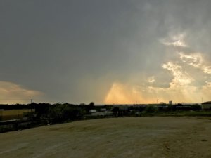
We left Tyler, TX around 2:30 PM (a bit late, but I'm usually hesitant) with a target of Gainesville, TX in mind. Before we got to Sherman, TX, I already wanted to be heading west and south but with lakes and DFW suburbs in the area, I decided to keep going towards Gainesville. Once there, it was obvious that we needed to head south to intercept the supercells already located west/northwest of DFW, heading northeast. We found a nice view just off of I-35 on Barthold Rd on the north side of Denton, TX.

IMG_9624.jpg

We hung around for a bit and let the storm get closer. We had a nice chat with another chaser that stopped by as well.

IMG_9629.jpg

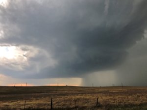
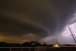
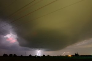
I didn't want to play around in precip as much as possible and I obviously wanted to avoid getting into any hail that these storms ended up dropping. I also wanted to avoid getting into suburbs as much as possible. We went east on 288 but didn't have much luck finding a good view. We continued east on Hwy 380 and found a nice view on the west side of Cross Roads on top of a hill on the east side of Lake Lewisville. The storm was really starting to get its act together and produced a decent wall cloud and vivid lightning.

IMG_9634.jpg
IMG_9636.jpg IMG_9644.jpg

Rain from other cells to the south began filling in and it looked like it choked off this storm. The southwest storm ended up producing a tornado report near Justin and became the dominant southern end of the messy cluster. The hail cores were large and intense so we kept heading east after dark. I wanted to get one last look at the main supercell remaining as it passed by and maybe get some more lightning before we called it quits. We stopped for a bite to eat in McKinney while the storms inched our way. We found another decent view on the northwest side of Farmersville, where we watched the cell begin to die as it moved by.

IMG_9660.jpg IMG_9677.jpg

It seems like these supercells could have used more moisture to lower LCL's in order to have a better shot at producing. All in all, not bad for my first chase in quite a while. My girlfriend still thinks I'm a little crazy, but enjoyed tagging along and did a great job as my driver. Looking at my pictures afterwards was a nice little reminder that I need to clean some dust off of my camera sensor and that I could still use more practice.
 
This date marked my first chase of 2017. It also marked my first tornado intercept of the year. I targeted south central Oklahoma and intercepted a developing supercell near Katie, OK and followed it northeast. This storm cycled several times, but never really showed a real tornado potential. I let this storm go as it cross the stationary front into more stable air.

Another storm had developed to the southwest and was heading to Ada. I targeted this storm in hopes it could "anchor" into the boundary layer and become tornadic as it interacted with the boundary. When I first got a visual of the storm (just west of Ada) the updraft base had a large donut hole in it. Realizing it would take several minutes to cycle I quickly plotted a route to track it east of Ada where I believed it would have it's greatest chance to produce a tornado. Because Highway 1 runs northeast out of Ada, I decided to find a different route as I expected the storm to turn right (east) as it hit the surface front. Highway 1 would put me in the hail core.

I dropped off of HWY 1 onto Lovelady Road, then east on Stonewall Road. This placed me directly east of the rapidly organizing supercell. The updraft began to look more classic in appearance. A wall cloud and funnel developed a couple of miles to my west, and what appeared to be a weak tornado formed, however this tornado wasn't officially confirmed. The first wall cloud occluded and a new wall cloud quickly formed on the leaded edge of the meso just to my west. I decided to reposition another mile or two east. Upon doing so the new wall cloud tightened as the RFD wrapped in and a funnel formed. Within seconds the circulation had made contact with the ground. Tornado! This tornado lasted about 5 minutes before dissipating. The supercell tried to cycle up once again, however it was quickly crossing into more stable air and would weaken soon after. Like others have mentioned, a lack of deeper boundary layer moisture probably mitigated the tornado threat this day, however there was just enough there to get the job done at least one time. Not a bad start to what turned about to be a solid chase season.

IMG_4576.1.jpg

 
Back
Top