Andrew Constans
EF0
I'll kick this one off with an intercept on the Bennington/Fort Calhoun cell NNW of Omaha.
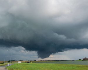
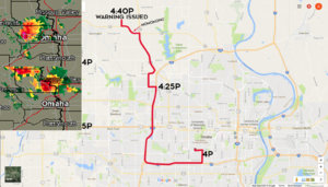
Got off work around 4p after watching the Dodge/West Point area cell wrap up on radar and pick up a tornado warning. Decided to go watch the cell out west (Elkhorn area) for a few before date night, posted up on Fort and 108th with a clear view to the west. There was a pronounced lowering with some quality upward motion, but no rotation. I gave it 10 minutes and decided to head home, but checked the radar for a minute to be sure I wasn't going to miss anything.
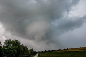
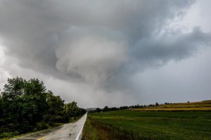
While I was looking away, the entire scene changed. I looked back up to a nice big wall cloud with crazy upward motion. I got north via 108th to keep pace with it, still not seeing much rotation. I missed my turn to 680N and took 133 instead, which landed me right in the bears cage. Cue a left turn onto curvy highway 36 to keep south of the wall (which I thought was straight, forgot my nav tablet at home) and I'm suddenly looking right up into a rotating wall cloud. I could see some little spin ups in the scud beneath it, and the wind was all over the place.
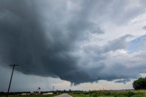
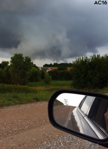
With nowhere to pull off/turn around, I gunned it west and managed to clear it a few minutes before it went tornado warned. I set up with a good vantage point on 132nd Street looking east as the cell continued NE, there was a brief funnel visible as I relocated to escape a wet hail filled RFD. Off duty NWS employees verified this, but did not see any debris.
In all, it was a success on execution. I'm definitely not chasing without a navigational aid again though, that encounter was WAY too close for comfort and I'm incredibly lucky that cell didn't decide to drop a tornado as I realized my mistake. I've never really been scared chasing yet, but that changed for a few incredibly lucky minutes last night.
Edit: apologies for the image scaling - here's the gallery http://imgur.com/gallery/4Al3U
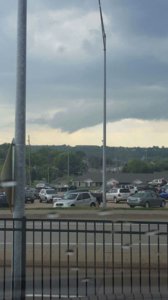
Looking West on Fort as I decided to go home, looked back up and was moving before I had a chance to get a pic
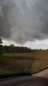
^4:40PM - tornado warning issued
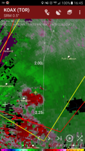
4:45PM
Got off work around 4p after watching the Dodge/West Point area cell wrap up on radar and pick up a tornado warning. Decided to go watch the cell out west (Elkhorn area) for a few before date night, posted up on Fort and 108th with a clear view to the west. There was a pronounced lowering with some quality upward motion, but no rotation. I gave it 10 minutes and decided to head home, but checked the radar for a minute to be sure I wasn't going to miss anything.
While I was looking away, the entire scene changed. I looked back up to a nice big wall cloud with crazy upward motion. I got north via 108th to keep pace with it, still not seeing much rotation. I missed my turn to 680N and took 133 instead, which landed me right in the bears cage. Cue a left turn onto curvy highway 36 to keep south of the wall (which I thought was straight, forgot my nav tablet at home) and I'm suddenly looking right up into a rotating wall cloud. I could see some little spin ups in the scud beneath it, and the wind was all over the place.
With nowhere to pull off/turn around, I gunned it west and managed to clear it a few minutes before it went tornado warned. I set up with a good vantage point on 132nd Street looking east as the cell continued NE, there was a brief funnel visible as I relocated to escape a wet hail filled RFD. Off duty NWS employees verified this, but did not see any debris.
In all, it was a success on execution. I'm definitely not chasing without a navigational aid again though, that encounter was WAY too close for comfort and I'm incredibly lucky that cell didn't decide to drop a tornado as I realized my mistake. I've never really been scared chasing yet, but that changed for a few incredibly lucky minutes last night.
Edit: apologies for the image scaling - here's the gallery http://imgur.com/gallery/4Al3U


Looking West on Fort as I decided to go home, looked back up and was moving before I had a chance to get a pic

^4:40PM - tornado warning issued

4:45PM

Last edited:

