2016-05-21 REPORTS: KS

Joined
May 16, 2011
Messages
246
Location
Seattle , Wa
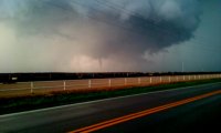
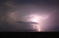
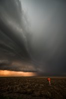
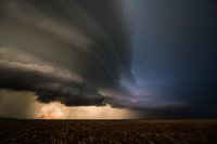
Played the only game in town Saturday, as did most other chasers and tour buses.
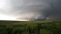
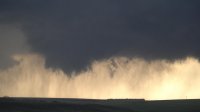
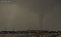
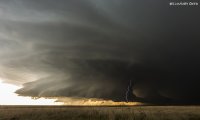
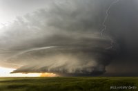
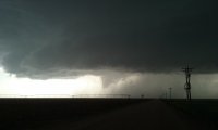
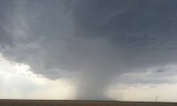
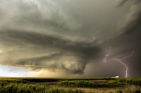
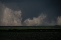
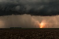
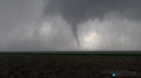
We were with the main show from the time it was born as a tiny shower near Tribune until it started dropping a couple brief tornadoes and displayed good structure.

I was shocked at how long it was able to maintain itself. The inflow to the storm was as strong as I've seen also.
It was also interesting watching it go from HP to developing wall clouds, to producing a few brief tornadoes and then back again to an HP beast.

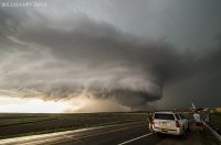
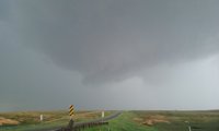
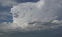
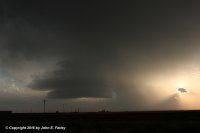
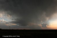
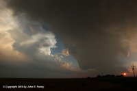
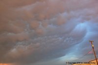
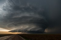
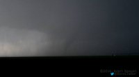
This storm was had best structure I have ever seen in person, and the amazing Mamatus to the SE was a great bonus.

"Warm up" Saturday turned out to be a very fun chase day.

[Broken External Image]:[URL='http://View attachment 724b5e88fa2acde8878d2c139a3f15f5.jpg 13268365_10154825836122542_7911032866029398447_o.jpg 13268455_10154825837012542_1307354459922632105_o (1).jpg 13235147_10154825836707542_5372216417362954460_o.jpg 13247832_10154825835612542_3302829469456805087_o.jpg[/URL]
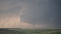
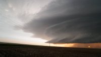
 
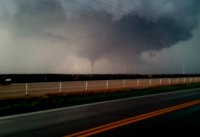
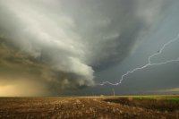
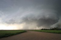
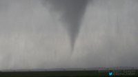
Incredible day on the high plains of Kansas. Watched that storm develop west of Leoti and then anchor itself on the southern flank of it. Nice inflow... multiple wall clouds and when it put down the two tornadoes (it dropped again within about 40 seconds) that mesocyclone really wrapped up hard. Stumping structure to end the day with the sun coming under the decaying storm.

aab0327dba914482a25d6978983db5d4.jpg
ea996a317d865289bd28c1d3d3b5ab19.jpg
17623faf5c5b2192f1fc2da0d054d540.jpg
5f79d67a0001a84f3b6d61f2f7f45de9.jpg
 
Landed in Denver at 11:30 MDT to start my chase vacation. When I made my travel plans last Tuesday I was thinking it would just be a travel/positioning day, so was thrilled to make it out to Tribune in time to get on the storm, where we saw the two brief touchdowns north of Leoti at around 7:00 CDT. No time to get the pics off my camera yet but will post when I can.

Just after the brief touchdowns the meso became rain-wrapped. We tried to continue edging north but visibility was poor. At one point we thought we saw a white funnel / tornado emerge and cross route 25 but I think it might have just been a tendril of scud, I can't be sure; a quick look at the small screen video on my camera doesn't seem to show any rotation. However, there was a tornado report at around that time, about 12 minutes after the time stamp on my video. Any insights about this?

Probably spent too much time trying to edge behind the meso, playing cat and mouse with the RFD, and missed out on some of the better structure shots, but did get a couple right at sunset when we bailed south.

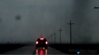
I thought the chaser convergence was among the worst I've seen: one storm, one road, no shoulder, difficult to pull off onto the grass because of a very steep angle. Still, many people could have pulled off the road more than they did. I saw one person facing north in the southbound lane, just sitting there, not sure what they could possibly have been doing or thinking. Another person heading south suddenly backed into a turnoff, swinging the front end of their car almost in front of us as we were heading north. Adding to the circus was a DOW truck that apparently got stuck in mud and was perpendicular to the road, blocking the southbound lane. Thank God nobody had to use that road for an escape route.

It didn't take away from a fun chase, which I considered a "bonus day" that helped work the rust off and get us in"chase mode."

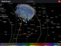
Anyway, back to the weather. One thing I was curious about is the fine line on this radar image extending southeast from GLD, it almost seems to correlate with the warm front, could that be possible??
 

Attachments

  • ImageUploadedByTapatalkHD1463924327.184068.jpg
    ImageUploadedByTapatalkHD1463924327.184068.jpg
    261.3 KB · Views: 168
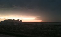
Chased the Leoti storm from birth to when it dropped the brief tornadoes, was cool to watch the cells moving NE hitting the warm front and stopping to grow in to that monster storm. After the tornadoes went east to Monument Rocks to get sunset and lightning pictures. Here are my pictures of the Day. 20160521_190537.jpg 20160521_190545.jpg 20160521_174700.jpg 20160521_183025.jpg 20160521_175149.jpg 20160521_163339.jpg 20160521_204214.jpg
 
Fun chase day that I had not planned to chase but couldn't resist so close to Denver. Several runs of HRRR verified having only that one cell go up. Headed for Tribune which had been morning target. Arrived slightly late due to waiting on chase partner but got on Leoti storm just after it was severe and before tornado warned. Due to vehicle, did not want to risk hail so stayed back for mostly structure shots. This storm spun like a top but we think we only caught one of the brief rain wrapped tornadoes. Lots of nice structure though. Would have gotten even more lightning but chase partner had to be back. Chaser convergence was horrible approaching worst I have seen and I was extremely irritated to see that about 50% of people out there lack all manners. Without fail, every single dirt road seemed to be blocked by only two or three cars sitting double and triple parked so that the road was inaccessible. A few roads that were not blocked that way accumulated 12-15 vehicles. Enough people were driving like fools that our decision to stay back for structure shots at times made the chase much more enjoyable. _MG_4688.jpg
 
Like James, I'll have to post pics at a later date. We were on a cell just to the West of where the Leoti storm popped up. Slid over to that one well before it parked itself North of Leoti. Sat on the edge of the circulation for hours. Saw two tornados plus several funnel clouds.
There wasn't a shortage of chasers on some pretty crappy roads. We saw one pickup slide into the ditch and also saw another one sitting in the ditch. From what I saw, the vast majority were being considerate and trying to stay out of the roadways as much as possible. I did have one particularly negative experience. We were leaving the storm as darkness was taking over and heading South away from the storm. Someone in dark clothes was right in the middle of the road taking pictures. We didn't even see him until we were almost on top of him and he decided to move. If he would have slipped down, I'm not confident we could have stopped in time.
Otherwise it was a fun day that I wasn't counting on a couple of days ago
 
Mods, can TX be added to the thread title? No tornadoes for me in the Panhandle, but the structure down there was not too shabby, either. On what was mainly a pre-positioning day for today's chase, I intercepted a couple LP supercells which eventually merged southwest of Vega/northwest of Hereford. They produced copious amounts of 1-2 inch hail in the vicinity of Simms, TX. Never saw another chaser on this storm, though apparently there were others, as one seemed to stay in the hail core even until after dark, making numerous reports to NWS AMA on the hail size. I preferred to stay out of the hail, and managed to do so.

chase52116-fb4.jpg

chase52116-fb5.jpg

chase52116-fb6.jpg

chase52116-fb7.jpg
 
We were just to the west of the storms as they fired. We skirted under the cells and approached from the east to avoid any potentially wet dirt roads (which our rental with road tyres doesn't like very much - can't wait to get our own chase vehicle!). Sometimes this puts us a bit out of position, but thanks to the almost stationary storms, we saw tornadoes, amazing structure and then a funnel at sunset. Wow, the wind and rain, and views - it was wild!

610_1311.jpg 610_1459.jpg 610_1699.jpg 610_1777.jpg 610_1732-2.jpg
 
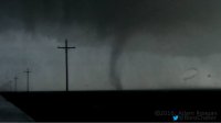
This was a fun sleeper day that netted me my first set of tornadoes on a slight risk day north of Leoti (I was limited to chasing high end setups while living in Tennessee). In all I saw 4 tornadoes but was only able to capture 3 of them on video.

68ea806ab2ad0d2804626b6f7a2fd334.jpg
cb1cf1feeca900a956b96028f89f201e.jpg
ecec7a385da477376bf6315cdf1243ee.jpg
29884f3f299583581624949f8f99e911.jpg
b8f8abb20bbe2b443ccb4ff811346ad5.jpg
09ea985e975eea66bc4ad2a9f93f4912.jpg

I didn't get much structure shots as I was more focused on the tornadoes this supercell was producing.

 
Back
Top