• While Stormtrack has discontinued its hosting of SpotterNetwork support on the forums, keep in mind that support for SpotterNetwork issues is available by emailing [email protected].

2013-04-01 REPORTS: TX

Joined
Aug 16, 2009
Messages
814
Location
Amarillo, TX
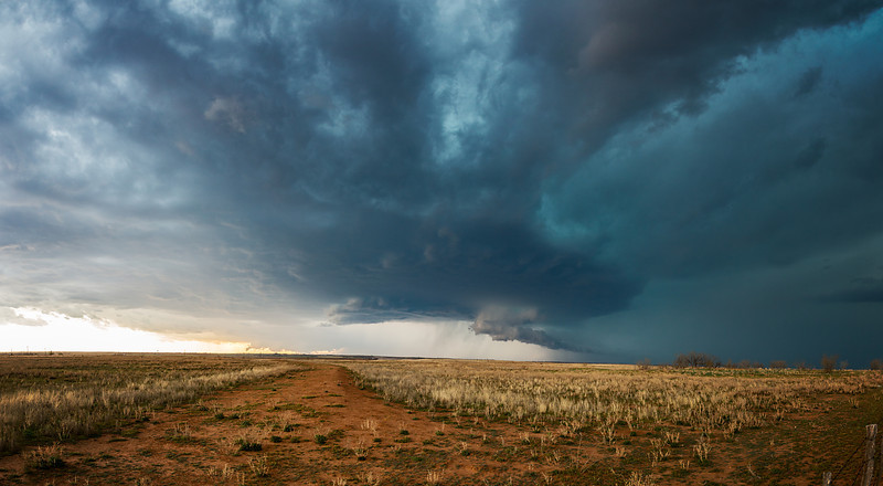
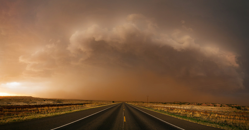
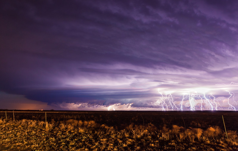
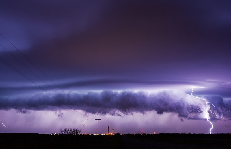
Well I saw the towers go up from work around 1pm in the afternoon. Every so often I looked south out of the shop and the storm kept growing. Before I knew it, SVR warned and isolated. I quickly came to a stopping point at work and hauled ass south around 4pm. We turned east at Tulia and that's when it was getting interesting. We came across the hail swath near Silverton and let the storm make some distance before we proceeded since there was some big stones. But sure enough, after that delay, I get a text saying "Drummond just bagged a fat tornado". Figures.................................................. ..................

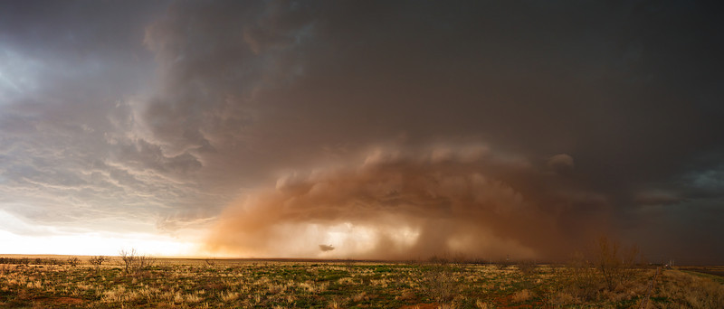
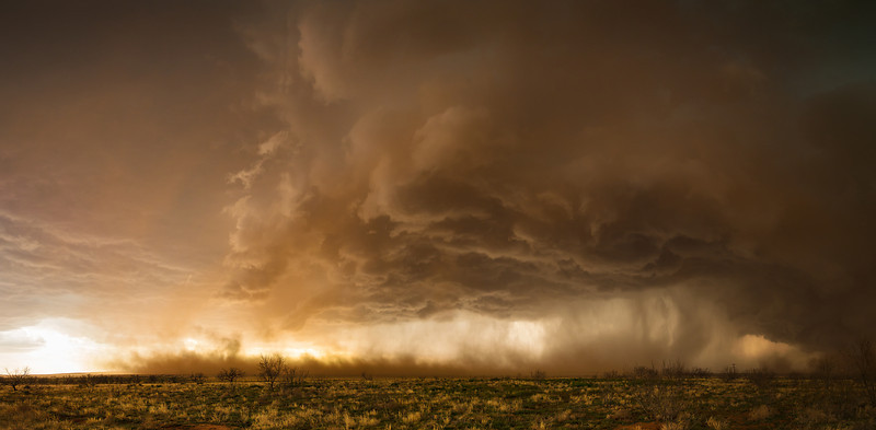
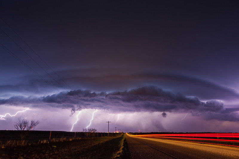
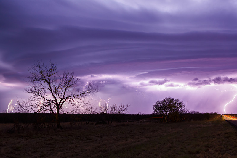
But here's my highlight video of the Silverton storm, plus some of the further south storm near Matador later on. After coring the Matador storm my car started to suck in water, and I was low on gas, so I turned home.


Watch video >
 
Tornado near Caprock Canyons State Park in Texas Panhandle

Well no secret now that I wasn't pulling an April Fool's joke on anyone yesterday when I got the tornado just west of Caprock Canyons State Park. Careful attention to the current details, surface analysis, and visible satellite imagery, along with a little Caprock Magic paid off with a great start to my season.

Watch video >
 
Chased this day with a few friends from Dallas. We made a snap decision that morning based upon what the short term models were showing. We initially targetted Childress near the triple point. As we approached Quanah storms were already well underway with fairly high based but beautiful structure. Rather than core the developing storm along 287 we made the decision to drop south and stay ahead of the cluster of storms that was slowly dropping SE. We rode out a pretty intense hail core West of Quanah near the Tennessee Valley cemetary and then headed south from there towards Paducah. We encountered a huge wall of outflow driven dust along this route as well as a large gustnado spinning just off the road to our East. We were able to get ahead of the storm and photograph some incredible haboob type features and the storm as it ingested all of the red dust kicked up by the outflow. We ended the day on one last cell that dropped towards Thorckmorton, TX. The lightning and striated structure was incredible.

Easily one of my favorite chases of all time on what looked like a somewhat marginal day.


Organizing storm just East of Quanah, TX.


Looking north at an approaching supercell and a large gustnado (right side of image). We actually saw some electrostatic discharge along the ground as we we were driving near this.


Looking north at the leading edge of the supercell as it approaches us north of Paducah.


Looking North West towards a second supercell that is ingesting the dirt kicked up by the storm closer to us.


The storm NW of us gets closer and sends outflow racing ahead of it. I have video of this as well that I will try to post later. We had to leave a few minutes after this image to avoid getting caught in the dust.


We're now North of Throckmorton having dropped south to intercept a supercell approaching that town. We stopped briefly to film the incredible lightning display. This is a stack of 5 images.


We're now East of Throckmorton along 380. The structure of the storm lit by the lightning was amazing.


Throckmorton had just taken a hit from the lightning and lost all of it's power.


One last lightning lit shot of the departing supercell as it dropped South of us.
 
Last edited by a moderator:
Back
Top