1953-6-8 Flint-Worcester Outbreak

Joined
Mar 3, 2012
Messages
273
I was surprised to see there wasn't a thread for this. I wrote a blog post about this event (http://stormstalker.wordpress.com/2013/09/05/flint-worcester-outbreak/) so I figured I'd share some of the interesting stuff I found:

It actually began on June 7, when a fairly strong storm system spawned an outbreak of somewhere between 30 and 40 tornadoes (several families were combined into single, long-track tornadoes), including a devastating F4 that obliterated several farmhouses east of Arcadia, Nebraska. Tragically, ten members of a single family - spanning three generations - were killed in one farmhouse that was swept away as the family ate Sunday dinner.

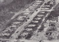
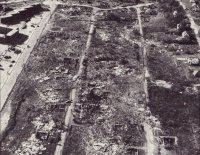
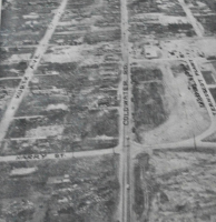
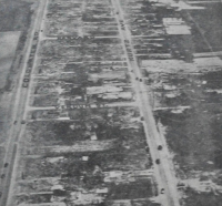
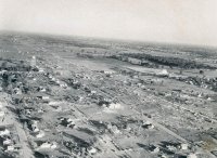
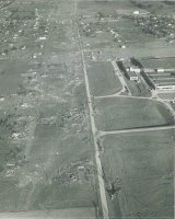
June 8 is most remembered for the Beecher, Michigan F5, and rightly so. The north side of Beecher was absolutely devastated, and the damage caused along the three mile stretch of Coldwater Road between Clio Road and North Dort Highway was as intense as you'll ever see. One hundred and thirteen people were killed in the span of a little over two and a half miles, including two dozen families suffering the loss of multiple members and five families losing four or more. There are several figures for path length, ranging from less than 20 to more than 30 miles. My research adds up to a path length of just over 29 miles. There was another tornado (F4) that touched down shortly thereafter and tracked through parts of Lapeer and St. Clair Counties. It was quite large and may have been very intense, but fortunately only struck a handful of homes.

Extraordinary damage along Coldwater Road:
0c8161c1dc8d8e8fa5c25f920274c7ec.jpg

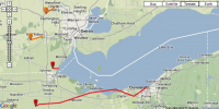
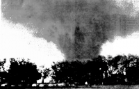
An F4 tornado in Temperance, Michigan killed four people and caused intense damage, but fortunately most of its path (officially only ~5.5 miles, my research indicates nearly 42 miles) was over Lake Erie. If it had been half a dozen miles to the south it would have tracked through the highly populated center of Toledo, Ohio, possibly causing massive devastation and loss of life. Very lucky break.

Temperance tornado shortly before entering Lake Erie:
b2d7f1d06ea88793820c8464af79d9fb.png

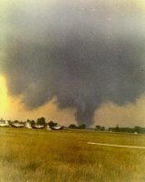
There were also several tornadoes in northern Ohio, which often get erroneously lumped together into a single tornado. An F4 tornado caused extreme damage and eight deaths in and around Cygnet, Ohio, including several homes that were swept away in probable F5 fashion. Following that tornado, an F3 caused moderate damage near Ceylon, and another long-track F3 caused severe damage and eight deaths in downtown Cleveland. Again, a very lucky break. Most of the damage was actually F2 or less, except a few homes that were totally destroyed. They were probably poorly built though.

The Cleveland tornado near Hopkins International Airport:
1b730171f15cf3d3a9828815ebbdc54d.jpg

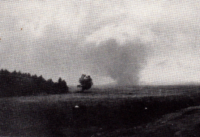
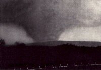
Of course, this outbreak is probably most famous for the Worcester F4 on the following day, June 9. There isn't much to say that hasn't already been said about this tornado. I've found a path length of just over 48 miles, in which the tornado caused massive damage to eight communities and killed 94 people. I'm sure everyone is also familiar with the F4/F5 debate. I'm of the opinion that the damage around Uncatena Avenue and just west of the Curtis Apartments complex in Worcester almost certainly warrants an F5 rating.

The half-mile wide tornado near Rutland:
7e68eb3e6f3b9065b83221b9dccdc27e.png

And later as a mile-wide wedge near Shrewsbury:
6bb16048e2add7e9d25b84dde95b6601.jpg

The damage along Uncatena Avenue:

c36f0fb3fa1308ab7c732983dc2ef86f.jpg

And west of the Curtis Apartments:

bfd272576c39aa9900bbc7767ec21668.jpg

I also made a map of all the tornado tracks, constructed using every reliable instance of damage I could find. They ought to be a lot more accurate than what you'd find elsewhere, though there may well be errors still.

https://mapsengine.google.com/map/edit?mid=z0Kbb3dsgNdE.k68g_yRxmZuE

You can click the star icon for each tornado to see fatality and path length information.
 
Last edited by a moderator:
Shawn, your article is truly stellar. Great research and great writing. You've got some tornado photos from that outbreak that I've never seen. The ones of the Temperance, MI, tornado, fascinate me--I've seen only the one photo, but you managed to dig up two others as well.

Unfortunately, no photos of the Flint-Beecher tornado appear to have ever emerged. I have, however, seen one photo that is purportedly of the supercell that produced the tornado, taken from a distance. My sweetheart lost her grandmother and an aunt in that tornado (though Lis herself wasn't even born until thirteen years later). It was one of just two Michigan tornadoes ever to receive the F5 rating; the other occurred three years later here in the Grand Rapids area.

But back to your article: kudos! You did a fabulous job.
 
Thanks Bob! Always good to hear your thoughts. I don't know why, but the Temperance tornado is fascinating to me. It was a very violent tornado, but it obviously gets overlooked with the Beecher tornado and then the Worcester tornado the following day. I read one report that mentioned the tornado "tore up the dirt" near the highway, but I couldn't find any confirmation so I didn't include it. If true, that certainly sounds like a description of ground scouring. That'd be rather impressive for that part of the country.

I've seen that photo of the supercell as well, I think I may have it somewhere here. Given that it was becoming fairly dark and almost no one was aware of the tornado until it struck there probably aren't any photos of the tornado, which is disappointing. There are a number of tornadoes for which the same can be said, and it's always a bit of a bummer to not have any photos of historical tornadoes. On the other hand, the Worcester tornado was fantastically well-documented, at least for the time. If it weren't for the landscape you'd think some of the photos were taken in Kansas or Oklahoma, perfect supercell structure and a monster wedge.

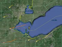
One thing that was a bit surprising was the inconsistent (and sometimes flat-out wrong) information out there regarding this outbreak. The path lengths are almost all different from the ones I've been able to document (which doesn't necessarily mean they're wrong, it could just as easily be me), death counts are inconsistent and conflicting, and the paths themselves are often wrong as well. For one particularly amusing example, check what tornadohistoryproject has for the northern Ohio tornado(es) and the Temperance tornado:

548bcdd4ed9420307d2e17854e12bee3.png

Should look more like this, and in fact the Cleveland tornado may have been a family of two or more as well:

2cf40fc0127b61046de6242cb3596703.jpg

And one of the F2 tornadoes on 6/7 in Iowa is officially listed as having a path length of something like 115 miles, but it was actually a family of nearly half a dozen tornadoes broken up at times by downbursts.

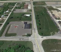
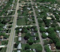
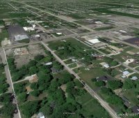
I also used Google Earth to take some screencaps at roughly the same angle as the aerial shots in Beecher were taken. Not particularly useful, but it gives you some rough idea of what a before/after would look like.

d92b8c9ac6b502e23630eecf91979d59.png

e4a88b5f4a14c3ddc24f332374b3098e.jpg

-----------

b56b13e4478236aadedcce8e74ebb5c4.png

dccd67c55f3f720f9d9c5aff7d582136.jpg

-----------

9d609102150b191db798b67fe76d1515.jpg

db8b4db3e7e709950894583a59e50be7.jpg
 
Shawn, your article is truly stellar. Great research and great writing. You've got some tornado photos from that outbreak that I've never seen. The ones of the Temperance, MI, tornado, fascinate me--I've seen only the one photo, but you managed to dig up two others as well.

Unfortunately, no photos of the Flint-Beecher tornado appear to have ever emerged. I have, however, seen one photo that is purportedly of the supercell that produced the tornado, taken from a distance. My sweetheart lost her grandmother and an aunt in that tornado (though Lis herself wasn't even born until thirteen years later). It was one of just two Michigan tornadoes ever to receive the F5 rating; the other occurred three years later here in the Grand Rapids area.

But back to your article: kudos! You did a fabulous job.

Bob, a friend of mine witnessed the Beech tornado as a child. I believe it passed just to the North of him athough it was close enough that he was almost killed in the house that he was in at the time. For fun, I may have to email him and see if he will write a short report of his own personal observations.
 
Shawn, how on earth did you go about determining those tornado paths? What was your method? It seems like a tremendous amount of legwork and ga$ had to have been involved in order to piece together the tracks of an outbreak that occurred sixty years ago. And whence the photos? Local libraries and museums?

I first saw the photo of the Temperance/Erie tornado when I was a kid, possibly in Flora's book. I didn't realize until many years later that it was associated with the Flint-Worcester storm system. Even years later, I look at that image and think, Man, what a grim-looking monster. It's good to get the story behind it that your article provides, and that pic taken from the train is paydirt.

Mike, DO IT! It would be great to read your friend's story here. Though maybe he's already written one. The Flint Public Library has a website dedicated to the tornado, and it includes a number of survivor accounts.
 
It was a hassle to say the least, but it's surprising how much information you can find online if you look hard enough. A lot of the information came from newspapers (Google News archive, newspapers.com, newspaperarchive.com, etc.), but also genealogy groups, local historical societies, contacting survivors and relatives of victims, grave searches like findagrave.com, etc. And then cross-checking the addresses wherever possible to make sure I'd gotten the right places. Aerial photos, photos of the tornadoes and that sorta thing also helped a lot. There are some places where I couldn't find any damage points so in those cases I just extrapolated from what I had, but for the most part I was able to plot at least a rough path using Google Earth, like this for example:

LWMTXF2.jpg


I tried to break each instance of damage down into Light (LGHT), Moderate (MDT) and Total (TOT) to get a sense for how wide the tornadoes were at a given point. Far from perfect, but still helpful.

And I'd be interested in that as well, Mike. Let us know if you hear from him!
 
Shawn, how on earth did you go about determining those tornado paths? What was your method? It seems like a tremendous amount of legwork and ga$ had to have been involved in order to piece together the tracks of an outbreak that occurred sixty years ago. And whence the photos? Local libraries and museums?

I first saw the photo of the Temperance/Erie tornado when I was a kid, possibly in Flora's book. I didn't realize until many years later that it was associated with the Flint-Worcester storm system. Even years later, I look at that image and think, Man, what a grim-looking monster. It's good to get the story behind it that your article provides, and that pic taken from the train is paydirt.

Mike, DO IT! It would be great to read your friend's story here. Though maybe he's already written one. The Flint Public Library has a website dedicated to the tornado, and it includes a number of survivor accounts.


Bob, I got an email response today from him. (He is a retired engineer.) Here it is:

"I was three years old. I was playing with my metal construction toys, bulldozer and dump truck, near the curb in front of my parents home. My parent's house was located at 149 E. Bishop, southwest of the Beecher area. The wind picked-up from the east, not the west. I looked to the east and I saw the street with its roll of trees on both side turn black. This black cloud was coming down the street towards me. I saw large trees being uprooted. Then I heard a sound of a train. This windy black cloud started to blow debris, dirt and sand at me. At this time I yelled for my mother. She came running from the house and snatched me up. The roar of the tornado was terrible. She carried me in such a way as I could see the tornado tear the antenna off the roof. Then she threw me over her shoulder as we entered the front door of the house. The antenna crashed through the door and followed us through the living room towards the kitchen. I remember yelling over the sound of the tornado to my mother to run faster. My mother made a sharp left turn towards the basement as the antenna crashed into the kitchen.

It was my understanding that the tornado then shifted to the northwest at the end of our street towards the Beecher area. I do not recall that the tornado destroyed any of the homes along our street."
 
Wow! Amazing that a three-year-old kid would have such a vivid recall. But then, that kind of an encounter with the Flint-Beecher tornado--yeah, that would be something that would etch itself pretty indelibly in one's memory at any age. Thanks for sharing that, Mike. It's an incredibly intense story.
 
Wow! Amazing that a three-year-old kid would have such a vivid recall. But then, that kind of an encounter with the Flint-Beecher tornado--yeah, that would be something that would etch itself pretty indelibly in one's memory at any age. Thanks for sharing that, Mike. It's an incredibly intense story.

Bob, I assume that since it was a shared experience with his mother, the memories of the event were re-enforced in subsequent years perhaps. Also, what 3 year old knows wind directions? :)

I looked at his address versus the map of the tornado that Shawn provided.

The tornado was about 1/2 mile wide and moved along Coldwater road. That would place him at least a mile South of the actual tornado path. I am going to guess that this tornado had a very strong RFD associated with it and what he actually experienced was the RFD. (Or rather-he could see the tornado but experienced just the RFD part of it.) A strong RFD with a rain curtain filled with debris could certainly be mistaken for a tornado and would be more than strong enough to take out a TV antenna and do the kind of damage to the house that he described. His description of the sound/fury of the tornado even from his distance gives one an idea on just how powerful this tornado was!
 
Last edited by a moderator:
Bob, I assume that since it was a shared experience with his mother, the memories of the event were re-enforced in subsequent years perhaps. Also, what 3 year old knows wind directions? :)

I looked at his address versus the map of the tornado that Shawn provided.

The tornado was about 1/2 mile wide and moved along Coldwater road. That would place him at least a mile South of the actual tornado path. I am going to guess that this tornado had a very strong RFD associated with it and what he actually experienced was the RFD. (Or rather-he could see the tornado but experienced just the RFD part of it.) A strong RFD with a rain curtain filled with debris could certainly be mistaken for a tornado and would be more than strong enough to take out a TV antenna and do the kind of damage to the house that he described. His description of the sound/fury of the tornado even from his distance gives one an idea on just how powerful this tornado was!

Using the measuring tool on Google Earth, he was likely ~1.75 miles away from the southern edge of the tornado when it passed Detroit Street. I'd imagine the situation you describe is probably what happened, and I can certainly imagine how he'd believe the tornado was much closer. There were reports of light damage well south of the tornado, I assume because of RFD/inflow. This also happened in Worcester, where spotty damage was reported more than two miles south/west of the path. Probably the most extreme incidence of this was in the Tri-State tornado, where moderate damage (including some flimsy structures being blown down completely) extended several miles south of the tornado's path, especially in Murphysboro and West Frankfort.

Thank you for sharing the story. It's always interesting to see how people perceive these events, especially if they were young and/or don't have a good understanding of tornadoes.
 
I, also, was three years old, in Braintree, MA, just south of Boston, the day of the Worcester tornado. My distinct memories are of my parents standing me up on the toilet to look out the west-facing window as what's now known as the rotating wall cloud passed over the house. I remember us going out in the back yard the next day and finding pieces of wood, roofing, and newspaper from the tornado.

That, plus the hurricanes in 1954 -- Carol and Edna -- and the hurricane-induced floods of 1955 was what gave me the special interest in weather, especially severe weather, that most of us share.
 
To resurrect this discussion: Tonight Lisa and I were talking about the tornado. Losing a grandmother, an aunt and her unborn baby, and other family members (Hedgers and Hargers) she never knew--she was born thirteen years later--was only part of the storm's impact on her. Lisa's mother, two half-sisters, and a half-brother survived the storm--barely, from what she tells me, as their own house got torn apart elsewhere in the storm's path. They made it to the basement by the skin of their teeth

I've asked Lisa to write down her exact account as she remembers it. It's a significant part of her family's history, but it occurred to me, as she recounted it this evening, that it's also an important account from this historic tornado that has remained untold and ought to be shared. The Hedger and Harger families suffered big losses--five adults, all of them women, plus the unborn child.

As I write, Lisa just walked into the room and handed me a slip of paper with their names and ages:
  • Alice Hedger (age 40), Lisa's paternal grandmother
  • Charlotte Hedger (3)--relationship unknown
  • Katherine Alice Hedger (5)--relationship unknown
  • Shirley Jean Hedger-Harger (22)--her dad's eldest sister
  • Shirley's unborn child
  • Lorraine Carol Harger, (10 months), Lisa's cousin

All the family's women got taken out by the storm. Lisa feels pleased that she is able to continue the female side of the family line.

Lisa's dad's house also sustained damage across from the Fisher Body Plant, thought it wasn't leveled. He apparently was away at the time the tornado hit.

Shawn, tornado historian that you are, I figured you in particular would take an interest. I'll post Lisa's story, which will no doubt be far more detailed and better informed than mine, once she has written it.

What strikes me is the far-reaching impact of this storm, which I think you can apply to other disastrous tornadoes where lives were lost. Sixty-three years later, Lisa feels the loss of family members she never got to know. And I find myself wondering how the storm affected surviving family members in ways that shaped their future and their children's future, including Lisa's.

When I've attended memorials for the 1965 Palm Sunday tornadoes in Dunlap, Indiana, I see survivors, their children, and their children's children, and I think, Wow. There are invisible lines here, not just of family, friends, and neighbors, but of a long-ago experience that shaped them all and, in a strange way, has created a web of interconnection many of them are only vaguely, if at all, aware of.
 
Last edited:
Not sure if it's a residual energy thing or what @Bob but the last time I drove through that neighborhood (last Spring - it's only about 10 minutes from where I work in Grand Blanc..) it gave me the chills. The lost of life there as described was appauling, but thankfully the warning process is much more advanced than it was in 1953. I know you've mentioned to me before about Lisa's tie to the area, but not in such detail. Thanks for sharing man!
 
I await Lisa's story eagerly, Bob! That's a terrible toll for those families to bear. I've been fortunate to speak with dozens of survivors and victims' family members and so on in the course of researching for my blog, and I'm always struck by the same thing as you. The scale of the tragedy in an event such as this is just hard to comprehend, not just in the immediate number of lives lost, but in the lingering sense of loss that extends beyond each victim to all their surviving family and their friends and others. I've heard many people say that they move on eventually, but they never feel quite whole again. For many, it becomes the major dividing line in their lives. There is "before tornado" and "after tornado." It's the sort of thing you rarely stop to think about until you encounter people who've been through such a thing.
 
Something else to maybe consider (I posted this on Shaun's blog some time ago but I'll repeat it here). With all the horror and devastation this tornado left in its wake, there may have been a considerable number of survivors who moved away from the area. Bear in mind also that in 1953, the postwar Baby Boom was still going strong. Each family that lost children or young adult members, or moved away afterward, had an impact on the city's population -- children that didn't grow up there, or perhaps were never born at all. Plus, many (not all) cities that experience this kind of destruction take quite a while to recover. If you add up all these considerations, I have to wonder if the ripple effects from this tornado played a role in Flint's economic implosion when the auto industry hit the skids in the 70s and early 80s. Perhaps the city was, even if just marginally, less resilient that it would have been otherwise, due to this disaster? There's probably no way to know for sure but it's an intriguing thought.
 
Back
Top