Skip Talbot
EF5
Targeted Taylorville, IL at 20z for low topped rotating storms. 12z NAM highlighted a prefrontal surface trough as a focal point for convective initiation between I-55 and I-57 in Illinois. Super cold temps aloft clipped the northern end of the warm sector north of I-64 with low 60s F temps and near 60 F dews at the surface south of I-74 making for robust low level instability, and ample vorticity along the trough wind shift line.
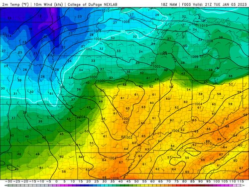
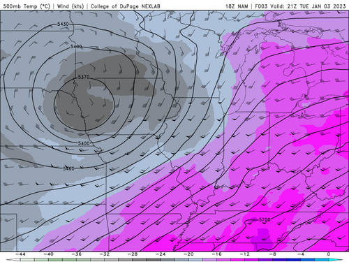
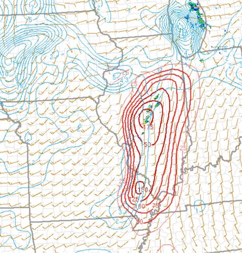
Mesoanalysis 0-3km CAPE and surface vorticity midafternoon:
Departed Springfield, IL at 2:30pm eastbound on I-72 to head off percolating convection extending from northeast of Taylorville to near Litchfield, IL. Watched downstream 10 miles west of Decatur as clusters of showers gradually intensified. At 3:44 pm a funnel cloud formed well south down the gust front of one of the larger cells nears Mechanicsburg, IL. The funnel roped out while tightening into a weak tornado with dusty ground circulation at 3:48 pm. Looking west from 1 mile south of Illiopolis:
Pursued cell north through Illiopolis, noting new circulation, again displaced from the main updraft southward down the gust front. Looking east-southeast from 2 miles north of Illiopolis at 4:05 pm:
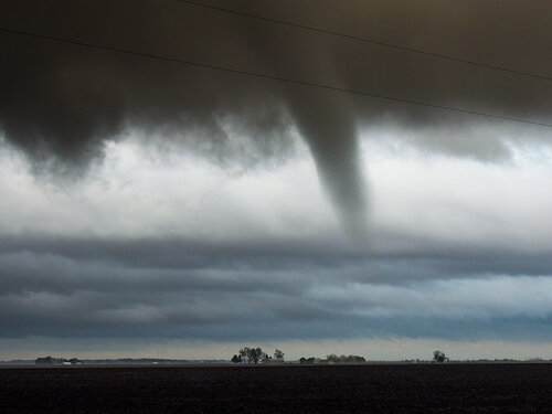
I couldn't confirm a significant presence at the surface with this circulation.
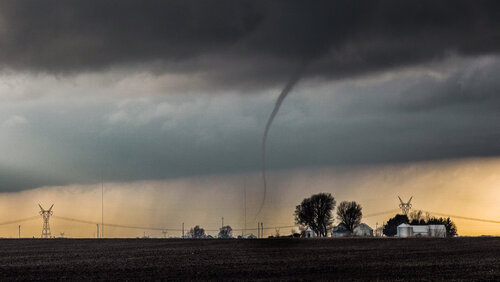
Stair stepped northeastward on the grid pursuing what was now a classic yet low topped supercell. At about 4:34 pm a robust funnel cloud formed, this time collocated with the supercell's main updraft, which likely led to the formation of a more significant tornado. Noted a fully condensed elephant trunk tornado at 4:36 pm. Looking northeast from a mile west of Maroa, IL:
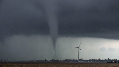
Encountered the damage path on Highway 51 on the northside of Maroa with a grain bin and other debris along the road and light debris strewn across the adjacent field. Tracked the cell northeast a few more miles before calling the chase at dark while tornado warnings continued southwestward down the line.


Mesoanalysis 0-3km CAPE and surface vorticity midafternoon:

Departed Springfield, IL at 2:30pm eastbound on I-72 to head off percolating convection extending from northeast of Taylorville to near Litchfield, IL. Watched downstream 10 miles west of Decatur as clusters of showers gradually intensified. At 3:44 pm a funnel cloud formed well south down the gust front of one of the larger cells nears Mechanicsburg, IL. The funnel roped out while tightening into a weak tornado with dusty ground circulation at 3:48 pm. Looking west from 1 mile south of Illiopolis:

Pursued cell north through Illiopolis, noting new circulation, again displaced from the main updraft southward down the gust front. Looking east-southeast from 2 miles north of Illiopolis at 4:05 pm:

I couldn't confirm a significant presence at the surface with this circulation.
Stair stepped northeastward on the grid pursuing what was now a classic yet low topped supercell. At about 4:34 pm a robust funnel cloud formed, this time collocated with the supercell's main updraft, which likely led to the formation of a more significant tornado. Noted a fully condensed elephant trunk tornado at 4:36 pm. Looking northeast from a mile west of Maroa, IL:

Encountered the damage path on Highway 51 on the northside of Maroa with a grain bin and other debris along the road and light debris strewn across the adjacent field. Tracked the cell northeast a few more miles before calling the chase at dark while tornado warnings continued southwestward down the line.

