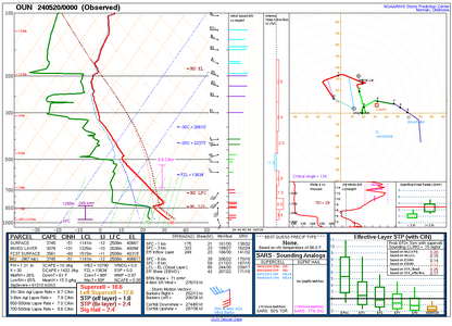
2024-05-19 EVENT: NE/KS/OK

I don't have much confidence in much other than a big bowing segment and potential high-end straight-line wind even today over central Kansas. Perhaps an isolated cell can get going along the dryline out ahead of the cluster expected to initially develop over the Raton Mesa and have enough time to do something before being overtaken by the MCS. Outflow boundary should be pushing north in the late afternoon into southern KS. If a storm can get rooted in that boundary ahead of the MCS, it could produce a tornado. I'm planning to head to DDC, and if all I get is a monster shelf cloud today, so be it!
 
Still clear as mud. the short-lived lone supercell (before it gets swallowed by the MCS) is back for a couple of hours on the HRRR. Otherwise, it is join the hordes in OK. Then backside mammatus once the MCS takes over.
 
I have updated my tornado forecast by adding an enhanced tornado risk area. The CAM's and general guidance are pretty consistent that there will be two "tail-end charlie" opportunities in the area.

I haven't made up my mind about chasing today. If I do, I would head for Medicine Lodge (P28) or Alva as a starting point.
 

Attachments

  • Screenshot 2024-05-19 at 12.07.06 PM.png
    Screenshot 2024-05-19 at 12.07.06 PM.png
    507.8 KB · Views: 9
The outflow from the overnight storms has pushed into NW Oklahoma and is hard to locate exactly now. Visible satellite shows it was more like an undular bore with multiple peaks, probably somewhere just south of Woodward. The DDC radar loop showed two distinct OFBs earlier. It may end up lifting to around the Kansas border by storm time. I am going to head southwest to around Pratt to keep the southern supercell in play, but I'm not optimistic that it's going to exist. CAMS are showing that outflow from the MCS just blasting through everything, which given the Dcape amounts seems pretty likely. I'll settle for a derecho day followed by upward lightning at either a wind farm somewhere or in Wichita at the Maize tower farm. If the southern storm does go, it could be a Simla-like laminar structure show with the forced updraft in the low levels.
 
After some indecision, I'm going to head north to the storm along I-70. There seems to be enough moisture pooling up there, and CAMs are trending toward that storm staying independent of the MCS through the evening. The environment ahead of it should improve as time goes on. Already, the easterly surface flow into that storm looks good.
 
Last edited:
After some indecision, I'm going to head north to the storm along I-70. There seems to be enough moisture pooling up there, and CAMs are trending toward that storm staying independent of the MCS through the evening. The environment ahead of it should improve as time goes on. Already, the easterly surface flow into that storm looks good.
Looks like an outflow boundary exists up in that region. If you can get a storm riding it I think it provides the best shot.
 
Spent about 3 hours with the only tornado warned storm in the country running along I-70. It was a HP mess even though it did start out looking pretty promising. It had a fairly rain free base for a little while anyway and had really nice structure at times. It’ll be interesting to see how things shape up over the next few hours and if the wind will live up to its potential. The hail did.

Edit…when I posted this I had no idea there had been tornadoes in Colorado 😬
 
Saw a big dusty tornado associated with a kink mesovortex in the outflow near Dorrance, Kansas just after 4pm, just north of I-70. I may have one other reported tornado near Russell on my dashcams. The storm lost its mesovortex-producing character shortly thereafter, so I ducked south out of its way on I-135. Now heading south to get run over by the derecho, then see if there will be an upward lightning party at the Wichita tower farm near Colwich.
 
Last edited:
I saw spinning dust on the ground south of Hays. Wasn't reported, not sure if it was truly a tornado or gustnado, but definite circulation on the ground vs the other straight line dust I saw repeatedly. It does look like that storm in Oklahoma was the storm of the day, though. Tornado reported in Colorado right where I drove past this morning. :rolleyes:
 
The storm down near OKC has looked good for a long time. Very slow motion. Appears a tornado just crossed the Kansas Turnpike in SW Shawnee county. CC drop on it.
 
Although this cell was my target I certainly didn't expect it to take the path that it did, and I'm not sure anyone else really expected it either. Seven hours, one cell, multiple tornadoes and it finally fell apart once it moved past OKC.

This season seems to be full of surprises.
 
Back
Top