• A friendly and periodic reminder of the rules we use for fostering high SNR and quality conversation and interaction at Stormtrack: Forum rules

    P.S. - Nothing specific happened to prompt this message! No one is in trouble, there are no flame wars in effect, nor any inappropriate conversation ongoing. This is being posted sitewide as a casual refresher.

2015-04-26 EVENT: TX

Really starting to like Sunday for a potential chase...

Strong trough diving SE doesn't seem to be the most ideal, but a lot looks to be in place for a solid setup including the potential for tornadoes.

Moisture looks to return rapidly into central TX on Sunday with mid 60's dews pretty likely south of Dallas and especially south and west of Waco. Obviously there is some really fat cape, with the NAM12 continuously depicting areas of >5000 J/KG sbcape and >4000 J/KG mlcape. Cin looks to be completely eroded by 21z and storms should fire along the dryline and quickly become supercells.

Low level shear is not super strong, but as the LLJ increases some towards dark to 30-40 kt... wouldn't be surprised to see pretty solid tornado potential setting up somewhere.

Still three days out, so plenty of time for it to change and maybe go to crap, lol.
 
As a reaction to this post from Randy Jennings in the reports-topic (I decided to put it here, because it fits here better than in the reports-topic):
(unfortunately I didn’t take one when velocity was showing 3 rotations in a row).

Here's a radar animation from that supercell, which shows both reflectivity and velocity. It's nice to see all those circulations and the transition to a bow-echo, after that supercell gets pushed from behind by those other cells. https://dl.dropboxusercontent.com/u/65745050/animatie_2015-04-26.png.
The animation is an APNG, so it's the best to view it in Firefox.

In addition to this I had created a couple of radar-volumes from the four largest supercells from this day. The first three all produced hail > 4 inch (reports of 4.25-4.5 inch), while the last one is the supercell that produced the tornadoes near Rio Vista. The times from the volumes are close to the times at which the hail was reported. The radar-volumes give a good view at the large BWERs accompanying those supercells. All volumes are visible at these link, to my post at a Dutch weather-forum:
http://weerwoord.be/includes/forum_read.php?id=2084425&tid=2084425
The text is of course in Dutch, but it isn't really neaded to understand the images.

The products shown are BR, BV, SRV and NROT. The first two supercells are visible from one angle, while the second two are visible from two angles. The corresponding times can be read above each sequence of images, and are in GMT.
Some of the files are APNGs.
 
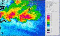
In the report thread for this event I posted my chase account and my regrets that I didn't take a radar screenshot of the velocity showing the 3 cells in a row. So I went and pulled radar from 10 PM to midnight and made this animated gif of the reflectivity. This is one of the most fascinating systems I have seen. It is incredible to watch it switch storm modes. It just sat over Johnson County TX for hours.

20150427_0303_0504_v3.gif
 
NWS FWD radar analysis...pretty interesting. Check out the anticyclonic signature.
11164046_844780192225262_635270781620839209_o.png
 
Back
Top